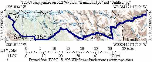
What a better way to start a trip defined by climbing than to begin by climbing the tallest mountain in the Bay Area, Mt. Hamilton. At 4209 feet it's small compared to the Sierras we were headed toward, and in fact is only at a slightly higher elevation than Yosemite valley (3980 at Curry Village)! Below is a map of the route from Palo Alto to the top of Mount Hamilton and then down to the point where Topo's coverage ends.
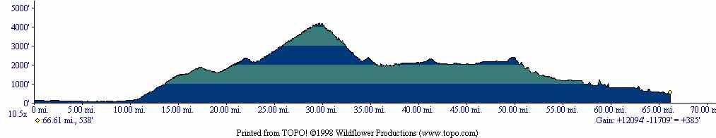
Here's an elevation profile of the segment from San Jose to the end of Topo's coverage. From Palo Alto to San Jose is flat, and from the end of the map to Turlock should be downhill and flat.
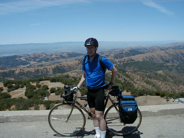
I first cycled to Mike's place in San Jose in the early morning and we left from there a little after 6:30am. Mt. Hamilton was a very nice climb in the cool morning. We were hoping to see the Sierras from the top, but although it was a pretty clear day it was not nearly clear enough to see so far away. Here's a picture of me obscructing the view back toward San Jose.
The descent turned out to be more painful than the climb, and then we entered the flat and hot Central Valley. It was actually a little exciting to see Highway 5 after spending so much time away from civilization. We might have stopped at Patterson but there were no hotels there, so we continued on to Turlock.
Return to trip overview.