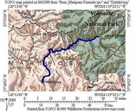
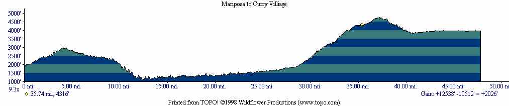
This was supposed to be a very easy day. Although there would be about 3000 feet of climbing up to Yosemite Valley, the mileage was short and we expected to be in by noon, able to spend the rest of the day exploring the valley and perhaps hiking a bit. But we were in for a bit of a surprise: We didn't get to Curry Villiage until after 2pm, and we did our hiking before that time. What mileage for the day doesn't show is that only 45 miles of it was on the bicycle. 6 miles was on foot. The map and elevation profile are for the route we actually took rather than the planned route.
As usual the morning started out very well, with a short climb followed by a descent through some very beautiful terrain.
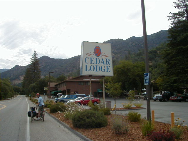
What a better place to stop for breakfast than the infamous Cedar Lodge in El Portal, which had a surprising number of people there. Breakfast was a buffet and extremely expensive.
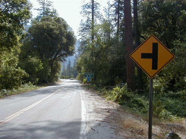
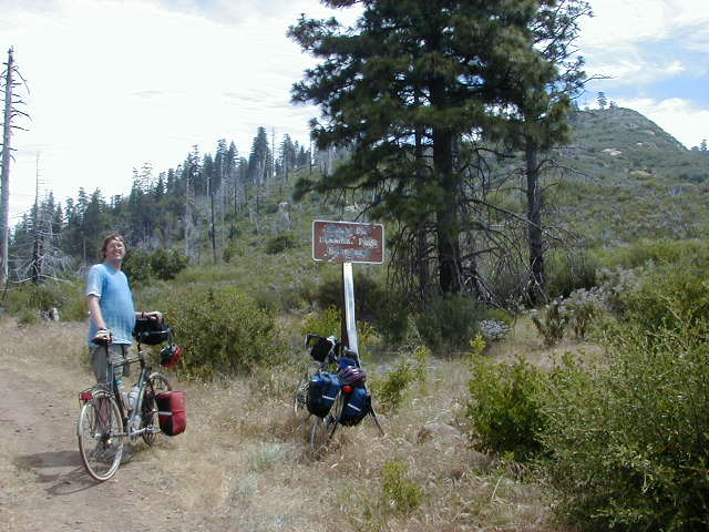
We were now ready for the rest of the climb up to Yosemite Valley, which seemed it would be pretty straightforward. But soon after leaving Cedar Lodge we were stopped by a ranger, who informed us that we could not use El Portal Road (140) to get into Yosemite. We had known it was closed at night for construction, but the web page neglected to mention it was closed to bikes and pedestrians at all times! We asked the ranger what we could do and he said the only possibility was to try to get a ride on a pickup truck. We tried to get him to think up something better, and finally he did. He said we could turn left on the upcoming El Portal Road, which would take us to Foresta Road, an unpaved 6 mile trail that would eventually get us back to a paved road that would connect to New Big Oak Flat Road, the other Western entrance to the Valley. I was overjoyed at this news--6 miles was not too far, even if we had to push our bicycles, and although it would have been nicer to be able to enter via 140 as planned, this way at least we could get in without being driven. Below is a picture of the turnoff to El Portal Road.
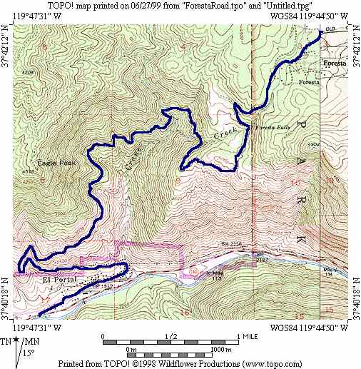
The ranger actually knew this trail very well and gave us fairly detailed directions. It was indeed (looking at it later with Topo) about 6 miles long, starting at about 2000 feet at a little after the 29 mile mark on the elevation chart above, and ending at the yellow dot at about 4300 feet. Then one climbs to over 4700 feet on a paved road out of Foresta to join New Big Oak Flat Road. So we ended up climbing an extra 700 feet, and 2300 feet of the climbing were done on foot. From the numbers the average grade would have been over 7%, but it varied quite a bit and some parts were quite steep. There were a couple places that were flat and smooth enough that we could cycle a little, but these were very short and we had to push the bikes almost the whole way. Below is the trail in more detail.
We actually made a wrong turn at one fork and went up an extremely steep (probably around 20%) and slippery inclide which led to a dead-end a water tank.We then got to go down (even more scary) this steep slope. Mike has a picture of the fork that he took before we went up the wrong way that I may add to this page later.
The trail was completely exposed to the sun, with very few spots to stop in the shade, and the day got hotter and hotter. So pushing bicycles (about 42 pounds in my case, and much heavier in Mike's) up this climb turned out to be rather grueling. However the scenery was quite beautiful and there were several waterfalls. Mike started running low on water and wanted to refill at one of them (adding water purification tablets) and here he is doing that.
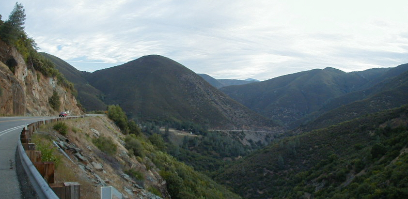
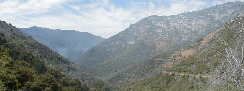
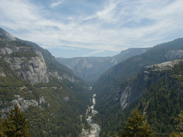
Further on up the trail you could get a good view of part of what we'd climbed so far, and it was quite impressive. You may notice some smoke coming from the valley--this was apparently a prescribed fire set by the rangers, some of whom we passed on the trail.
Eventually we reached the entrance to the park itself, although it was a little hard to read the sign. Now it was clear why the ranger who had stopped us had been reluctant to tell us about this route--it bypasses the official entrance, so you don't have to pay the $10 per person entrance fee!
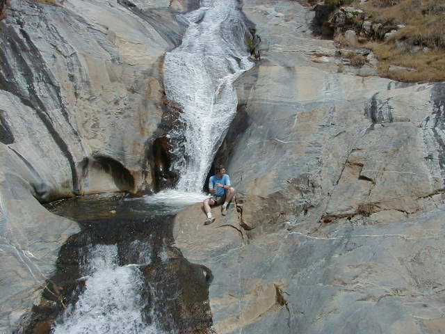
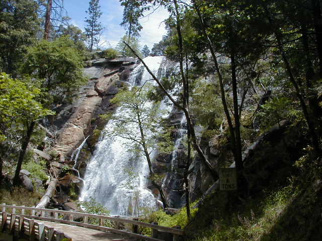
The highlight of Foresta Road was the Foresta Falls, quite cool with some shade nearby. We stopped here to rest and eat a little.
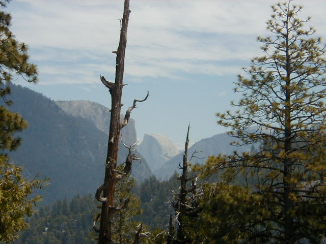
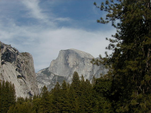
Finally we got back to the paved road and got to descend into the Valley via New Big Oak Flat Road, the same road we would be taking out the next day. There were some very nice views on the way down, and here is my first glimpse of Half Dome.
And below you see the Merced River flowing out of the Valley.
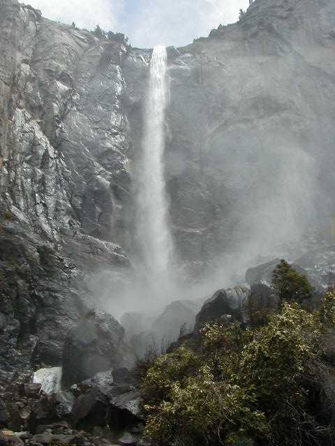
Finally we reached the Valley itself, and despite being extremely tired we stopped by the Bridalveil Falls, which Mike had seen on a previous visit. This was well worth seeing.
When we reached Curry Villiage we got the second surprise of the day. I had confirmed my reservation 3 days prior, and in fact had upgraded from the canvas cabin to a wood cabin without bath. At the reservations desk I tried to upgrade again, to one with a bath, and was told none was available. Then I was told the cabin we had reserved was also not available as they'd had to close down about 50 cabins due to danger from recent rockslides! However things turned out well as the woman somehow found us a wood cabin with a bath, and even gave it to us at the cheaper price.
I called my wife that night and she said Curry Villiage had called and said our reservation had been cancelled. Both this and the El Portal Road closure information are things I'm glad I didn't know until it was too late, given that things worked out well in the end.
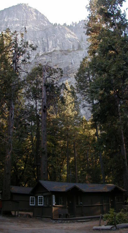
After moving into our cabin we had to at least take a little walk around, and here are the obligatory pictures of Yosemite Falls--

--and Half Dome, which is just stunning to see in person and my favorite site in the Valley.
Here's a shot of the dangerous Glacier Point overlooking Curry Villiage.
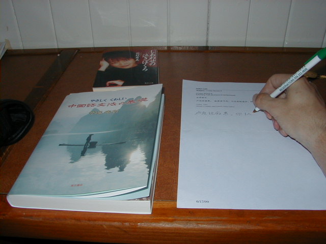
The cabin had a writing desk so I wrote down a little (about a half sentence) of Cookie Stories 8. To the left is the reading material I brought along on the trip.
Return to trip overview.