
We considered trying climbing over Kingsbury Grade to get to Stateline or South Lake Tahoe the previous day, but as it was so hot and the climb completely exposed, we decided to wait until the next day when we could climb it in the morning. But this meant a long last day and two big climbs, the second being Mt. Rose, the next day if we were to get to Reno. However we figured if we were too tired to do the second climb, we could always stop at Incline Villiage or thereabouts and then do the last segment the next day and take the later train.
This turned out to be exactly the right decision. We were able to do both climbs in one day without any problem, and it turned out for me this was the best day of the trip, a great way to end it.
The map and elevation data start a little after where we started, since Waterloo Road wasn't all apparently there when the topo maps were made.
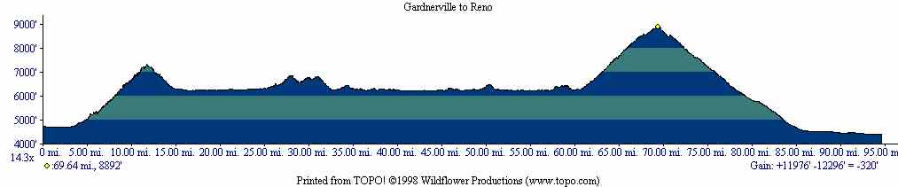
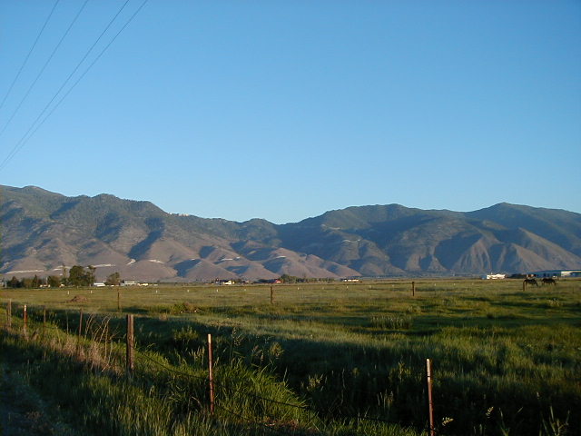
Kingsbury Grade was clearly visible from downtown Gardnerville, but as I suspected the climb looked a lot more intimidating than it was. It would have been awful to do in the heat, but in the morning it was pretty easy, never very steep. However toward the top there were headwinds so strong that I elected to walk in a couple places as that used much less energy to go just about as fast. This was the only paved climb I walked on. All the climbs on the trip were not very steep and were possible to do even loaded.
Mike had told me earlier about how winds in the mountains were often down-canyon in the morning and up-canyon in the afternoon. We found this to be true almost every time in the Sierras, and it would be a big help for our afternoon climb.
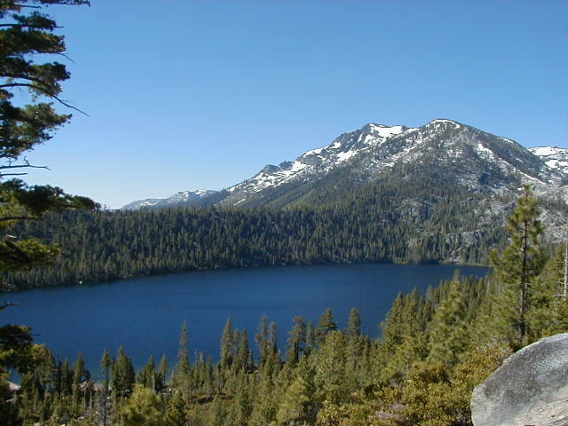
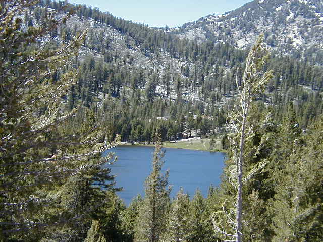
We had a quick breakfast in South Lake Tahoe, and then finally were off to see the actual lake, which we'd only glimpsed on the descent from Daggett Pass. Here is Cascade Lake, a small lake just before Emerald Bay.
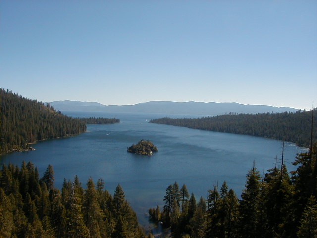
We knew there was some sort of climb up to Emerald Bay (the bumps in the middle of the elevation profile), but were unprepared for it being rather serious, and in fact featuring the steepest inclines we saw all trip! But the effort was worth it.
Along much of the west side of the lake is a very nice bike path which gets you away from the very busy Highway 89. The only annoying thing is that it crosses back and forth over 89 quite often.

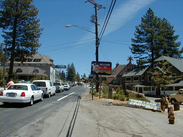
Crossing back into Nevada, we hit an extremely long line of stopped cars as well as a climb. Never have I passed so many cars before going 6mph. At the front we found they were repaving one of the lanes and letting each side through for roughly 20 minutes at a time. We had to wait nearly that long for our side to get its turn.
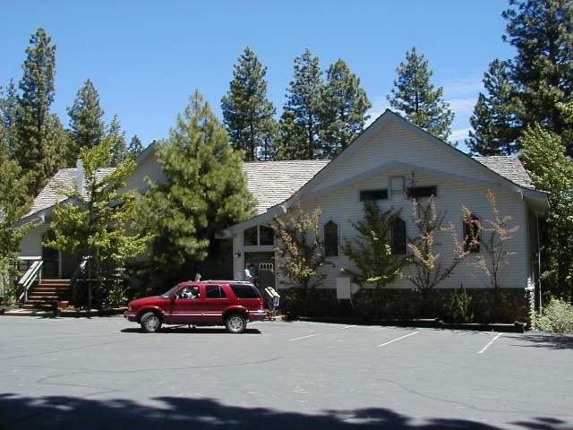
Just after the repaving was Incline Village and the start of Mt. Rose Road. We'd intended to get lunch in Incline Village, but there was abolutely nothing before the turn off! We wanted to do the climb before it got too hot, though, so we just started up on it, hoping we'd run into someplace. Very soon we saw the St. Francis Catholic Church, were we were at least able to get water and use the restroom. This was a good thing because we didn't run into anything else the rest of the way. We could have possibly detoured to for example the golf course, but that would have meant a substantial descent and then climb back up.
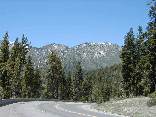
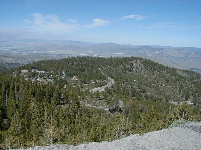
I didn't expect Mt. Rose to be anything but boring, and so got the best surprise of the trip to find it was actually extremely beautiful, and a fantastic steady climb. It turned out to be my favorite climb of the trip! What helped was that the temperature was on the warm side but just about perfect, the scenery was terrific, and there was a strong up-canyon tailwind to push us along. As we got near the top the wind got to be extremely strong and very annoying, however. Here's an example of the scenery.
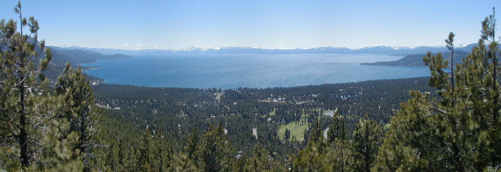
The views of Lake Tahoe were especially terrific from this road. The mountains across the lake were much more visible in person than they came out in this photo.
Incline Lake.
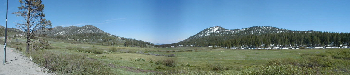
The poor man's Tuolumne Meadows--this is Tahoe Meadows, still very beautiful. The stiching software had a little trouble with this panorama as well in the middle.
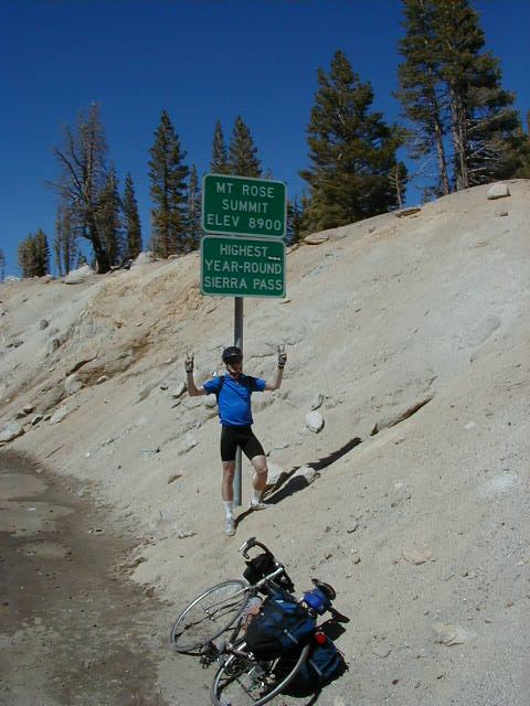
I was in a great mood when I reached the summit of this road, and since it was nicely under 9000 feet had no altitude problems.
By the way I actually had two bike outfits which I wore three days apiece, and I did laundry every other day. However I wore this outfit, which I liked better of the two, on the three "hard" days, which turned out to be the only three I had my picture taken on.
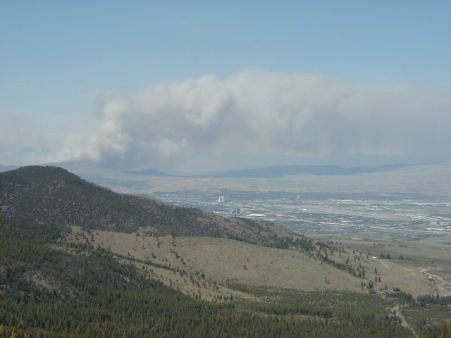
Just past the summit we could see down to Reno, and it looked like a volcano had erupted! Quite a surprise. Actuallly this turned out to be a huge fire.
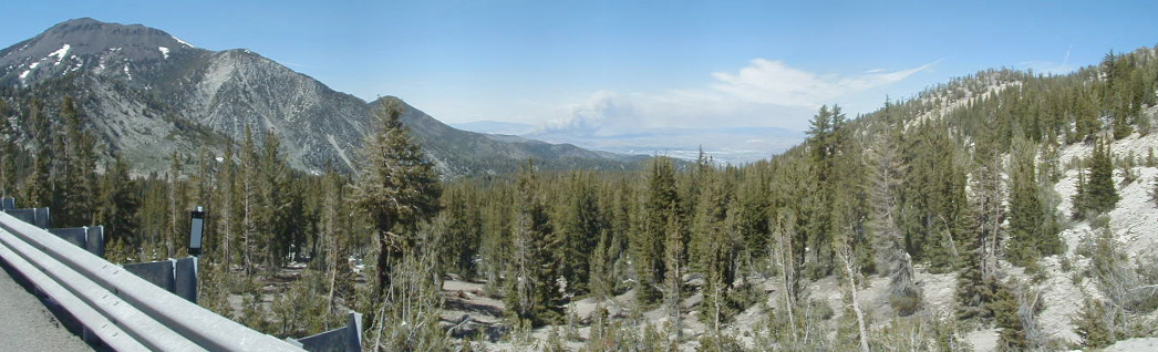
Further down we can see the rest of the descent where it flattens out. Whereas Mt. Rose was a fantastic climb, the other side was a terrible descent, with extremely strong head and cross winds, and lots of traffic (including a couple fire trucks going down to help with that huge fire).
Further down I took a closer picture of the smoke from the fire with downtown Reno in the center.
We finally had lunch around 4pm at Taco Bell at the bottom of the descent. It was here that Mike told me he had though about renting a minivan and driving back rather than taking the train the next day. He called Hertz and while all their vans were currently in use it seemed one might come back later in the afternoon, so we decided to bike to the airport to try our luck.
On the business 395, at mile 93, my rear tire had a flat--only 7 miles from the end of a nearly 500 mile trip! That was a pain, but it still didn't keep this day from being my favorite. In Reno the wind was very strong (15-30mph according to the news) but it was pretty much tailwinds, along with downhill, all the way for us.
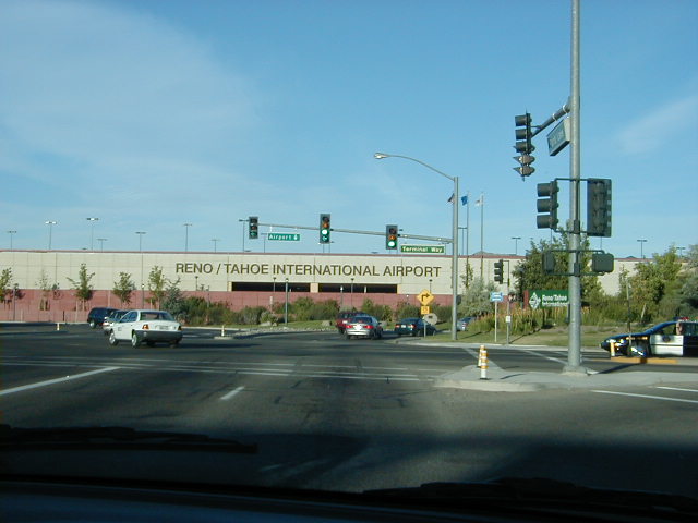
We finally reached the airport. This is what it looked like to us, but we didn't take a picture at the time since it wasn't clear we'd actually go home this way. So this picture was actually taken later from through the front window of the minivan--we drove by especially just for it.
I'll replace the photo below later with one that has both Mike and I in it that's in his camera. We managed to get the minivan, and while waiting for it I biked around the parking lot a couple times since my odometer read only 99.65 and I wanted to make this a 100 mile day. We then changed clothes, cleaned up a bit, and drove home.

Return to trip overview.