Since I moved back to Palo Alto in 1994, I've gotten interested in bicycling again. I used to bicycle a lot in Indianapolis, but gave it up when I moved to Boston since it was too dangerous there. But the San Francisco Bay Area is just about the best place imaginable to bicycle, with excellent weather (except during the winter) and a great variety of beautiful terrain.
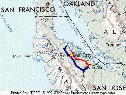
I tried many different routes from Palo Alto to Oracle (in Redwood Shores) before settling on two that seem to be the best. The best route to Oracle I believe is to go through Stanford to Junipero Serra, and then take Alameda de las Pulgas all the way to San Carlos Avenue. I cross Highway 101 at Holly (a little safer than Ralston) and take Twin Dolphin Drive to Oracle. The total length is 14.3 miles according to my odometer, my fastest average speed was 17.1 mph. The route is shown on the map above as the blue route to the yellow route to the red route.
Foothill Expressway, Junipero Serra and Alameda de las Pulgas all connect together and in a sense form one long road, which is a fabulous bike route and my second favorite "mostly-flat" (although parts of Alameda are very hilly as we shall see below) bike route after Canada Road. There are a fair number of lights and stop signs in places, but overall not too bad. This is in a sense the bike highway for the Peninsula. Junipero Serra and Alameda have beautiful scenery as well.
Alameda isn't quite as nice going home from Oracle for two reasons. The first is that there's more traffic in the afternoon. The second is the bewildering number of right-turn-only lanes on the route back--whereas there are none on the way there! I do take Alameda home on my Siebel route, mostly because the hilly section is so much fun, but while at Oracle I was lazy and mostly took a very flat route back near the Bay. With afternoon tailwinds I could get a pretty good speed up in certain sections, but like the route to Oracle there are plenty of stop lights and signs to slow you down.
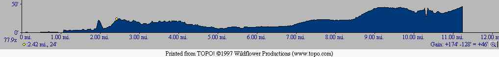
The very first route I took to and from Oracle was Middlefield Road (followed by Winslow and Industrial), which is the most obvious route but also the worst--lots of traffic and enough stops to drive you crazy. The better route is to take Old County Road, which runs along the train tracks (so few stops) to downtown Redwood City. There's really no good route through downtown, but once you get out you can take Bay Road, a terrific stretch which has a fence along the entire right side (separating Atherton from the riff-raff) and a nice bike lane. After that I take a complicated series of back roads home. The total distance is 11.4 miles and my average best speed was 17.2 mph. The route is shown on the map above as the red route. A profile for the route is below. Oracle is on the left and my home is on the right. The yellow dot shows where route to work merges with this route. You can get an idea of how flat the route is by looking at the vertical scale, but to give an even better idea: The bump at the 2 mile mark is the Holly overpass over Highway 101, and the dip at around 10.5 miles is the San Francisquito Creek! I guess Topo doesn't know about the road going over it.
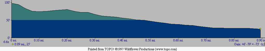
The profile of the short yellow section (in the "to-work" direction) shown below. As you can see this section is nicely downhill (and downwind, incidentally).
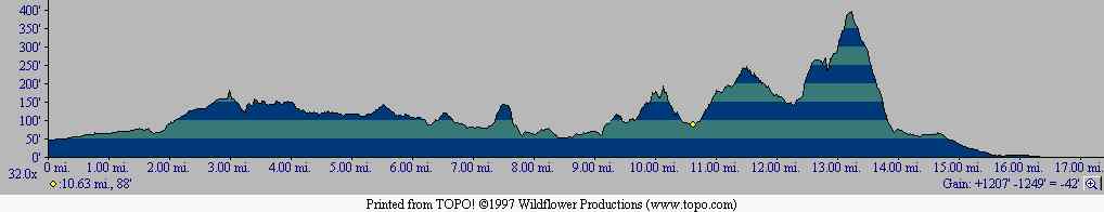
In December, 1997 I changed jobs and started work at Siebel Systems, in San Mateo at the corner of Highways 101 and 92. Due to the wet Winter I've only been able to bicycle there a few times so far, but the route is even better than the route to Oracle. Basically I go the same way as I went to Oracle, but instead of turning right on San Carlos Avenue I turn left, and this eventually turns back into Alameda de las Pulgas, which I take to 25th Street, cross over El Camino Real to Delaware Street, and take that pretty much to Siebel. The route is 16.6 miles long and is shown in blue on the map above. I take the route in reverse to go home, which is quite a different ride, mostly because of the hills. On the way there the slope is more gradual going up and more sudden going down. On the way back of course it's the reverse.
What makes this route so much fun is that there's even more Alameda de las Pulgas, and the new section is the best part! Even prettier than the south part I took before, and much hillier. The profile below shows the overall route, with my home at the left and Siebel at the right. The yellow dot shows where it diverges from the Oracle route, and as you can see the best hills are all after that. You can also see that the steepest section occurs at the very end (or beginning of the trip back). This section is interesting enough that Lucas Pereira devoted a page to it as part of his excellent series of gradient measurements of various roads. That page has a lot of detail and is well worth looking at. You'll see that there's a 20% grade in one section of this road!
As of 4/30/98, my best average speeds to and from Siebel have been 16.3 mph and 16.1 mph respectively. I'm very close to my first goal, which is one hour cycling time.
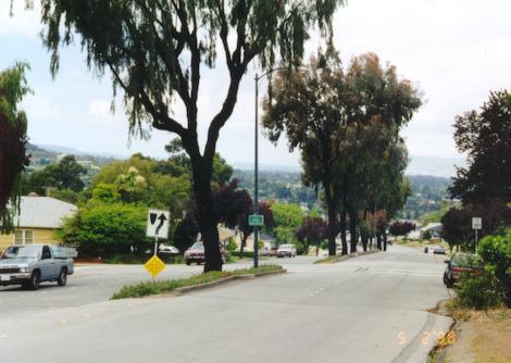
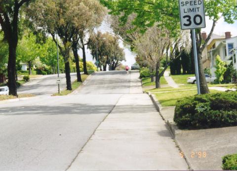
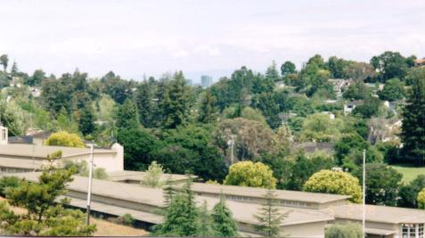 From the top of the last hill of the "flats" portion of the ride, just
before the Oracle Split (Alameda and San Carlos), Oracle itself can be
seen between the trees.
From the top of the last hill of the "flats" portion of the ride, just
before the Oracle Split (Alameda and San Carlos), Oracle itself can be
seen between the trees.
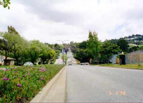
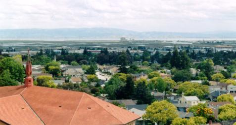 Another view (to the right of the one above) from the same hill.
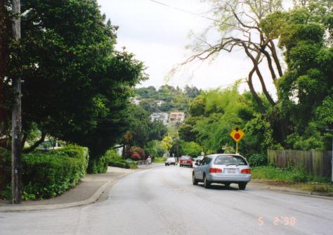
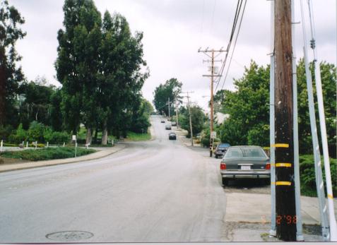 Alameda just north of Ralston--the rollercoaster upramp. I swear it's
a lot steeper than it looks here! In fact it even looks a lot steeper
when you're there.
Alameda just north of Ralston--the rollercoaster upramp. I swear it's
a lot steeper than it looks here! In fact it even looks a lot steeper
when you're there.
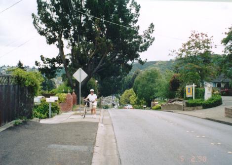 From the top of the upramp; this gives a little better idea of the slope.
 The last uphill portion of the route to work.
 Looking back down from the top of the hill.
 The Big Hill, from the top.
 The Big Hill on the way home, from the bottom.
 Nearly up the 20% grade section.
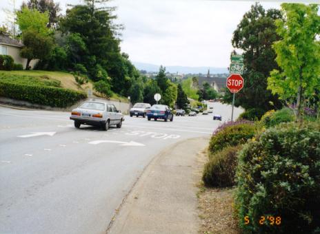 The first of the infuriating number of right-turn-only lanes (just
south of the top of the hill from which Oracle could be seen) on the
return trip.
The first of the infuriating number of right-turn-only lanes (just
south of the top of the hill from which Oracle could be seen) on the
return trip.
Return to John Leo's Cycling Page