
In September I visited Colorado. One reason was to meet Marie Redonnet, who had just started a year-long appointment at the University of Colorado (for some reason abbreviated CU), Boulder, and her husband Bernard Prince. Another was to see friends from Epsilon Theta who were living there: Mike Vermeulen, Linnea Avallone, and Tina Voelker. Finally I wanted to climb some mountains.
After visiting Japan and getting to use a lot of Japanese earlier in the summer, it was interesting that I would get three days in a row to practice each of the other three languages I'm learning. The night of Thursday, September 7, right before I left, my Chinese TA Wang Huan had a party at her apartment for her former students. Her parents who don't speak English were there as well. Part of the purpose of the party was for us to practice Chinese, but we'd all forgotten our Chinese and just spoke in English. Then Friday, September 8 I finally met Marie Redonnet and Bernard Prince, and sat in on a class on the 20th Century French Novel given by Marie in French of course. Here I should have practiced my French, but it's also still terrible (I can only really read it). Fortunately Marie and Bernard could speak quite good English, so we were able to converse in that. Then Saturday after Mike and I climbed Mount Victoria, Tina and her family (including her mother in law who only speaks German) visited Mike and me in Frisco where we went to Oktoberfest. So here I could have used some German but I really know just about no German at all.
I arrived Friday morning and explored the CU campus a little before meeting Linnea for lunch, and then explored a bit of Boulder before meeting Mike at REI. This was the first time I'd spent any time in Boulder and I loved it right away. A beautiful college town, just the kind of place I'd love to live in. Much less expensive than LA or the Bay Area in CA, and unsurpassed access to mountains and the outdoors. I immediately started thinking about how I could move there for at least a year or two.
My plan for mountain climbing was to climb as many 14ers as possible. Saturday I wanted to try some combination of Democrat/Lincoln/Bross (maybe all three if possible!), Sunday Torreys (plus Grays, my first and only 14er, again if possible), and then Monday the third attempt at Longs Peak. However just like two years ago the weather had other plans. There were snow storms in the mountains a week or two before I came, and still plenty of snow above even 11,500 feet. It looked like Longs was out, and possibly the other 14ers as well. I'd hoped to climb as many as 6, but might end up with zero!
In any case we drove to Mike's parents' condo in Frisco, which at 9000 feet and close to several of the 14ers would be our base of operations and allow me to acclimatize. We also soon got an idea of how much snow was on the peaks. It looked pretty bad, with more rain and snow in the forecast, so we decided to climb some lower local peaks first and see how the weather went.
We first decided to try a very local peak, so close that the trailhead is a short walk from the condo! This was Royal Mountain (10,502 feet), and in addition we'd try Mount Victoria (11,785) and also Peak 1 (12,805) if possible. Here's a picture of Royal Mountain from downtown Frisco.
Royal Mountain was an easy and pleasant climb. We then went back to the saddle and headed toward Mount Victoria and Peak 1. Mount Victoria is just a sort of bump on a ridge leading to Peak 1 and is not even named on most maps it seems. However Peak 1 was quite impressive, especially on this day as it was covered by snow and partly in the clouds. It felt almost like we were in the Himalayas! Incidentally the dirt bump in this photo on the left of Peak 1 is not quite Mount Victoria but rather another lower local high point. There was some kind of weather station on it.
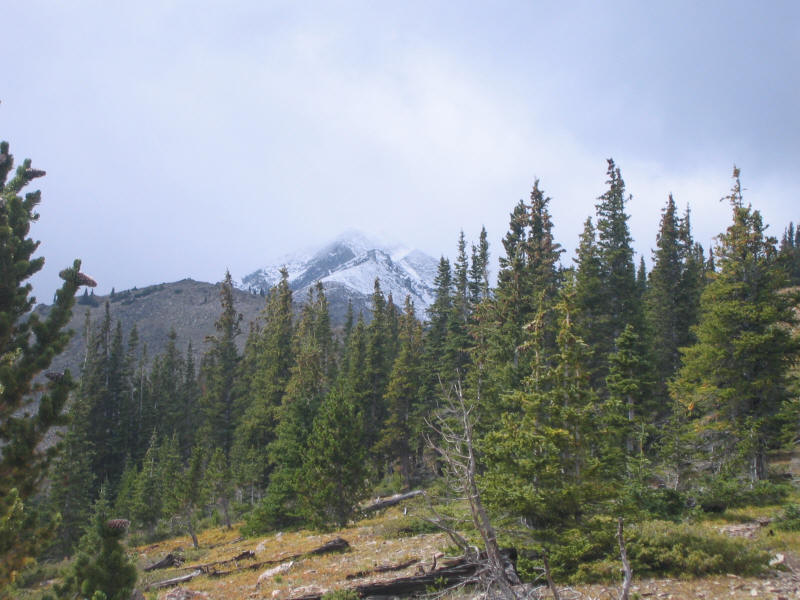
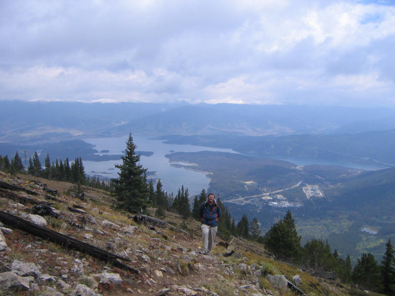
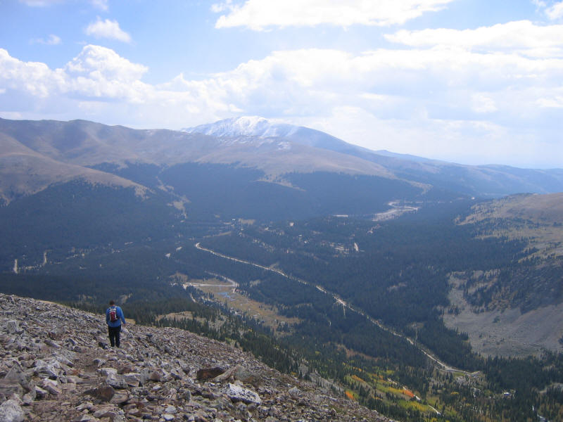
Despite clouds and poor light the scenery was beautiful. Here you can see Mike on the trail and Dillon Reservoir below. In the distance are more snow-covered peaks.
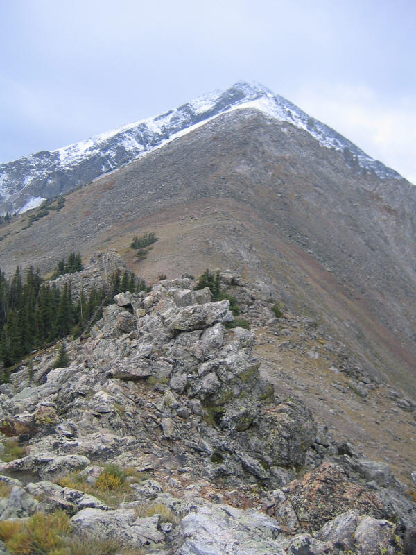
We made it to the top of Mount Victoria but decided against continuing to Peak 1. Below you can see the ridge leading to the peak. I rather regret not going to Peak 1, as this ridge looks like great fun to climb. But the snow could have been a pain. As if to validate our decision, soon after we started descending it began to sleet on us. It ended up sleeting on us all three days in fact!
A really fun hike to try sometime would be to go along the ridge and climb all the numbered peaks (Peak 1 to 10), descend into Breckinridge, and then take the bus back to Frisco.
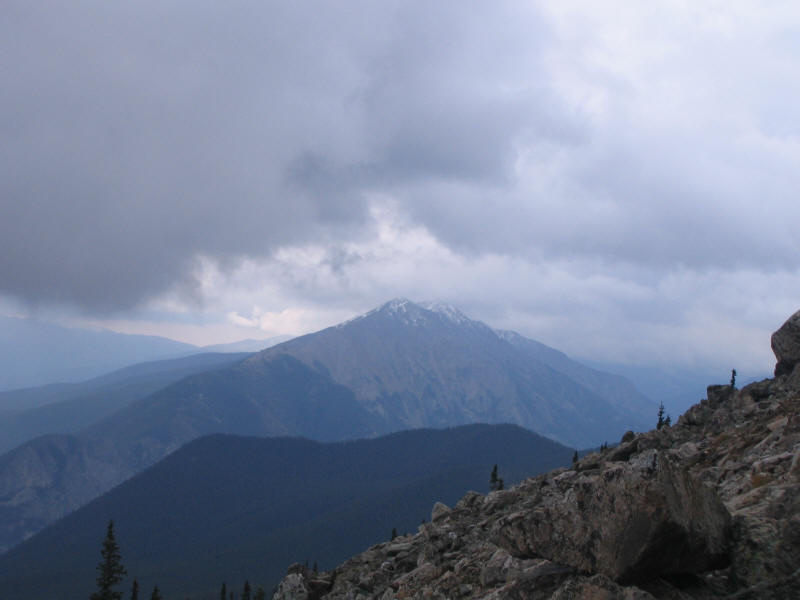
Since the weather forecast still didn't look too good, we decided to try another nearby but higher peak to climb. This was Buffalo Mountain (12,777 feet). I'd taken some pictures of it from the top of Royal Mountain, and also from the ground after climbing it, but none of them came out well so I'm not including them here. But we did get a pretty nice view of Peak 1 (with Tenmile Peak (Peak 2) behind it) from Buffalo Mountain.
Once you get past treeline Buffalo Mountain is a steep talus slope. You can't tell in the picture but there's a fairly easy to follow trail marked by cairns that switchbacks up the slope.
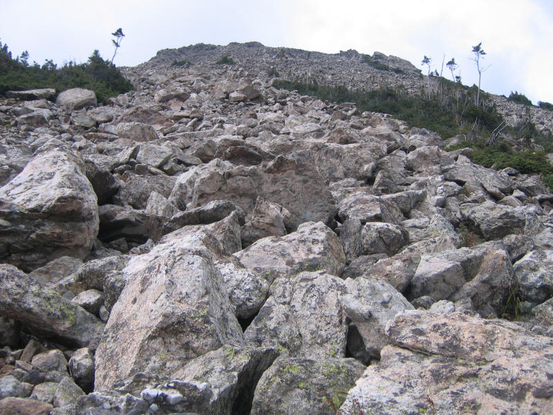
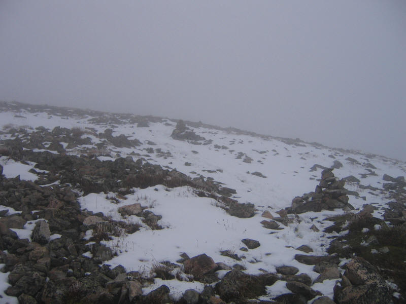
Higher up you reach the snow and the clouds. This picture gives a good idea of what it looked like. It's good there were these big cairns as I never would have found my way down the right way otherwise. I'm thinking of trying to climb Mount Rainier next summer and so wanted to try some snow climbing and this turned out to be a good opportunity! But there wasn't that much snow and it wasn't deep, so even in my trail running shoes I was fine.
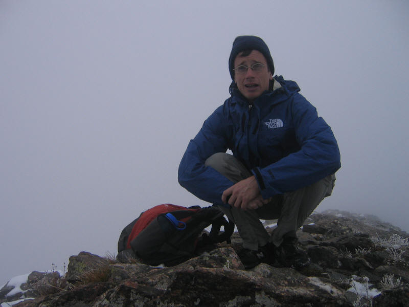
I reached the top before Mike and didn't want to linger there, so I took a picture of myself on the summit with the camera's self-timer.
I brought one liter of water and a few snacks for both climbs, and that was sufficient. Both were terrific climbs, and showed me that there are plenty of great climbs in Colorado aside from the 14ers! In a way it was good that the weather was bad. I got to do some wonderful hikes I wouldn't have tried otherwise, and got to climb a bit in snow and see a lot of snow-covered peaks. Quite a difference from California in the summer!
Monday was supposed to have better weather, but with so much snow below even 13,000 feet it wasn't clear a 14er would be really doable as an ordinary hike. We decided to try Quandary Peak (14,265 feet), one of the easiest 14ers with a good trail to the top, and hope it would be okay. Otherwise we'd just climb as high as we could. Mike had climbed it before, and it was conveniently quite close to Frisco. In fact it is at the south end of the short Tenmile Range that starts in the north with Royal Mountain and Peak 1!
Different guidebooks said different things about trail length and just where it starts, and also mentioned there is some confusion at the start due to multiple trails. The roads leading to the trailhead were also supposed to be hard to find. However we found the roads well-marked now, and the trailhead clearly marked with nice big signs. There were also signs at any ambiguous intersections of the real trail and other trails, so it was easy to go fast and not worry if you were off-route. Due to the multiple possible trailheads that have existed there are also multiple lengths for the trail listed in different guides, from 5.4 miles roundtrip up. There's a posted length at the trailhead sign but I've unfortunately forgotten what it was. So I've used the length (6.75 miles) and elevation gain (3450 feet) listed on the 14ers.com website, which seems to have up-to-date information.
This was the only hike this trip I did entirely at my own speed. I figured since there was one unambiguous trail and it was out-and-back that Mike and I would have no trouble running into each other again, and I was curious what speed I could do the hike in. Mike's parents had left some newspaper clippings from the Denver Post of "hikes of the week", and one was Quandary. Written by Dave Muller, who had also authored Colorado Summit Hikes for Everyone that we had used for the previous two climbs. He lists very exact times to do each climb up and down, which I learned from the book are his own times. For Quandary he said I believe 168 minutes up and 124 minutes down. I don't know how old he was when he did those times, but another article mentioned that he'd just finished climbing all the 14ers at age 66 and was on his second pacemaker, or something like that. I figured he had the advantage of having a lot more experience than I did climbing in Colorado, having no altitude problems, and probably climbing in better conditions with no snow. He may have done a shorter route as well. Still I was curious how my own times would compare to a guy in his 60s.
The trail starts very easy as dirt in the woods, and then gets rocky above treeline. As with all the climbs I've done in Colorado the trail is in extremely good condition, far better than the trails in California. They even cut nice flat steps into the rock in some of the steeper places. I did go slowly when it got steep and my heart would start beating fast in places, but I had no altitude troubles at all this climb, so the acclimatization strategy paid off beautifully.
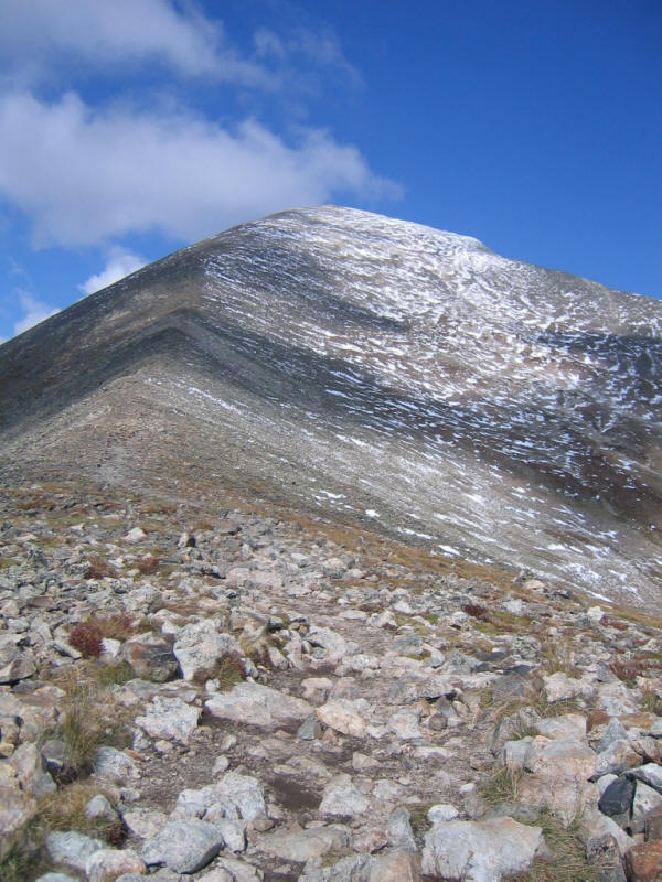
It takes a while to reach the East Ridge of Quandary, but when you do the fun really begins. Here's a look toward the summit. As you can see the snow wasn't too bad, and I'm sure quite a lot of it melted that morning as we were climbing! For the first time we had good weather, although it would vary quite a bit during the day.
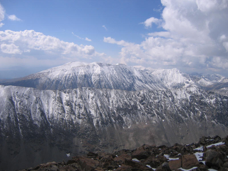
Near the top I passed a couple with a dog (we ran into people with dogs on all the hikes, and in fact on the first two ran into the same two women and their dog! (joined by a third woman the second time). We ran into just a few people on each of the hikes. I made it up Quandary in 157 minutes, so I managed to beat Dave Muller's time, which made me happy. I tried to take a picture of myself on the summit as I'd done on Buffalo Mountain but I had trouble balancing the camera on rocks and none of them came out well. I also forgot to sign the summit register! However I did get some spectacular photos from the top. The one below shows some 14ers to the south, the pointy one left of center being Mt. Lincoln, and then to its right Mt. Cameron and further right Mt. Democrat. To the left of Lincoln is I suppose Mt. Bross. These were the climbs I'd originally wanted to do this trip. I would have done them from the other side, which perhaps had less snow, but clearly Quandary was the right choice this time!
Here's a look toward the west. The ridge leads straight to Fletcher Mountain (13,951 feet).
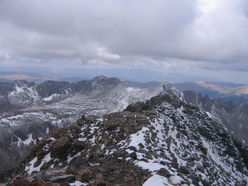
A look to the northwest. Toward the right is Pacific Peak (13,950).
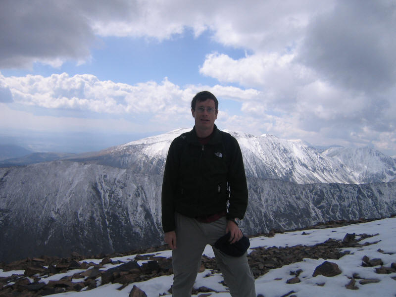
As I was taking these pictures it started to sleet. So I figured I'd better head down. I had been hoping the couple with the dog would make it up soon so they could take my picture on the summit, but a little ways down the ridge I ran into them and had them take a picture of me with a nice background. They asked me when I'd started and were surprised when I said 8:15am. They'd started at 6:40, and so it took them about 4:30 to reach the top. They said they'd eat their lunch up there, but I can't imagine it was much fun with the sleet. I ended up not eating anything this hike (I brought some snacks but the hike was short and I was kind of sick of eating them after the other two days) and although I brought almost 2 liters of water I drank less than 1 liter due to the mostly cool and sometimes cold weather. I should mention that on all three hikes I wore lightweight capilene long underwear (top and bottom) and brought fleece, a Gore-Tex rain jacket, wool hat, baseball cap, and ski gloves I'd bought in Breckinridge two years ago for Longs. I wore everything at some point on Quandary Peak and most everything on the other two hikes.
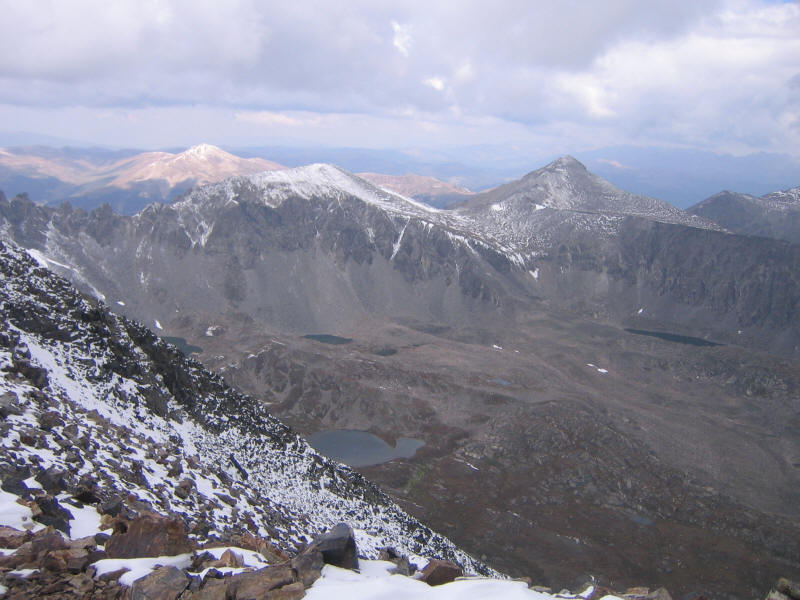
I ran into Mike at some point on the way down. He was going slow and since he'd already bagged Quandary before decided to just head down with me. Once we got low enough the weather got better, and I took this picture toward the east. The mountain in the distance is Mount Silverheels (13,822).
Right after I took the picture it started to sleet again, fairly hard, and then that turned into fine snow further down. Once we reached treeline conditions got better. With the good dirt trail I ran ahead as fast as I could, as it seemed I could get down in less than two hours (and that included the time I spent stopped talking to the couple and getting my picture taken). I made it in 1:55, so again I was happy. A terrific hike and a great way to end the trip. I was very happy to get in one 14er. We drove back to Fort Collins that afternoon, and I flew back to LA the next day. I can't wait to return and climb some more!
Roundtrip distance: 6.75 miles
Elevation gain: 3450 feet
Time up: 2:37 (8:16am to 10:53am)
Time on top: 0:11 (10:53am to 11:04am)
Time down: 1:55 (11:04am to 12:59pm)
Total Time: 4:43