|
The complete set of pictures, good and bad, is available, as is my equipment list. I was dismayed to find most of my pictures had been taken at size 300KB instead of 3MB as intended. Perhaps the settings got switched as the camera was bumped around in my pocket. Strangely the pictures around Glen Pass came out at 3MB, and those were the most important so that was lucky in a way!
I don't recall when I first heard of the Rae Lakes Loop, but I know when I was thinking about doing my first backpacking trip in the Sierras last summer I planned to do this loop, which is perhaps the classic backpacking trip in the Sierras. There are plenty of pages about the loop already, none of which I looked at very carefully as I didn't want to spoil the surprise, but Kevin Gong's page is particularly good, with much better photos than I was able to manage.
I ended up backpacking with Jim Ralston and friends last summer instead, and so didn't do a solo trip, and then did another trip with them this summer. I'm glad I was able to go with experienced people first before doing a solo trip, and I learned a great deal from them. Still I felt a need not only to get back to the mountains one more time before the end of this summer, but also to do a trip in which I had to make the decisions for a change. A two-night trip seemed perfect, since it required some effort and planning, but still any errors could be recovered from! And the Rae Lakes loop seemed like the perfect two night trip. Another advantage is that the standard trailhead to start at is on the west side, and so convenient since I'd just moved back to the Bay Area.
Measuring the lengths of trails is an inexact science at best, and this loop is no exception. I had plenty of different estimates for lengths. The excellent Tom Harrison map (Kearsarge Pass), which details the loop, gives distances between each junction but then hedges its bets by simply saying the loop is "over 40 miles". There are mileage signs on the trail itself (almost always different from the Tom Harrison distances) but I consider them the least reliable as they contradicted themselves in several places, the most amusing to be two signs just a few feet apart that had different mileages to the same place! The Rae Lakes Loop is so popular it has its own NPS webpage, and for lack of better information I will use the distances there, which seem to match my own feeling of the distances the best (perhaps simply because they are the longest!). I've copied the table here just in case they change or move it. Note the total length of the loop is given as 46 miles. Strangely all the distances here seem to be rounded to the nearest half-mile.
|
|
|
|
||||||||||||||||||||||||||||||||||||||||||||||||||||||||
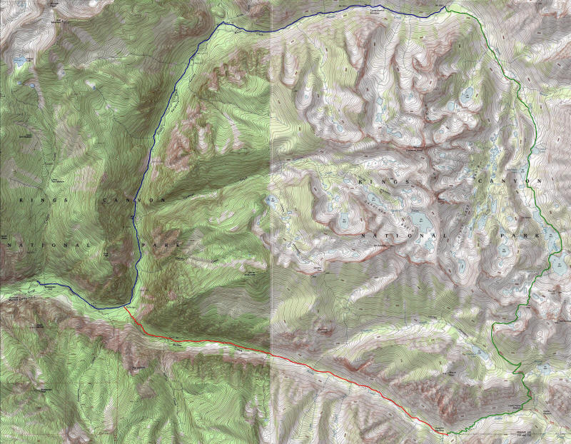
The map below shows where I went each day. The first day was blue, the second green and the third red followed by blue.
I debated whether to start this trip Sunday August 10 or Monday August 11, and ended up doing it Monday since I met with two groups of friends Saturday, ate too much, and needed Sunday to recover. This turned out to be the right decision. I was very worried I would not be able to get a permit for the ultra-popular Rae Lakes Loop, even on a weekday, since it was peak season. I didn't have a reservation and according to the web site all or almost all reserved spots had been taken for both Sunday and Monday in both directions. There were a small number of walkin spots but they could well be snatched up quickly as well, and I didn't want to drive 5 hours there to find I couldn't do the loop. However I did have a backup plan--another loop out of Roads End which would be a little longer and probably harder (starting with a 5600 foot hot climb): go up the Cooper Creek trail over Granite Pass and return to Cedar Grove via Kennedy Pass. It seemed no trouble to get a permit for this loop, but I really wanted to do Rae Lakes if possible.
My guess for the reason of Rae Lakes' popularity is that it is a loop of just the right length for a short multi-day backpacking trip (most people do it in more than 3 days however), has spectacular scenery, and is relatively easy, with not much elevation gain for the distance. It turned out a little differently than I thought--there were longer stretches of relatively dull scenery than I thought there would be (although certainly plenty of stunning areas), and the hike was quite a bit harder than I expected. Still it's understandable why it's so popular.
Although the ranger station at Roads End opens at 7am, I didn't want to wake up too early and so got up at 4am after a fitful night of poor sleep and the first school nightmares I think I've ever had--that is the first school nightmares as a teacher! I dreamed I couldn't remember when were the classes I had to teach and so forth. I got on the computer after waking and was contacted via chat by my friend Lydia Yue who hadn't slept all night! It was nice to be able to chat a little with her before I left.
I left a little before 5am I think and made it to Roads End a little less than 5 hours later including a quick stop for gas in Fresno. The quickest route according to Google and my GPS is via 152, but I figured the one-lane there was dangerous and it would be really quicker to take 580 to 99. I decided to go that way (early enough to avoid the morning rush hour traffic in the East Bay, although it was backed up the other direction already) there (since the Dumbarton Bridge is free that direction) and take 152 back, and indeed 152 ended up being slower (it also took just under 5 hours, but with no stops on the way back). I'll probably do this same driving "loop" in the future as both drives are really boring but at least you get a little variety by doing one of each.
The last segment to Roads End is one I wanted to do earlier in the summer and I was glad to finally get to try it. The scenery was stunning but I couldn't really enjoy it while driving; I'll have to go again with family and friends and stop in places along the way and really enjoy it. I feel this area is an entirely new one that I don't understand at all and I want to take the time to get to know it. As the Kings Canyon Curse finally ended earlier in the summer I of course had no trouble getting into the park this time.
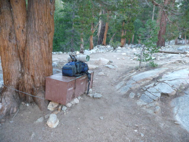
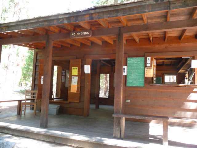
I must have gotten to the ranger station a little before 10am and it was just in time as two groups came right after me, both with several people and one also wanting to do the loop without a reservation (the other wanted to do it too but had a reservation!). It turns out there were still several spaces available and we all got on. I had debated buying a bear canister but wasn't sure just which one I wanted to buy and so decided to rent one at the station. This turned out to be the right idea because they not only had the awful heavy Garcia canisters ($5 for the whole trip) which the ranger tried to give me, but I noticed the much lighter but super expensive titanium Bearikade Weekender canister (one I'd considered but it's $225) which was something like $5 plus $1 a night, so just $7 and the obvious choice. It is a beautifully designed canister and if I have to buy one I'll probably get it, but I hope I can just keep finding it for rent! I'd brought my Ursack which I should have been able to use if I'd done the other loop, but ended up leaving it in the car.
I told the ranger I wanted to do the loop in 3 days and 2 nights, and he marked my provisional camp sites as Woods Creek (meaning near the junction with the John Muir Trail it seemed) and Junction Meadow. The only openings were for the clockwise direction, but I had no idea which direction was better (or if it mattered) and was happy to go either way; I figured I could try the other direction next time. His choices of locations turned out to be perfect and I used them. He said the loop length was 42 miles, which is less than the NPS website claims, but I wonder if he wasn't subtracting the 2 mile connecting trail (which you use both directions) to the main loop. He was a young guy around 20 maybe and said he'd be running the loop in the counterclockwise direction on Wednesday (I'd heard this is a popular day trail run) so I would likely run into him then. I asked him if carrying just one liter of water would be okay and he said it should be fine, and that all the seasonal streams on the map were flowing. Perhaps I misunderstood him but it would turn out that many seasonal streams along Woods Creek were dry, whereas there were many streams not on the map that were flowing across the trail on the Bubbs Creek segment. But in any case I was fine with at most one liter of water carried.
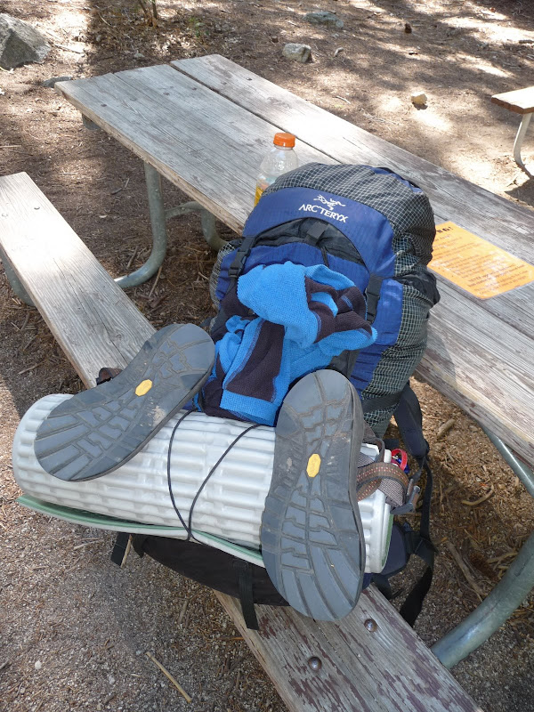
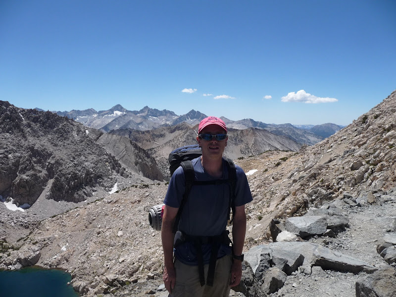
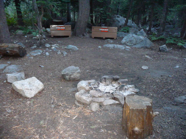
I drove my car to the nearby overnight lot, which was nearly completely full, and got one of the last parallel-parking spots, in the sun. I transferred my food into the bear canister, somehow managed to squeeze everything into my backpack, and headed back to the ranger station and trailhead. At a picnic table by the trailhead, I finished off the gatorade I'd brought from home and ate some snacks, my first food since a small breakfast at 4:30am. Here's my pack ready to go, with the fleece and mat strapped on, and sandals and water bottle (with one liter of Palo Alto tap water to start with) clipped on.
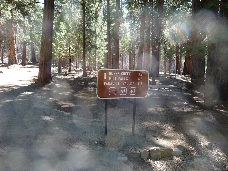
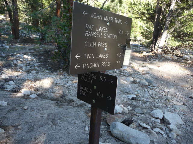
With my permit in hand and nothing to do but cover some 15 (I thought) miles, I was in no hurry, but I finally got started at 10:36am. Here's the sign at the trailhead. Note that all three distances differ from the table above.
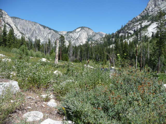
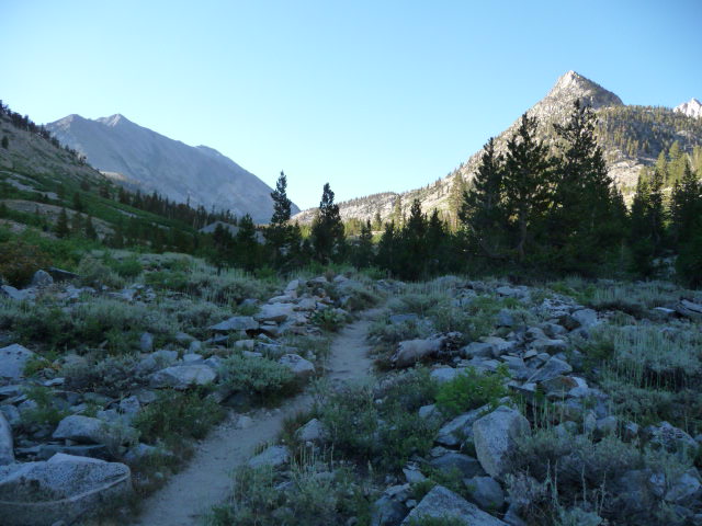
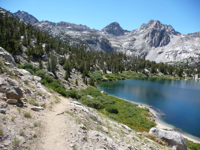
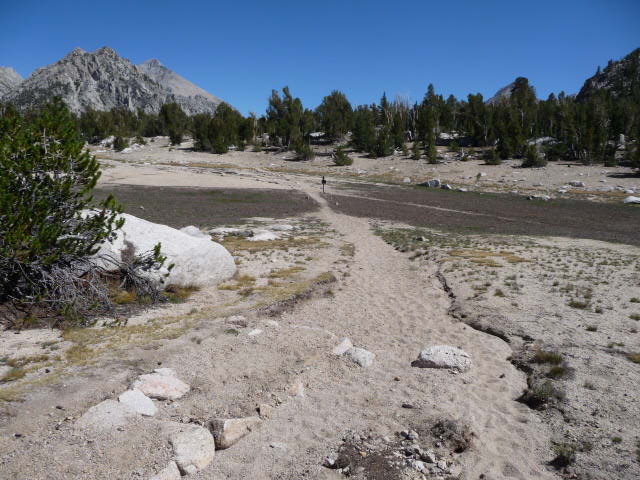
One great thing about this loop is the first two miles (which are also the last two miles since they are before the loop proper) are completely flat, and also have some nice scenery (see the picture at the end). The trail is wide and very nice, if a little sandy and soft in places. So it's the perfect easy way to start a backpacking trip. Even with my 28 pound pack I had no trouble walking the two miles in 32 minutes, or just under 4mph, my normal walking pace on a sidewalk carrying no weight!
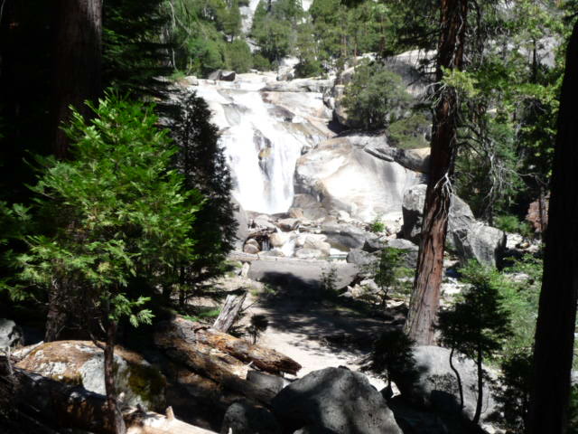
Mist Falls is a popular destination for a day hike from Roads End, and there were quite a few people on the trail. I was easily passing the day hikers, and never saw again the other backpackers who started after me. So I was feeling very good and strong at the beginning. I made it to Mist Falls, 4 miles in, in 1:15, still a good 3.2mph pace. The name Mist Falls brought to mind the Mist Trail and Vernal Falls on the way to Half Dome, but this waterfall was quite disappointing in comparison. Maybe there was real mist earlier in the season. It would turn out there were far more and more impressive waterfalls along Bubbs Creek on the way back, so I'm not sure why people come this way instead.
In fact much of the first 15 or so miles of the loop was rather unexciting scenery-wise, and it seemed the Bubbs Creek trail on the way back was better. So I was thinking maybe the counterclockwise loop would be preferable, as you'd get the better scenery first and save the less exciting stuff for the end when you're too tired to really care. But this direction was still great, and I'm sure both have their advantages and disadvantages.
I was feeling so good early on that I started to have thoughts of maintaining a 3mph pace and doing the hike in two days instead of 3! I'd just need to do 21 to 23 miles (depending on how long the loop really was), maybe trying to make it to Rae Lakes the first day which seemed like it should be about halfway (and indeed it's a little more than halfway in the clockwise direction according to the table above). Of course this would somewhat ruin the point of staying out in the mountains longer, but on the other hand it would be nice to be able to do it, and as I had a lot to do before school starts it wouldn't be bad to get back a day early. I figured I'd just see how it goes.
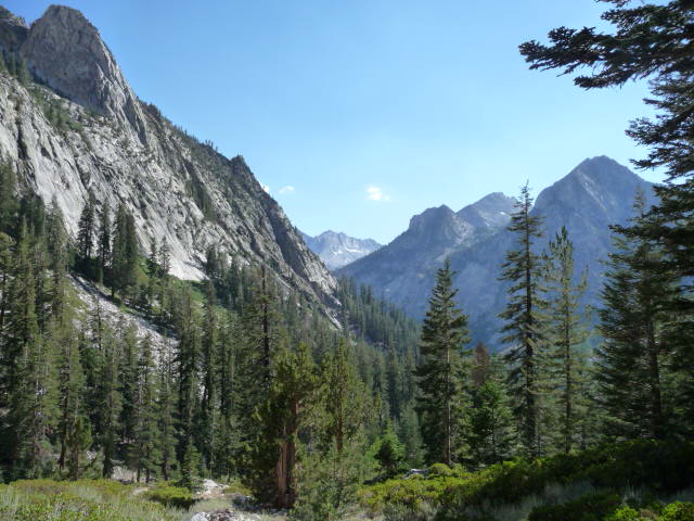
After Mist Falls the next section is through Paradise Valley, which was an extremely nice section although heavily wooded and so not having the best views. Here's one decent picture.
You're only allowed to camp in certain places in three parts (Lower, Middle, and Upper Paradise Valley), and they seemed like nice spots but this was much too early for me. After the mosquito troubles we had last trip I was hoping they'd all be gone by now, but unfortunately the Lower and Middle sections still had a lot of mosquitoes. There seemed to be far fewer by Upper. There was a sign in Lower that said some people had been feeding a young bear and it was now coming to look for food. Also a backpacker coming from the other direction, a little above Lower I think, told me I'd see some bears on the side of the trail just 10 minutes past him. I'd never seen bears before so I was a little excited and also anxious about this, but it turned out they were gone by the time I got there.
The weight of my pack did really start wearing me down, and by Upper Paradise Valley it was clear to me that I wasn't going to be doing 20+ miles that day. I'd be happy just to get to the junction of the John Muir Trail (JMT). Also I could feel friction on the back of my right heel that seemed like it could develop into a blister, but I ignored it and just adjusted my gait hoping nothing would happen. I'd had similar problems (although with the back of my left heel) with my old New Balance shoes, and was hoping these new shoes would be better. I should have been more careful, though, as this would get very painful. I also had a problem that my backpack seemed to be digging into my tailbone, and the straps hurt my shoulders more than normal too. I just attributed this to the weight, but I'd find out later I wasn't quite wearing the backpack high enough, a stupid mistake given that I've used this backpack on many trips before. I just wasn't thinking clearly for some reason--maybe I was more tired than I even thought.
Somewhere between Upper Paradise and the JMT I ran into this very tempting camp spot just off the trail. I passed it by, though.
I was going to have to find my first campsites on my own, and I wasn't quite sure just how I'd do this. I certainly was looking at many areas as I went along and evaluating them, although I thought it would be better to get out of sight of the trail. A problem there was that there often wasn't much flat ground away from the trail. The important criteria was to have a spot of flat ground with no vegetation big enough for my tent, to have shade, and to be close to water but not have mosquitoes. I wasn't sure whether I was going to find such ideal spots, and what I would be willing to give up.
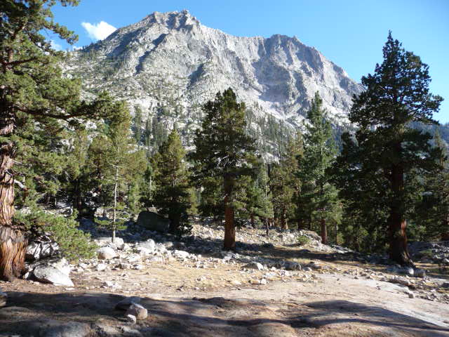
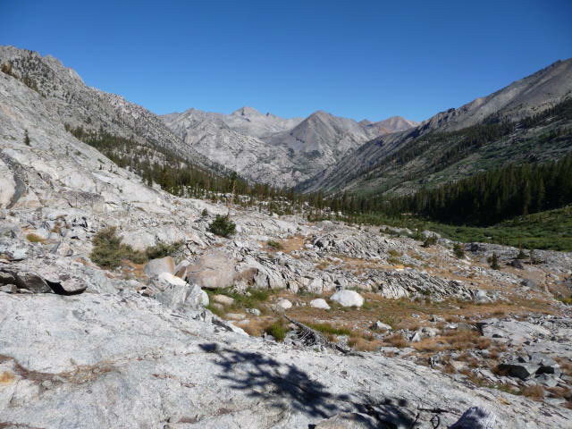
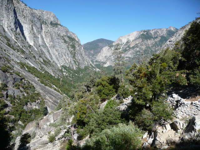
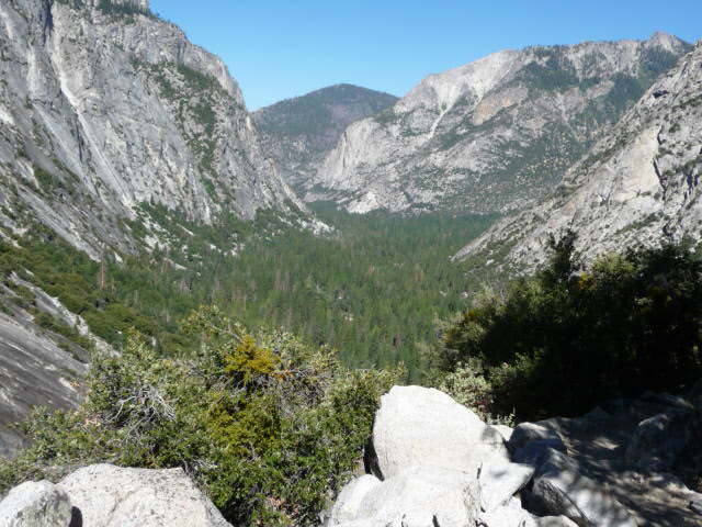
In any case I marched on, getting slower and taking more breaks. Finally I reached the Castle Dome Meadow, getting out of the forest and finally getting some great views.
I was running into another problem now, however: my water was running out! There were supposed to be several seasonal streams crossing the trail around this point but every single one was completely dry. I was getting a bit worried. Of course the trail is following Woods Creek, but I know well from experience that you can be right beside a creek with no contour lines on the map separating you and the creek but it may still well be impossible to get to the water. This was the case. Finally I did reach something that looked like a use path that might lead to water, and I followed it. It went into a nice shady area with lots of horse manure that looked like it had been a recent horse camp. I found my water and coming back a slightly different way found a cleaner camping site with a guy already there. He said he'd wanted to go further but had just run out of energy. I understood completely but still wanted to get to the Muir trail if possible. It looked like a very nice camping spot, though.
Now I had my water filled (I should note that I again drank all the water straight and have been fine) I struggled on for another hour and finally reached the junction with the JMT. The sign says 15.1 miles to Roads End but the table says 17 miles and I believe the latter. It had taken me 7:04 to make it to this point, and so a measly 2.4mph pace (2.3mph for the last 15 miles). I had slowed down quite a bit, and was exhausted.
I had crossed Pinchot Pass just last month on my previous trip, and in fact had hiked to the junction of the JMT with the trail leading to Sawmill Pass, a junction a mere 3.4 miles from where I was. I had been toying with the idea of hiking to that point as a dayhike the next morning, which would provide the satisfaction of connecting these two trips which started from opposite sides of the Sierras, but I knew I wouldn't have the energy and tomorrow would be a tough enough day without adding to the difficulty. A little sad, but I'm sure I'll hike this section soon enough.
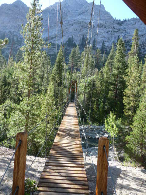
There was still one surprise at the end of the day--a large suspension bridge crossing Woods Creek!
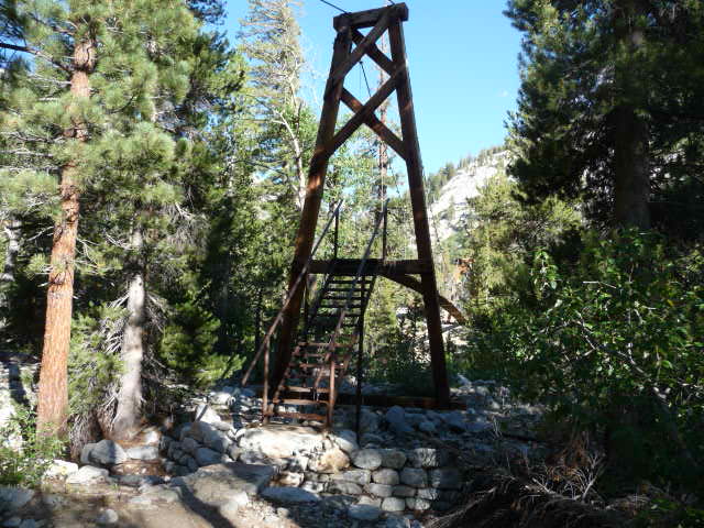
There are signs at each end saying only one person at a time, and it's easy to see why as the the bridge sways and creaks and is a bit frightening. Here's a shot from the other side.
There's a sign taped onto the junction sign (two photos above) saying there's an outhouse on the JMT just a little north of the junction. I think Li had mentioned this place while we were hiking last trip. I didn't visit it though, mainly because I didn't want to make two more trips over the suspension bridge!
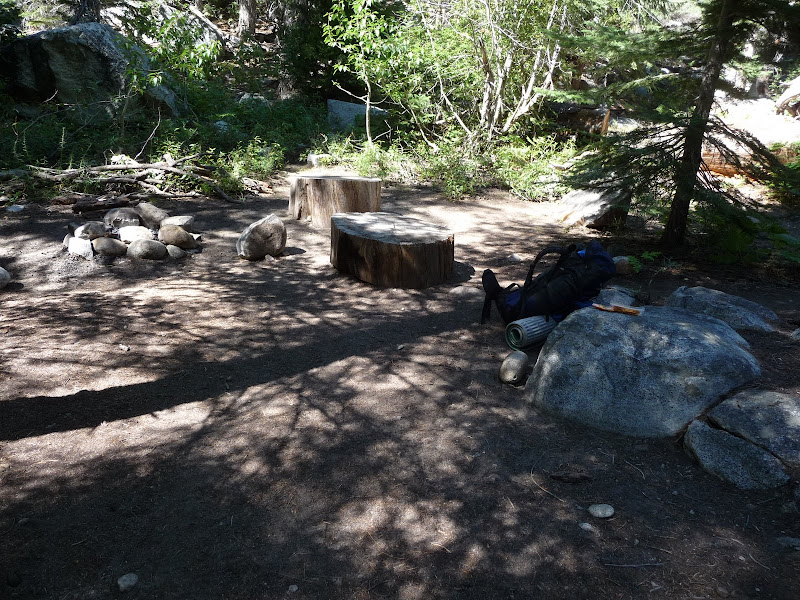
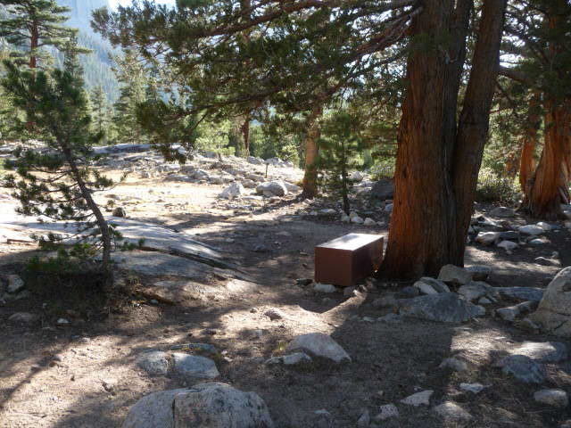
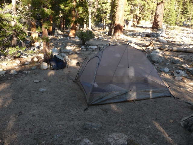
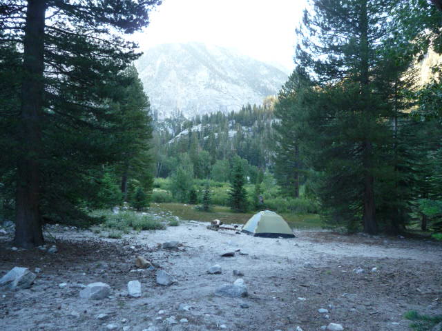
Now on the Muir trail, my first order of business was to find a camp site. I thought near the junction would be bad as there would be lots of people, but I immediately stumbled upon a superb site with a bear box, several nice spots for tents, and plenty of shade just off the trail near the bridge! And amazingly there was no one there! It was very close to the creek and there was a nice breeze and no mosquitoes! It seemed too good to be true, but I decided to stop there. Here's a picture taken from near where I set my tent up. The bridge is to the right.
I had a very nice view too.
Here's my tent set up. There were a lot of good spots and I felt a little bad taking over this site which was designed more for a larger group.
On the other hand despite being at a very popular junction I saw almost no one the time I was there. Not long after I arrived someone crossed the bridge (it was easy to tell since it made a lot of noise), and seeing me there crossed back and I guessed decided to camp on the other side. A couple other people crossed and saw me and headed west down the creek to find some other spot. And it would turn out there were a couple other people a little southwest of where I was who had scouted around more and apparently found an even better spot than I had (the woman said mine was second best).
Actually one thing about doing the trip solo was that I was a bit lonely! So I didn't mind running into people and was happy to camp in a spot with relatively high traffic (which just meant a half dozen people or less). I set up my tent without the fly (no rain worries this trip, and the weather was superb), got some water and washed my feet in the stream, and cooked dinner. I had a lot of trouble getting my stove to light and was worried it would never work, but finally it started. I found a surprising amount of food in the bear box given that there was no one around! So I just kept my food in the canister which was easier anyway. Some of the food seemed to be caches for people doing the JMT (which is supposedly not allowed, I think) and maybe some of that was old and never collected (the reason I suppose it is not allowed!) but at least one sack was used by the couple who were camped out of sight southwest of me. I learned of them since a woman came at one point to get some food and spoons out of the sack.
We talked for a while and I learned she was from Boston, having gone to grad school at Tufts, and worked mostly in Dubai. She'd just come from there recently, via Boston, and was in CA for a friend's wedding and thought to do this trip while she was here. They started Sunday, camping last night in Lower Paradise Valley, which she said was unpleasant not only due to the mosquitoes but due to that bear that had been fed and was now actively trying to get more food. She was woken up over and over the previous night by some other campers yelling at the bear to go away.
There was no sign of bears here, surprisingly, and the mosquitoes seemed few and rather lazy compared to lower down. (Below 6700 feet or so they were pretty bad, but by 8000 feet and above they seemed somewhat apathetic and I didn't have much trouble with them. I never bothered to put on insect repellant the entire trip.)
Lacking energy to do anything else I went to bed quite early, something like 6:30 or 7pm. I just lie down though and didn't actually sleep at all until after 9pm when it actually got dark (plus I don't normally fall asleep until after 9pm). I seemed to wake up a lot during the course of the night, but I must have slept some 7 or 8 hours all total. The temperature was quite good, and only got down to about 46 degrees around dawn.
Although rest and sleep helped over night, I was still quite sore the next day. Basically every part of my body that interfaced with something else hurt--my feet, my tailbone and waist, and my shoulders. I still didn't realize there was a problem with the way I was wearing my backpack. Skin had come off the back of my right heel and that hurt the most. Fortunately I had plenty of moleskin and bandages, but nothing stuck very well and I had to keep stopping and changing it. I adjusted my gait but this seemed to contribute to some blisters starting on my right toes; I was more proactive about putting bandaids on them. Luckily my left foot never developed any real problems. I was worried things would only get worse, but one thing I've always found with long trips, whether cycling or hiking, is that it always seems to go in waves. I have bad patches that seem like they'll get worse, but they pass and then I'll feel good again. This happened several times over this trip.
I deliberately stayed in bed longer than usual to try to get as much rest as possible. Finally I did get up--I forget just when--and ate a hot breakfast. Here I am packed up and ready to go at 7:39am.
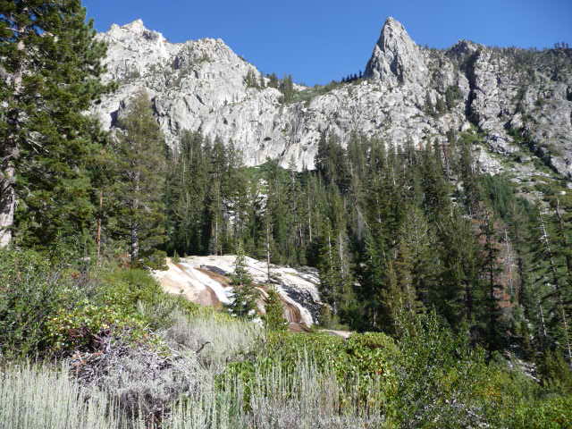
I thought the best scenery of the trip would be along the Muir trail, and indeed it was, but the early segment was more dull than I expected. Here at 8:11am the views start opening up.
At 9:38am even better scenery.
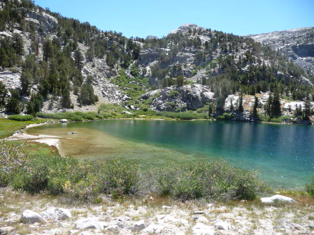
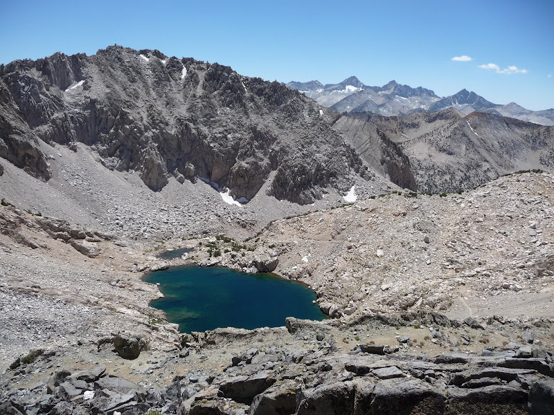
At 9:57am I arrived at Dollar Lake, a particularly beautiful place. I could easily see small fish in the lake. It had taken 2:18 to travel just 5 miles, gaining 1700 feet.
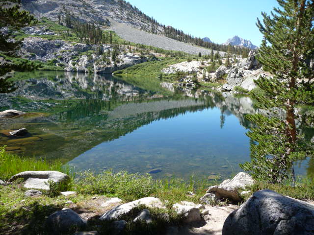
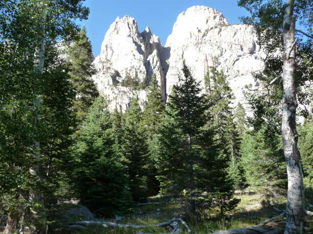
After Dollar Lake, the next major landmark (and perhaps the most impressive of the entire trip) was Fin Dome. I took many pictures of it but sadly all were at low resolution! Here's one of them, taken at 10:57am. I'm not sure if this lake is considered one of the Rae Lakes or is unnamed.
I was running out of my one liter of water, but thought there must be a spring near the ranger hut at Rae Lakes, so I stopped by there and talked briefly with the ranger.
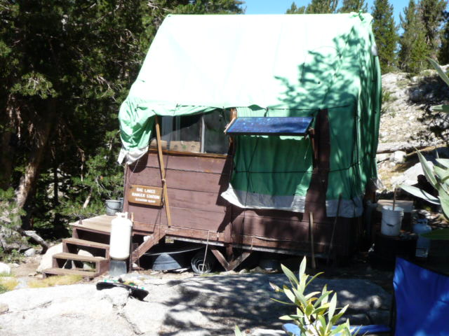
Sure enough he pointed me to the spring near the hut, and I refilled there. He mentioned there was another spring a mile up the climb to Glen Pass, with water running across the trail. I topped off my water there and I think that lasted me until Junction Meadow, or maybe I got some more from streams crossing the trail on the other side.
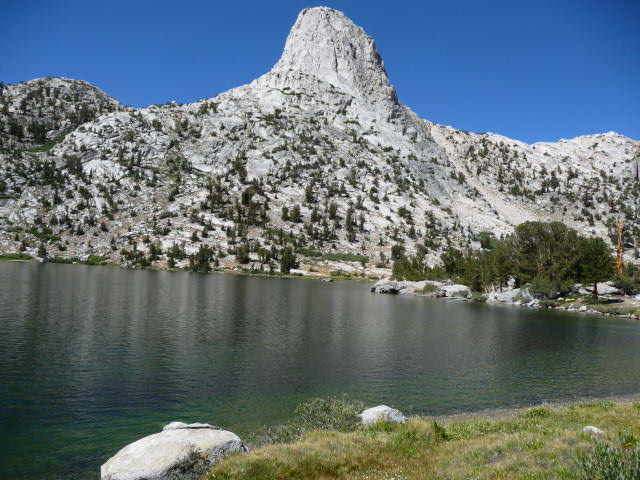
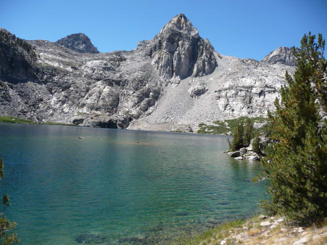
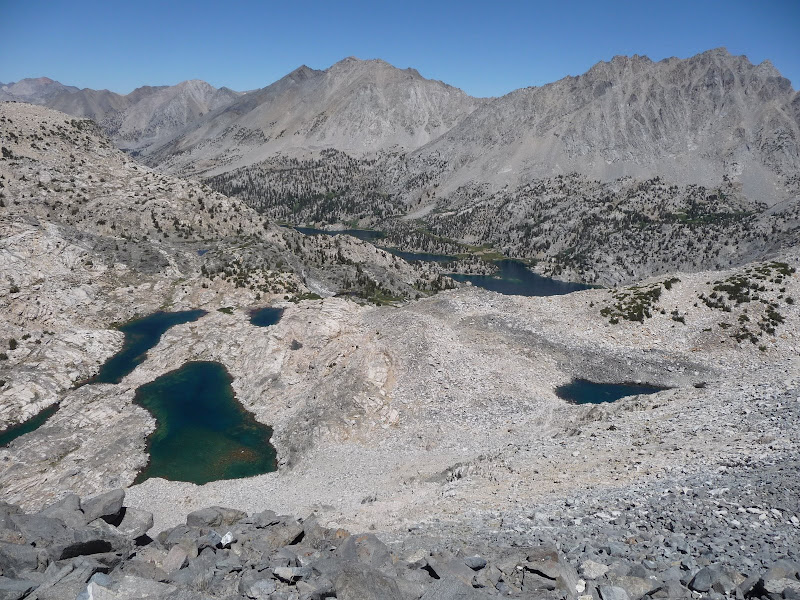
Finally here's the northern Rae Lake, with Painted Lady behind it (11:20am).
More beautiful scenery.
Now the southern Rae Lake again dominated by Painted Lady. The trail goes between the lakes which is really cool.
At noon I reached the junction with the side trail to the Sixty Lakes Basin. It was now (according to the Harrison map) a two mile climb to the top of Glen Pass, gaining over 1400 feet. I was dreading this climb, which would be the toughest of the trip, and I was worried how much trouble I'd have with altitude as Glen Pass is just under 12,000 feet. I'd had terrible altitude trouble all through last trip, but so far hadn't felt anything this trip.
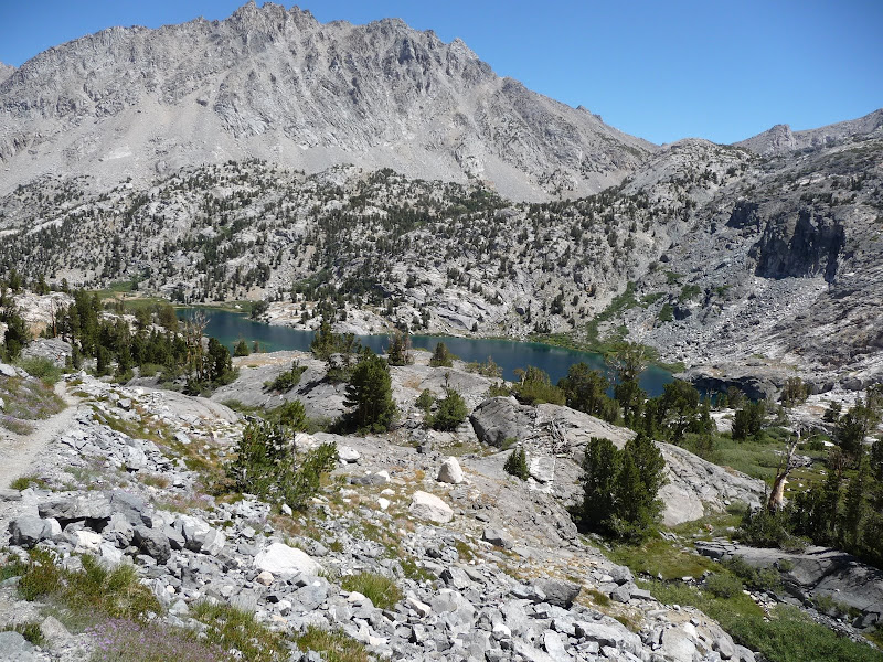
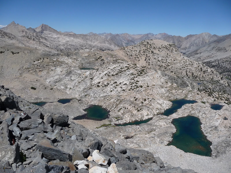
I kept track of my rate of elevation gain per half hour, which I've now forgotten, but I was doing better than I expected. Indeed this segment which I had dreaded turned out to be the highlight of the entire trip! I just love climbing steep trails, and this one was excellent, just right. I got into a good rhythm and just kept going, although I would stop occasionally for pictures or water. Here's a look down at the Rae Lakes from partway up the climb.
Surprisingly I had no trouble with altitude at all! Very surprising. Maybe I just need that one trip early in the summer to get used to altitude and then I'll be fine even with a large gap between trips. I must say I don't really understand my problems with altitude sickness still. It's possible that sleeping at lower elevations than last trip helped too. In any case I was very happy to have no altitude problems. Blisters were just pain and I could keep moving through that. Altitude sickness and knee problems (which I luckily had none of this trip too), on the other hand, are completely debilitating. I was happy to have only the blisters and soreness. Here's the final approach to the top of Glen Pass (11,978 feet).
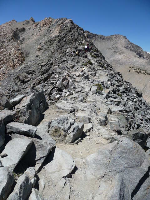
I made it to the top in only 1:24! The view of the other side was of course spectacular.
And here's a look back toward the Rae Lakes.
Looking a little more to the left. Of course it's impossible to capture the true panorama of beauty.
There were quite a few people on top, including a fairly large group of kids (maybe scouts?) with some adult supervisors. One asked me if I wanted my picture taken, which I wouldn't have thought of otherwise. So that was really nice. Here's the result.
I sat down a little lower from the crowds, ate some food and enjoyed the view. I didn't stay long since it was hot up there and I was getting fried. I ended up putting on three layers of sunblock this day, I think, but still nearly got burned.
From the pass we could see a mule train coming up. Here's a picture taken with zoom.
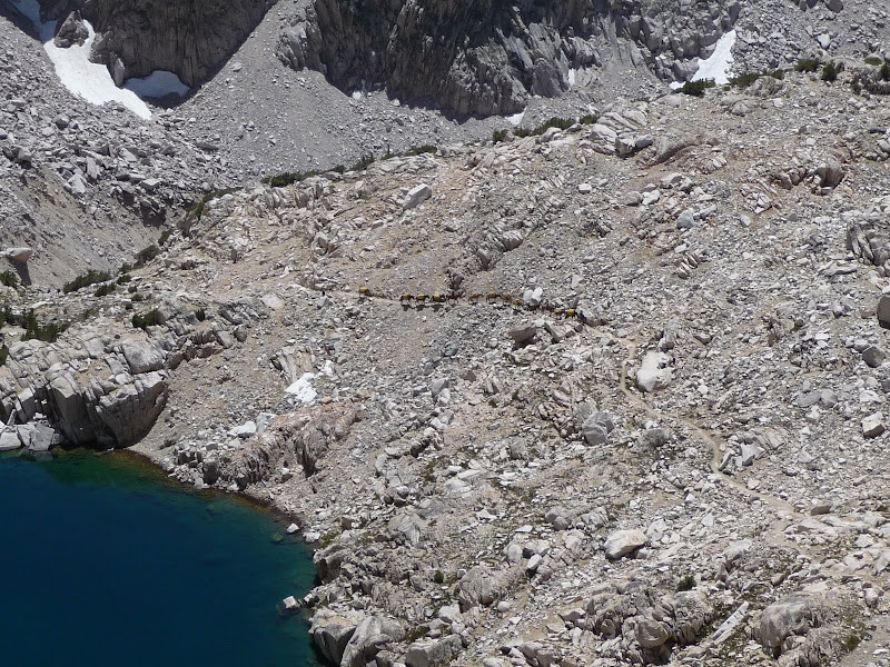
I headed down a bit and still above the mules (or were they horses?) stepped off the trail at one place I could, since it was steep and narrow and there was little room for the most part. I waited for the mules to pass, but unluckily soon after I stopped some of them lower down decided to bolt and head down the trail! I was so confused by all this I neglected to take any pictures, sadly. The muleteers had to cut switchbacks, which was quite dangerous there, and try to catch up to the mules and get them to come back. One guy asked me to hold onto the rope of the lead horse so that he could help and so that the horse would not itself go anywhere. This I did, and I got this nice closeup picture.
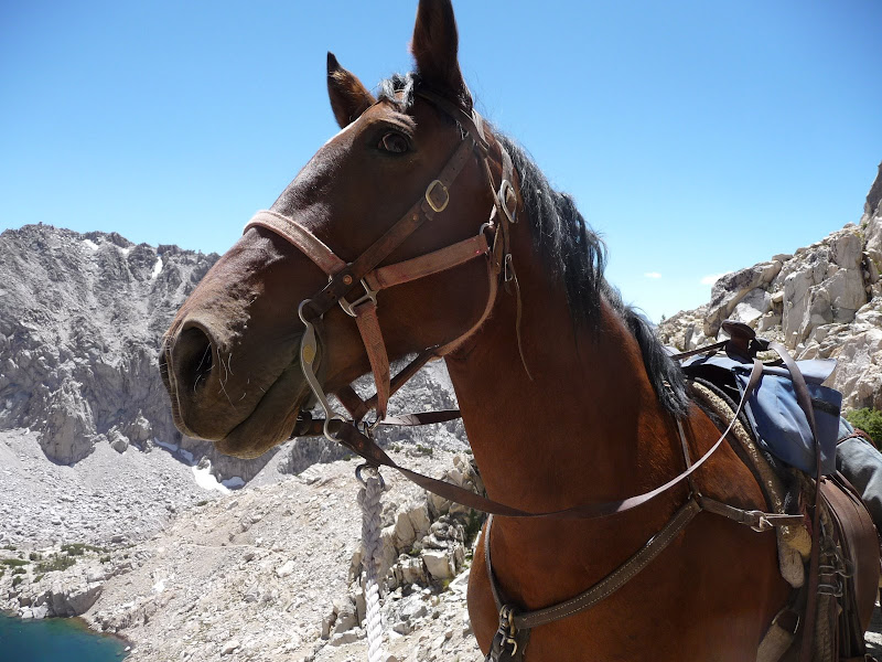
I talked to the horse to keep it calm (apparently this is a good thing to do) and stroked its mane. It would occasionally nuzzle its head into me, which it did with enough force that it was a little scary. Fortunately I was on the uphill side and couldn't be knocked down the mountain, although it perhaps could have crushed me if it wanted to.
Finally they got the mules back in order and took the reigns from me. A woman told me they were from Red's Meadow resort and were taking supplies there. She said I could go there, mention her name and that I'd helped them, and they'd give me a free dinner! I may well take them up on that. The resort is near Mammoth and so a long way away. There was a guy waiting with me who was backpacking the Muir trail starting from Mammoth (he planned to take a bus from Lone Pine back) and had gone through Red's Meadow. I asked him why they didn't just drive their supplies right to the resort (which is on a road) but he didn't seem to understand my question. I'm not sure just why they were doing this, unless it was some kind of practice. They teach classes and guide trips, but this particular trip seemed to be neither--everyone seemed to be a professional. Anyway although I lost over a half hour waiting, it was one of the most interesting experiences of the trip.
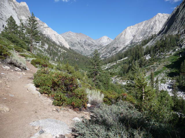
The descent down the pass was otherwise straightforward, and I was able to jog along parts of it. I noted that the thicker soles of my new shoes seemed to make it easier go down rocky trails, but I'm still not completely sure about that. It took a while, but I finally made it down to the trail junctions past Charlotte Lake a little before 3pm. It took 1:19 to descend the 2.5 miles back down to 10,560 feet; very slow, but I did lose a lot of time with the mules.
Past this meadow there was more great scenery; these are East and West Vidette.
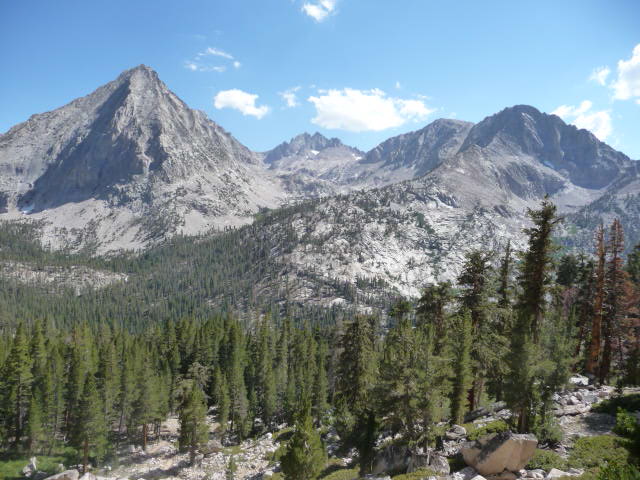
Getting closer to East Vidette.
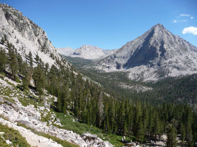
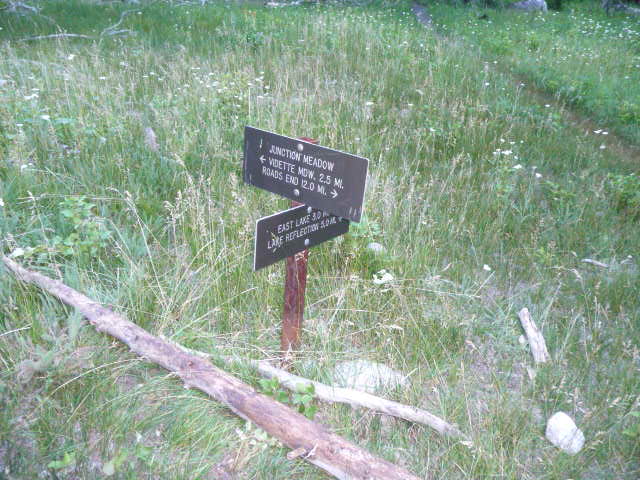
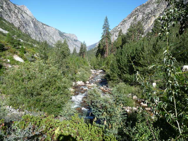
I made it to Vidette Meadow at 3:46pm, and being exhausted thought about just stopping and camping there. But it was still early and I really wanted to make the third day as easy as possible, so I decided to continue the 3 more miles to Junction Meadow. I had now left the Muir trail and was following Bubbs Creek. Here's some scenery along the trail a half hour later.
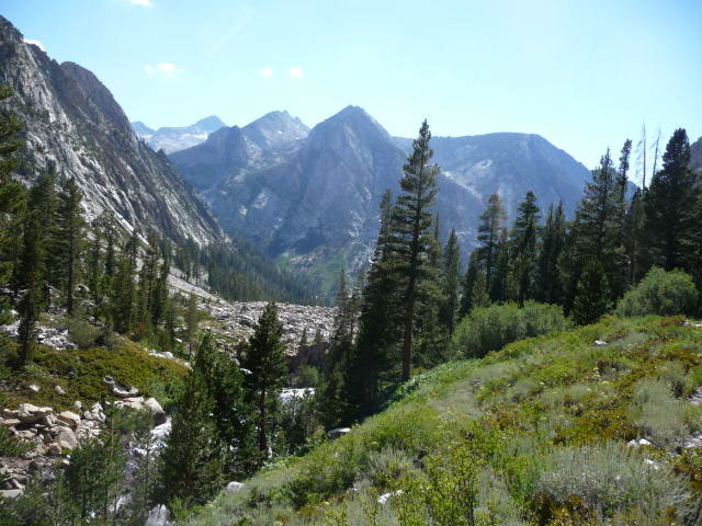
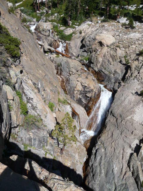
Bubbs Creek had many waterfalls along it, although often they were hard to see well and photograph. Here's one area.
More great scenery. Unfortunately I was too tired and sore to enjoy it!
Scenery further on, a little before Junction Meadow.
Finally at 5:02pm I reached Junction Meadow. It had taken 9:23 to hike 18 miles, for a pathetic average 1.9mph speed. There had been an elevation gain of 3500 feet followed by a loss of 3800 feet, but those are not too much given the distance. The main problem was that I was in pain the whole day and going slowly.
A side trail toward East Lake crossed the creek, and there were camp sites near the river but I decided against them since there would be no view and it seemed there were more mosquitoes there. So I camped in a spot right next to the main trail by the junction, and again surprisingly there was no one else there, although I'd find the reason was that there were a lot more camp sites a little further along. In any case this was a good spot and although there were more mosquitoes than the last site they were still rather lazy and didn't seem to be biting much. It's hard to tell in this overexposed low-resolution picture but my tent is in the lower left. So a spectacular setting.
I ate a hot dinner and then went to bed early again, around 6:30. I was very sore however and slept much less than the night before. The moon was out for a bit even though it never got high, and even after it dipped behind the mountains it still gave off enough light that I couldn't see the stars well until the early morning.
My goal the third day was to get back to the trailhead as quickly as possible. To this end I skipped having a hot breakfast, instead finishing off my cheese and eating other cold snacks, but I still didn't manage to get started until later than I hoped, around 6:56am. Here's the sign at the junction which says I have 12 miles to go; according to the table it is 11 miles and the Harrison map 10.7 miles. I was of course even more sore than the previous day, but my backpack finally felt reasonably light with almost no food left in it, and I figured out I'd been carrying it too low--the part that was pushing against my tailbone was supposed to be above my tailbone. So that relieved a lot of the pain but my feet still hurt, and were getting sore in general from so much pounding as well. I felt like the walking wounded, and it seemed it was going to be a race to see if I could get to the trailhead before becoming seriously disabled.
Still in Junction Meadow I noticed a side trail leading to what was obviously a stock camp.
And further down still I ran into another nice camp site.
At about 8:08am, just before Charlotte Creek, I ran into the ranger doing his trail run! He didn't seem to be carrying anything, even food and water, but probably he had them in a small fanny pack I couldn't see. He said he'd been running for 1.5 hours. As he'd gone 7.5 miles, that's a 5mph pace which if he kept it up would mean it would take him a little over 9 hours to do the loop. I'd love to be able to run this loop in a day, but I fear I'm already too old to be able to get in that kind of shape. I told him it would take me 2 or 3 times his time to get to the trailhead, and I wasn't too far off as it took 2:47 from that point, even though I was going downhill, but then I was rather handicapped.
The scenery continued to be beautiful, overall much better than the Paradise Valley side, and I wished I could have enjoyed it more. Here are some pictures.
At some point on this trail I had my first ever encounter with a bear! At least I think it was a bear, as I actually didn't see it, but suddenly I could hear a crashing sound of something very heavy forcing its way into the vegetation off the trail just ahead of me. The bear had seen me first and fortunately had fled. I saw quite a bit of bear scat along the trail as I continued so I figured it was loping up the trail until it saw me.
I reached the Sphynx Junction at 9:33, and caught up with a group of backpackers who had passed me but were now resting. They had also started from Junction Meadow this morning (perhaps the tent I photographed was one of theirs) but were finishing a much longer trip than I had done--they were in the 8th and last day of a trip from Roads End to the top of Whitney and back! This is over 86 miles roundtrip, and is apparently the shortest approach to Whitney from the west side. Sounds like fun! I sped up after this junction, both to stay ahead of them and more importantly because I'd entered mosquito hell! This section had by far the worst concentration of mosquitoes of the entire loop--there wasn't much breeze and they swarmed in a cloud around me. Fortunately the switchbacks were very high quality and I was able to jog most of the way. I managed to stop and take a few pictures still.
Finally I reached a section of several bridges crossing Bubbs Creek.
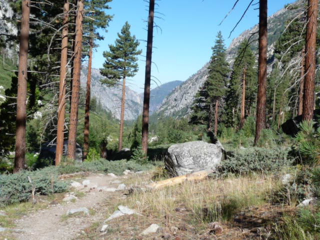
Past the first few I reached the first of two close junctions, which had two signs on opposite sides of the trail, one saying Roads End was 2.0 miles away and the other saying it was 2.2 miles, via the same route! The Harrison map splits the difference and says 2.1 miles, and it's probably right as it seemed about 0.1 miles to the next junction where there is also a 2.0 mile sign, and the start of the easy segment I had begun my trip with. It was nice to finally be back there, although those last 2 miles, which this time took 37 minutes, seemed to go on forever. Once again I was in the land of the day hikers and passed many people going the other way. Here's some of the scenery.

Finally at 10:55am I reached the ranger station, and the end of my journey. It had taken 4 hours to go the final 11 miles, so 2.75mph, I suppose not too terrible given how sore I was.
I returned my bear canister, threw out my trash, and made it back to the car. I then drove 5 hours nonstop home.
The loop was a lot harder than I expected. I'd tried to get my friend Kaya Yuki to do this trip with me but am glad I didn't succeed--it was at the limit of my strength, and I think she would have been very unhappy and perhaps never spoken to me again! An easier trip is in order for her first backpacking experience. One way to make this trip easier would be to allow more days to do it, but the tradeoff is having to carry more weight in food and I'm not really sure where the sweet spot is. But I think with some training both of us would be ready to really enjoy this trip, and I'd love to try it with her in the counterclockwise direction some day.
One lesson I learned is never ever do a multiday hiking trip in new shoes! I really should have taken more time to break them in, or better yet used my old shoes for one last trip rather than throwing them out prior to moving. I won't make that mistake again. Also I need to get used to carrying more weight, and make sure to carry it correctly next time. I've noticed that my enjoyment of hikes varies inversely with how much I carry, but there's no alternative to carrying weight if you're going to backpack, so I just need to get stronger. The trip would have gone much better if I didn't have the pain from blisters and the backpack. Also I love the hiking, but still don't really enjoy eating and sleeping outdoors that much, though I'm getting used to them more at least.
Although it might not seem like it, I honestly don't like to suffer on these trips--my hope is always that I'll be in good enough shape that they'll be fairly easy and that I'll be able to enjoy everything, but more often than not it doesn't seem to work out that way. I guess one has to push oneself to get stronger, and I hope I did get stronger from this trip. I consider it to be a success--I didn't make too many bad decisions and managed to get through despite them, and even though there was some pain I've forgotten that already and mostly remember how beautiful it was. Most importantly this trip demarcated the end of my summer, and finishing it I'm ready now for my new job and the new school year.