This is a long report. For an explanation of climbing ratings (2nd class, 3rd class, etc) that are used often in this report, see for example here.
Pictures taken by Daniel Ralston with his camera are noted in the text by (DR).
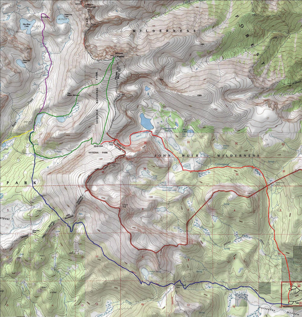
The map below shows very roughly where we went each day. July 8 is blue, 9 is green, 10 is purple, and 11 is green followed by red. A short walk at the end July 10 is shown in yellow.
It must have been around a year ago, likely on some UCLA math department hike, when I first talked with Professor Jim Ralston about his trips to the Sierras. I found out that he did backpacking trips that revolved around 3rd class climbing. This sounded like exactly what I would most enjoy doing, and I asked him if I could come along sometime. It was already too late for last summer, but he very kindly invited me to join his group this summer, for an expedition to Bench Lake to climb Arrow Peak. Jim and his longtime friend Richard Korf, a professor in the UCLA computer science department, had attempted Arrow Peak via this route last summer but had gotten unnerved and decided not to do it. This time they wanted to make it to the top.
I had only backpacked once in my life before, apparently October 7-8, 2000, in the Santa Cruz Mountains in the Bay Area. My friend Mike Vermeulen and I did the Skyline-to-the-Sea trail in reverse (so The-Sea-to-Skyline) in two days with a car shuttle (my wife helped by driving one car back): 12 miles the first day and 19 the second. So this was only one overnight, and we stayed at a campground with running water and toilets that night so this could hardly be considered roughing it. Still we did get most of our food stolen by animals and have some other interesting adventures...unfortunately I can't find any writeup of that trip, though. The next closest thing I'd done to backpacking was the High Sierra Camp Loop in Yosemite, but that was far too luxurious. I was eager to try the real thing. I actually was planning a two-night solo backpacking trip--something like a loop starting at Lodgepole Campground or Crescent Meadows on the west side of Sequoia National Park. When Jim invited me on his trip I abandoned that one, but I would still like to do it sometime.
The original plan was to be out for as many as seven days, but once details were more settled the plan was for five days and four nights. A couple days to hike to Bench Lake, then a couple days to climb Arrow Peak and maybe something else, and then a day to hike out. Five people would be going: Jim and his son Daniel, Daniel's friend Alan Lewis, and Rich. Interestingly we had a representative from each age decade (tell me if I get the exact age wrong), with Daniel being 28, Alan 30, myself 42, Rich 50 and Jim 62. Everyone aside from myself had extensive backpacking experience. Jim and Rich had spent decades exploring the Sierras and other ranges; Rich had also climbed Denali and Aconcogua. Daniel had backpacked since he was 5 years old, and Alan had just hiked the John Muir Trail (which I am hoping to do, as early as next summer) plus an additional 70 miles with a friend who is a serious long-distance hiker. I was the only person with essentially no experience at all, and I was looking forward to learning a lot from everyone. I knew that everyone has different opinions on what to do, so I figured it would be especially nice to be going with four other people.
Backpacking, like most things, is really very simple. You just bring sufficient clothing, shelter and food with you and you walk, eat and sleep. Of course once you start to think about how to do this "optimally" things start getting complicated, but I didn't want to get too bogged down in the details. I'd read quite a lot about backpacking from books, but knew the only way to really learn how to do it was to do it. Fortunately I had most of the equipment already; mostly what I was concerned about was food--how much to bring and what to carry it in. In much of the Sierras bear canisters are required. I didn't want to carry something that heavy and was happy to see that the Ursack with an aluminum insert is conditionally approved this year, so I ordered one online. When we found out the area we were going to does not require canisters, I figured I'd just bring the Ursack without the insert and thus have some protection against marmots and so forth. Rich and Alan would be bringing stoves, and Jim would lend a lightweight 2 person tent that Rich and I could use; since Rich was carrying his stove and pots, I volunteered to carry the tent.
Another decision was which backpack to use. I found everything would fit into my Khamsin 52 liter pack, but I wanted to try my new Naos 70 liter pack that I'd bought for Rainier (which I won't do until next summer). I'd only used the Naos once before on a dayhike and carried maybe 30 pounds in it. I liked it a lot, but wanted to try it on a real backpacking trip, so even though it was overkill for this one I decided to use it. I wasn't sure how concerned I wanted to be about weight. On one hand I knew the less I carried the more enjoyable it would be. On the other hand I need to start training my body to carry extra weight, since I'll need to carry 40+ pounds for Rainier. I figured I would simply bring what I felt I needed but not any extraneous weight and see how that worked out. I didn't have the tent when I weighed my backpack, but my estimate is that my pack weight was 35-40 pounds depending on how much water I carried (up to 2 liters).
I've put the details of what I brought and so forth in an appendix near the end of this report since this is likely of interest only to me. I was quite worried I wouldn't be properly prepared for this trip, more worried than I was able to admit to myself.
Our plan was to meet at the Lone Pine visitor center at 4:30pm, so we got off to a late start. Jim picked me up at 11:45am, we drove to Rich's place and he drove the three of us to Lone Pine. Daniel and Alan drove separately from San Diego. We still hadn't decided just what we would do this day. Daniel and Alan wanted to start the hike that evening, once temperatures cooled off a bit in Taboose Pass, which involves climbing 6000 feet in 8 miles in desert conditions. We would camp after gaining say half that elevation, and hopefully it wouldn't be too hot at that point. Then the next day we could try to make it to Bench Lake, 6 miles from the pass. Rich on the other hand favored camping at Horseshoe Meadow to acclimatize, and then drive to the trailhead early in the morning and get in about 6 miles before it got too hot; we'd then do the rest of the distance the next day. We'd have to leave Horseshoe Meadow very early though to get to the trailhead and start hiking before it would get too hot.
I favored the former plan as I was eager to get started. I was also very excited to finally visit Kings Canyon National Park. I told Jim and Rich of the "Kings Canyon Curse". I had intended to visit Kings Canyon several times, including two long bicycle trips (to Reno and Las Vegas) but something always conspired to keep me out. Finally the Curse would end!
As we were driving up 395, Rich noticed a discoloration in the sky ahead and wondered if there was a fire in the distance. Jim and I thought otherwise, but it would turn out Rich was right.
We got to the visitor center an hour early at 3:30pm. Unfortunately Daniel and Alan were still going to get there at 4:30. But we figured we could pick up the wilderness permit and wait for them. There was something of a line, but finally we got to the counter only to learn some incredible news: There had been some 20 lightning strikes near Independence the previous afternoon, igniting 10 wildfires! Highway 395 was closed beyond Lone Pine (and it would soon after close down to Pearsonville, so we were lucky to make it to Lone Pine). There was apparently talk of evacuating part of Independence. There was no way to get to our trailhead, which was north of Independence, right around the fire area. And no one had any idea when the fire would be contained and we could do our hike. It was lucky this hadn't happened when we were in the middle of the trip, as we could have been trapped and unable to get back to our car!
Here are four LA Times articles about the Inyo Complex fire. They may become unavailable at some point.
In any case we had to now make other plans. One option was to just cancel the trip and come back later once the fires were out. However Jim's and Rich's schedules for the rest of the summer made this impossible. We decided since we were there we might as well do some kind of trip, and due to the fire our options were now very limited. There were spaces to enter at Cottonwood Pass on Sunday, which meant we'd be hiking in the Whitney Region. Jim and Rich had already spent a lot of time in this region and would have preferred to go elsewhere, but that was our only option. It looked like we could make a decent trip out of it, even if it overlapped some trips Jim and Rich had already done. We'd go to Lower Soldier Lake the first day, then maybe spend a day there exploring. The third day we'd go through Miter Basin and over Crabtree Pass, camping somewhere around the Crabtree Lakes. The fourth day we'd descend into Crabtree Meadow and then head up the Muir trail to Guitar Lake. Finally we'd climb to Trail Crest, perhaps summit Whitney (which Daniel had never done) and then descend to Whitney Portal. There was one problem in that Trail Crest now has a quota and there were only 4 spots left but 5 in our party! But the ranger was able to get permission from her supervisor to add one more in these exceptional circumstances.
We now had a new itinerary, but still had some problems. One was that we were now in an area requiring bear canisters! Jim had brought his just in case, but Rich hadn't and decided to rent one (they had only one left). Alan and I had our Ursacks but without the liners, and decided just to use those and hope they were okay. As it turned out we only camped at Soldier Lake which had a food storage locker, so we were fine, and we didn't see any bears. Another problem was that none of us had a map of this region with us! Rich bought the Tom Harrison Mt. Whitney High Country map, which I already own but of course had left at home. I didn't want another one, and figured we'd be fine with just Rich's map. This is the first time I've done a significant hike without my own map, though, and it felt very strange.
The trailhead for Cottonwood Pass is Horseshoe Meadow! Jim and I told Rich he should be careful what he wishes for. What's more, this new plan meant we would not be entering Kings Canyon National Park after all! The Curse continues! We'd enter Sequoia National Park instead. I'd been inside this park once before, just briefly a year ago: the Whitney trail from Trail Crest to the summit is inside the park.
We had burgers for lunch at the Whitney Cafe (much better than the High Sierra Cafe I'd gone to with Kyoko and Kyle), dropped off Daniel's car at Whitney Portal, and all drove to Horseshoe Meadow in Rich's car. We talked about how this was 7/7/07, supposedly the luckiest day of the century, and all the bad luck we'd already had that day (Daniel's windshield had also cracked). Alan happened to notice, I think when we were in the car, when it was 7:07pm.
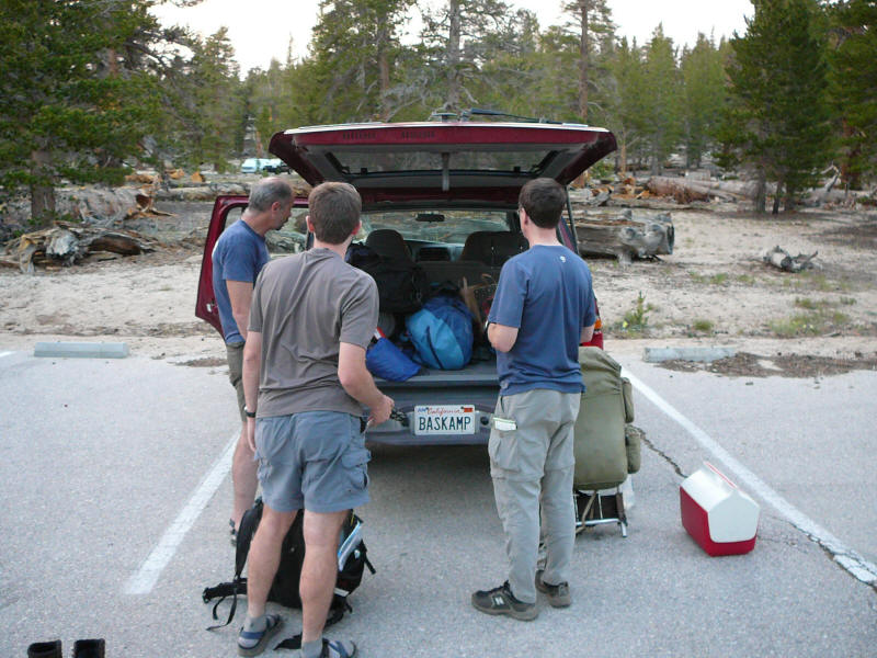
The campground was full when we arrived, but there was plenty of space nearby so we just set up a little beyond the campground. There was piped water and vault toilets, so were still in some kind of civilization. Here we are unloading our stuff. (DR)
Daniel set up his tent and Alan his hammock. Rich decided to sleep in the car and Jim and I elected to just sleep under the stars. The only other time I tried to do this was at Joshua Tree and it started raining in the middle of the night, forcing a hasty retreat into my own car. But this time the weather was absolutely perfect, and there were no bugs as well. Here is my simple setup; clothes in the stuff sack act as the pillow.
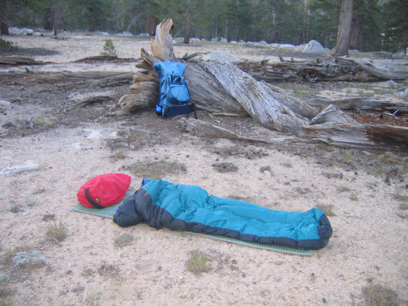
This was very comfortable and a wonderful way to spend the night. The only trouble was that I didn't end up sleeping, or if I did it could only have been for an hour or so. But it was a wonderful experience--I could follow the entire progress of the night, something I'd never done before. The stars were amazing, and later the moon rose in the sky. Eventually the sky started to get lighter and lighter and dawn arrived.
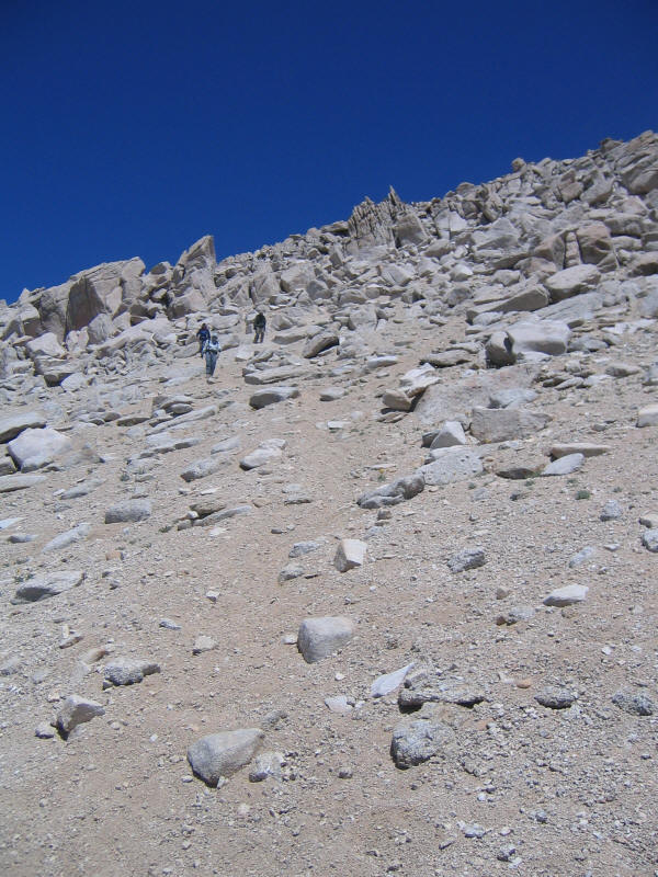
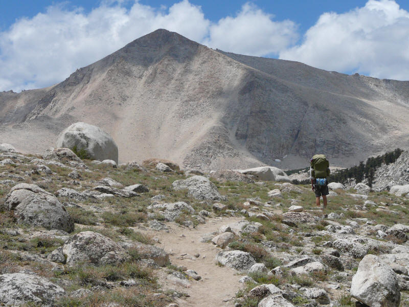
Despite not sleeping I still felt fine the next morning. We had breakfast by the car, and then started out just after 8am. The plan was just to hike at our own speed and meet up at the pass, 3.8 miles away. I was excited to finally begin the trip. I started out hiking with Alan, the fastest of our group, and felt pretty decent. I had plenty of worries about my condition, since I'd been feeling weak for the last couple weeks (probably my body fighting some colds my son had) and hadn't done much exercise. Also I was a few pounds overweight, but I felt like that was probably good because I'd have some to burn off and not have to eat so much. I'd never carried so much weight before, and not for so long, so I was wondering how I'd hold up with that. Finally there was my nemesis altitude, which I'd already had trouble with earlier in the summer. I was hoping that previous acclimatization at Whitney Portal when I camped there with Kyoko and Kyle the week before, plus the night at Horseshoe Meadow (which is about 10,000 feet) would be enough. This was to be an easy day as well: Just 3.8 miles to Cottonwood Pass at 11,140 feet, then 4.6 mostly flat miles along the Pacific Crest Trail to another junction also at 11,140 feet, and finally 1.8 miles slightly downhill to where we'd camp near Lower Soldier Lake at 10,800 feet. (Incidentally my map says 0.7 miles for the last segment, whereas I recall Rich's map, the same one but perhaps a newer edition, said 0.5 miles.) So just 10.2 miles with maybe 1500 feet or so of total elevation gain. Enormously easier than what we were going to do going up Taboose Pass. You couldn't ask for an easier first day of backpacking.
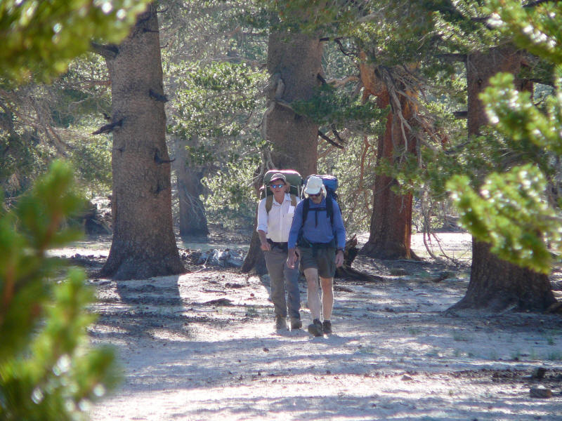
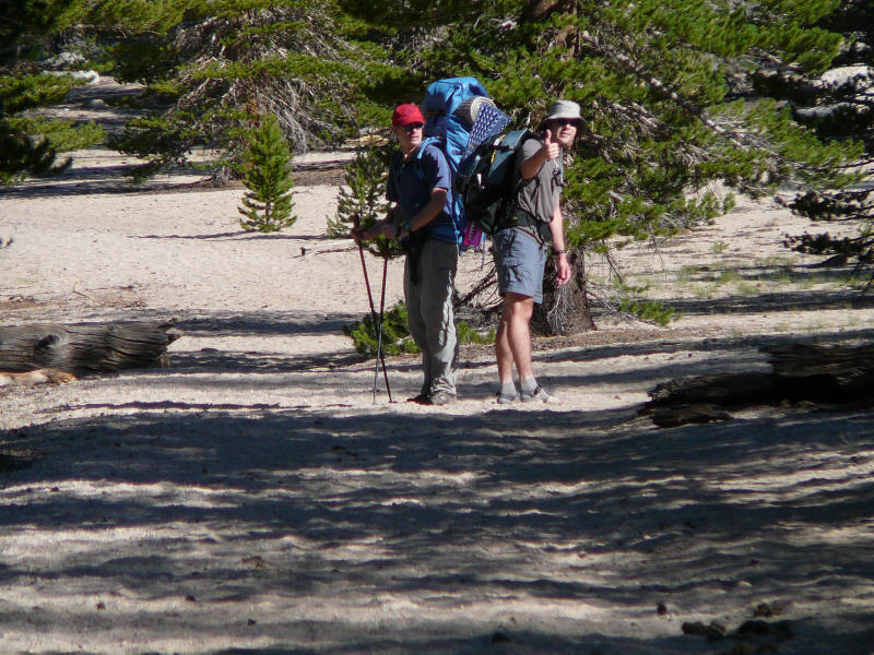
Here are Jim and Rich near the beginning. (DR)
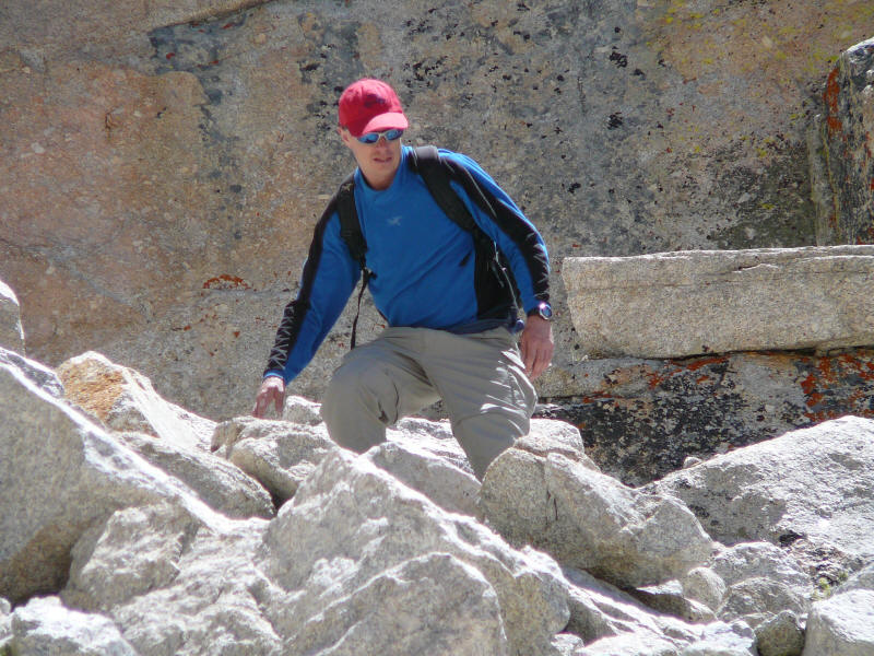
And here are myself and Alan. (DR) As I didn't take any pictures of Daniel, and he took very few of himself, he doesn't appear until in a photo later in this report. Note in this picture that I was too lazy to squeeze my sleeping pad into the pack (I did squeeze it in on the way back). Also I'm the only one with trekking poles. Another worry I had was my right heel and arch which had been hurting recently, so I wanted to be careful with them. Also I thought the poles would help a lot when carrying a heavy pack, and indeed they did.
Here's Rich near the beginning in one of the greener sections. (DR)
Here is Big Whitney Meadow, from around Cottonwood Pass. We reached the pass at around 11am.
Although I started out strongly, I quickly wore out. I'm sure part of it was not being in good shape and not being used to carrying so much weight. Also the heat got me down, although I drank plenty of water. But it was clear the major factor was the altitude. It wasn't nearly as bad as the worst times I've had it, but clearly I was feeling altitude sickness. I went slower and slower, and everyone passed me. Finally only Jim stayed back with me to make sure I was okay. I was very glad we were doing this rather than the much harder Taboose Pass. Who knows what would have happened to me had we done that. In a way things worked out very well.
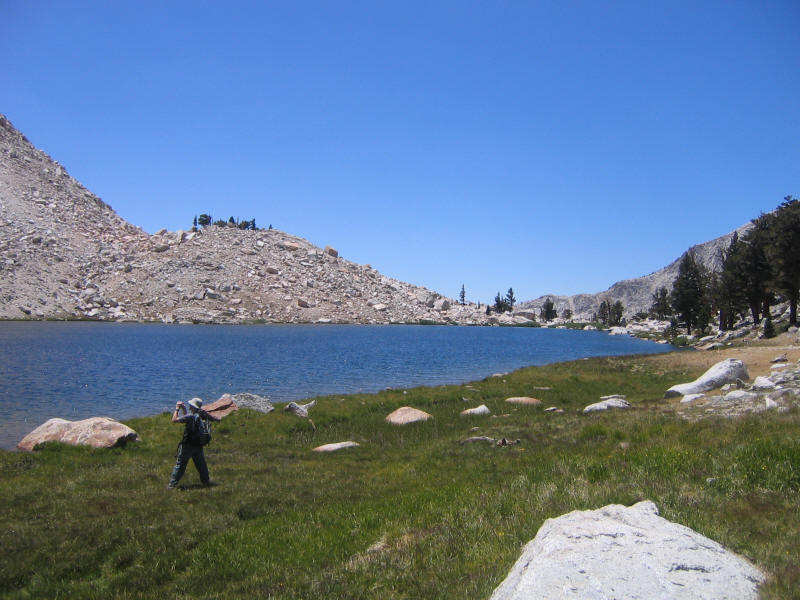
There were several other groups hiking this trail, which seems very popular, and most of them seemed to doing roughly the same thing we were, that is heading for Whitney. However they'd follow the PCT around rather than going cross-country like we were going to do. As slow as I was, I was still faster than most of these other people, so I didn't feel too terrible, and I was happy to be in a strong group even if that meant I was the weakest. We ran into a trio, two men and a woman (one of the very few women we saw in the backcountry--I didn't realize how strange this was until I returned to UCLA and saw so many women around!), and found out they were also going to Soldier Lake. Upon hearing this Rich decided to go there as fast as possible so that we could get his favorite campsite. So he and Alan took off. The other three of us ended up leapfrogging the trio the rest of the trip. Although I reached the camp a good hour after Rich did (he arrived around 1pm, and I 2pm), I still was ahead of the trio. We didn't see just where they set up but did see them once or twice walking around later.
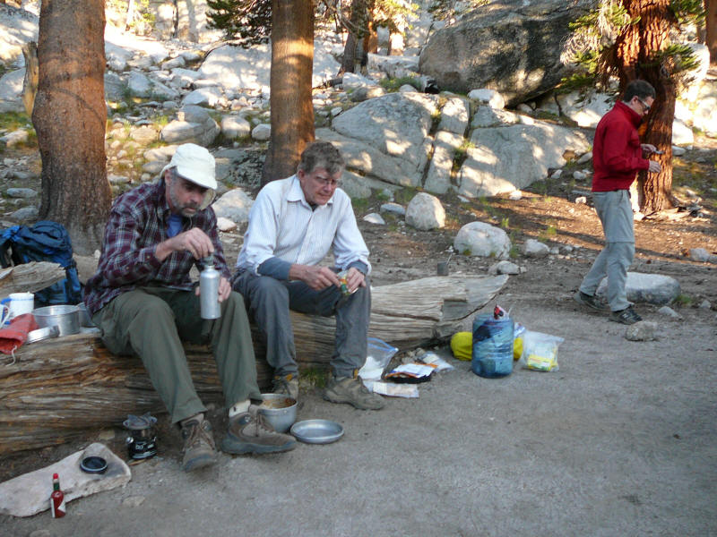
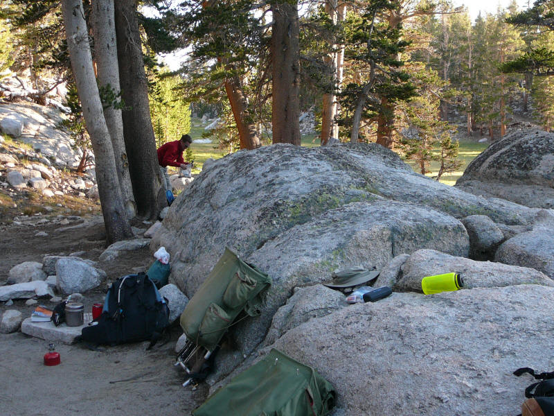
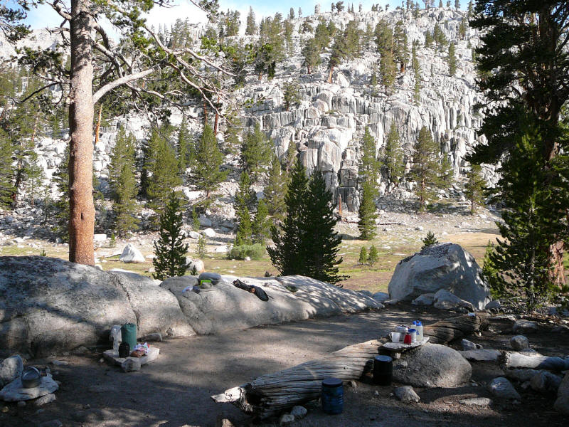
Rich found us a terrific spot, and we'd spend the rest of the trip there. Here's a picture of our cooking area. (DR)
Here is Alan's hammock (the green one with the fly), which he used in place of a tent. Daniel brought the blue hammock just to rest in. (DR)
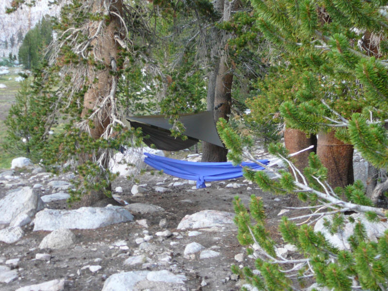
Here's the other side of the cooking area, with me preparing my freeze-dried dinner in the background. (DR)
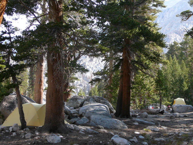
The next two pictures were actually taken July 10 in the morning. The first shows the Ralston tent on the left and the tent Rich and I used on the right in the distance. (DR)
Here's another view of our kitchen and common area between the tents. (DR)
By the end of the first day I had a good idea of each person's style. One difference was backpacks. Jim and Daniel both used old external frame packs. Rich used a large internal-frame pack, although not as large as my own pack. I was embarrassed to bring such a large backpack but was happy I'd tried it out on this trip. It performed wonderfully and was very comfortable. There was a little soreness at my left hipbone, but I think this was caused by the belt on my pants. A day or two before the end I cut off the belt (which is stupidly sown into the pants at one place). Alan, who was experimenting with ultra lightweight techniques, used a Mountainsmith Ghost, a bag favored in those circles. He still carried a lot of weight in it, including a heavy personal locator beacon he'd purchased for winter camping trips in Oregon, and Rich's copy of Secor's first-edition High Sierra book. Indeed I lifted everyone's pack at the start of our trip and couldn't notice any real difference between their weights.
Alan was also experimenting with lightweight shelters, and had brought along a recently purchased hammock that a friend had used. It was very interesting with a rainfly and the sleeping area is enclosed with mesh for bug protection, certainly essential for this trip. He apparently found it somewhat uncomfortable to sleep in, though. The Ralstons brought their two superlightweight Black Diamond tents, the Skylight (a 2.5 person tent they used) and the Lighthouse (a 2 person tent). Both were single-wall and very light indeed; I think Daniel said the Skylight weights 4.5 pounds and the Lighthouse 3.5 pounds packed. Interestingly both apparently can't be sold in California since they are not flame-resistant, but we didn't cook in our tents so that was not an issue. The Skylight looked even better, but the Lighthouse was a very nice tent. Plenty of room for Rich and I, and it kept the bugs out and kept us dry (even though the Ralstons hadn't yet seam-sealed it). On the down side ventilation was poor (only a small opening on one side) and there was only one door, which is very inconvenient with two people.
For stoves, Rich brought his Coleman Peak-1 which he said had worked flawlessly for him for over 20 years. Alan brought his Snowpeak Gigapower stove which is similar to my own Primus. Both stoves worked well. For food we brought all sorts of things. Jim, Daniel and Alan were on the gourmet side and brought some fairly fancy food requiring a fair amount of preparation. I was happy with my Mountain Home freeze-dried meals which only require adding boiling water. Rich was somewhere in-between. What we all shared in common is that we brought way too much food. I was surprised at even the veterans doing this, but they didn't seem concerned about carrying extra weight.
Most interesting was everyone's attitude toward purifying water. Both Rich and Alan were careful to purify everything they drank (although not water they washed with); Rich using iodine and Alan using chlorine (for cooking they instead made sure the water was well-boiling). Jim wanted water coming out of Lower Soldier Lake to be purified but wasn't concerned with water higher up. Daniel talked about just drinking water from streams but in practice seemed to drink almost only purified water. I was a little surprised at all this, as it seemed the most recent research had shown that there is little danger in drinking unpurified Sierra water. For example there is this excellent article which I didn't read until after the trip but which is referenced in some books I have. I personally have a water filter which I used exactly once (on my long North Dome hike in Yosemite, back when I was worried about filtering water) and will probably never use again, and I carry iodine tablets in case of emergency (doubtful-looking water) but have yet to open them. I decided I wasn't going to let water be a worry for me, and if I get sick then so be it. We'll see what happens.
At this point my real worry was altitude sickness, which I was the only one in our group suffering from. I felt awful and my digestive system was completely screwed up. I recall sitting in camp, feeling terrible, thinking it was such a waste to be in this beautiful place and not be able to enjoy it. It seemed so unfair that I should love mountains yet have all this trouble with altitude. I started to think maybe I should give up mountaineering and forget about the trips I'd been planning to climb Shasta, Hood and Rainier. Of course this just made me feel worse. I was hoping I'd acclimatize soon and start feeling better, but it wasn't clear that would happen. There was nothing to do but wait. Then on top of this I again couldn't sleep this night. A little better than the night before, maybe 2-3 hours, but still miserable. This was the low point of the trip.
I still felt terrible this morning but was able to eat breakfast (I found hot food easier to eat than cold). Our plan was an easy hike to the summit of Mount Langley, which at 14,027 feet is the southernmost 14er in California. Rich had climbed it before but none of the others had, and I at least was looking forward to a combination of an easy day and being able to bag another 14er. Of course with my altitude problems the day could be very hard indeed, but I was hoping after a couple nights I might be okay. Only 3200 feet elevation gain, but this was all at high altitude.
We started off at 6:45am, I seem to recall, and here's a picture taken at 7:20. (DR)

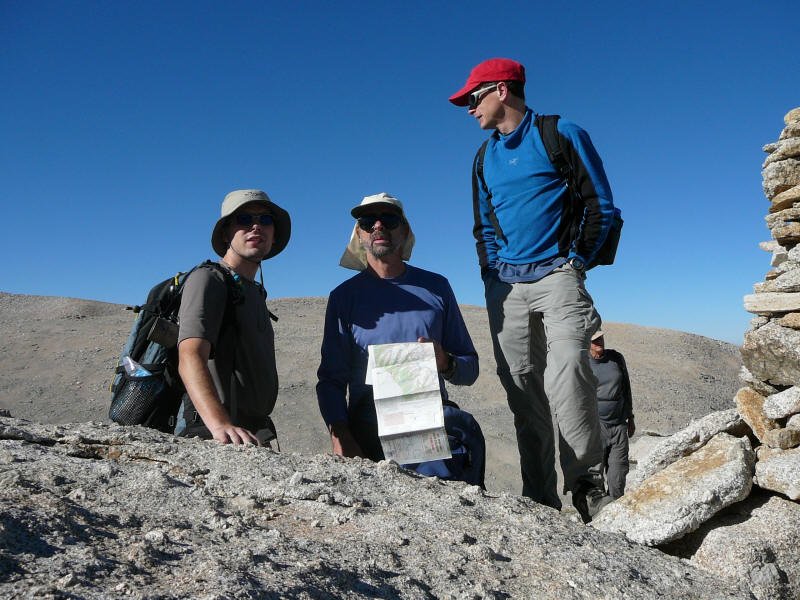
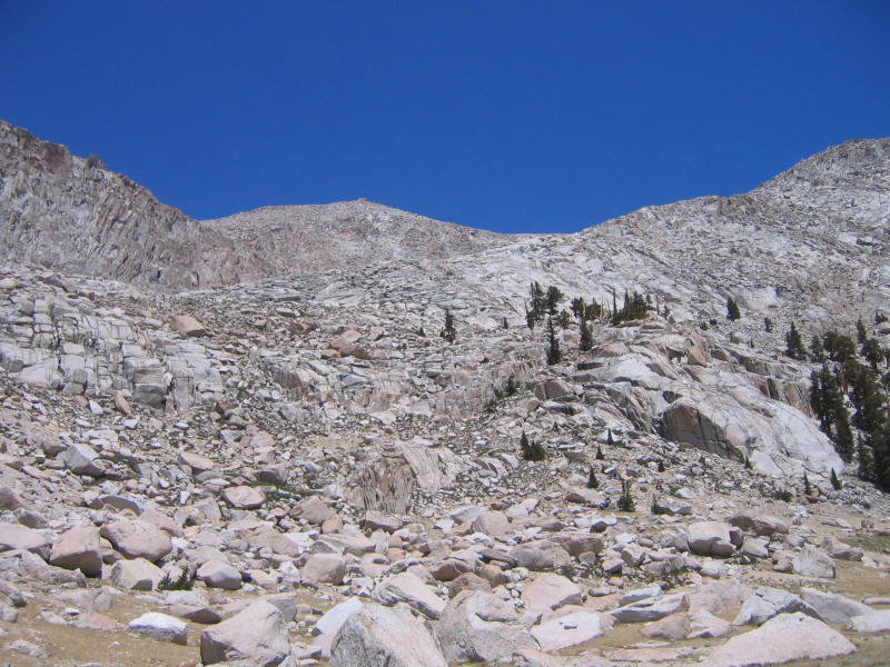
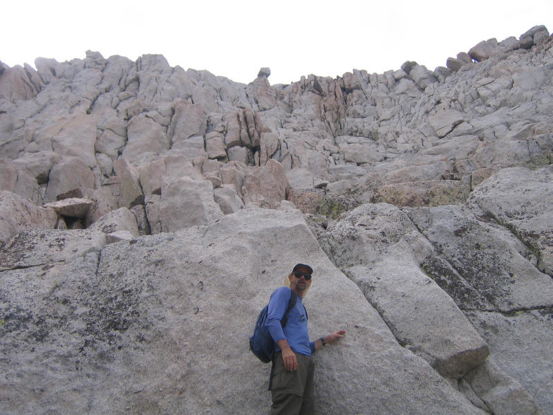
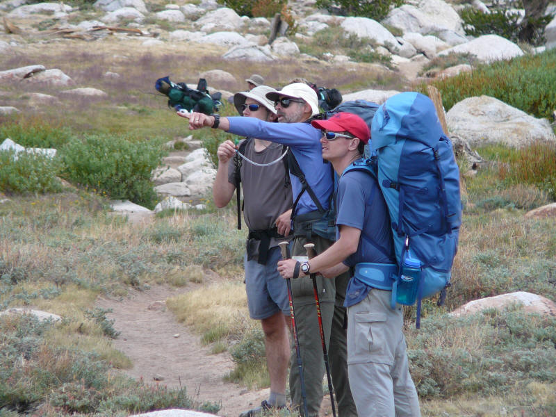
Our plan was to take the trail toward New Army Pass, branch off toward Old Army Pass, and then head up the easy slopes of the mountain. The route was supposed to be class 1, but I was expecting something more like Mt. Dana where it's really class 2 with a lot of boulder hopping. I was surprised then to find a real trail leading up the mountain! There were actually several use trails and often a trail would split into two or more parts, so it got more and more confusing. Here we are at 8:10am in front of one of the gendarmes. (DR)
And a little later trying to figure out which way to go. (DR)
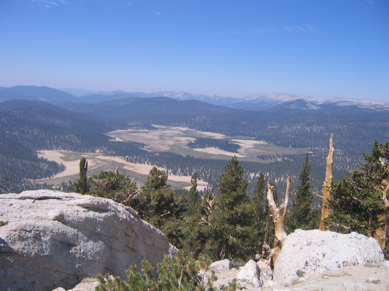
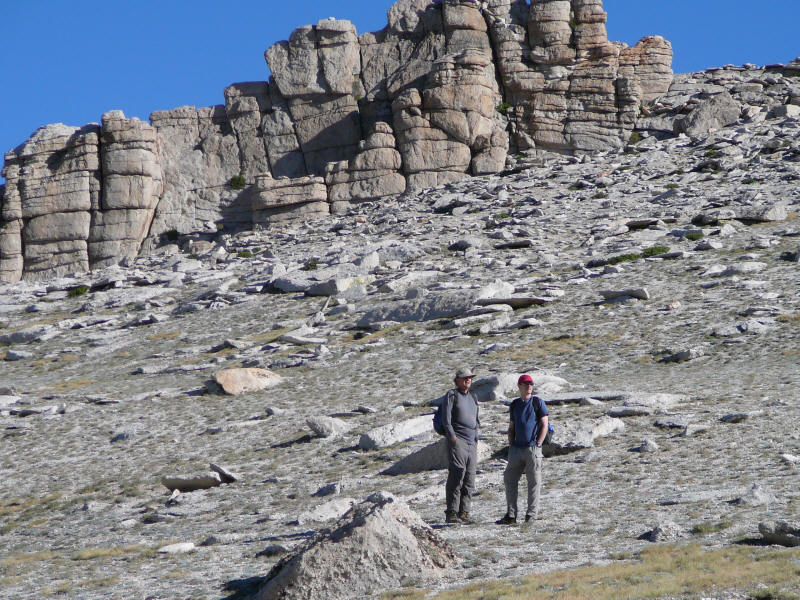
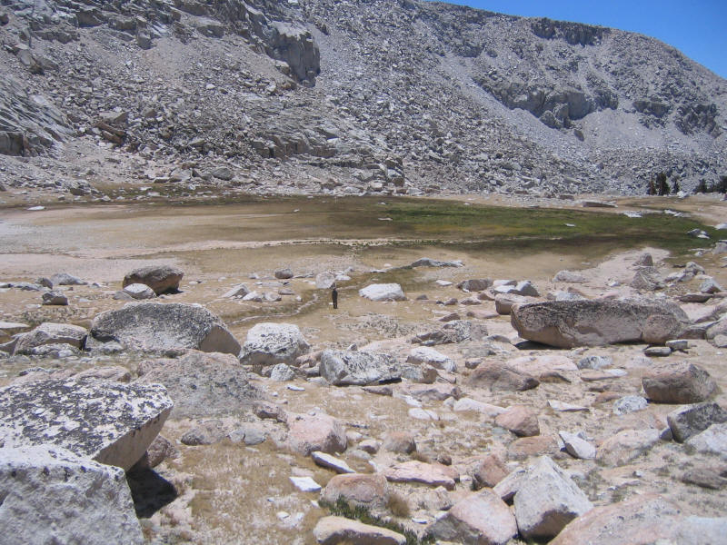
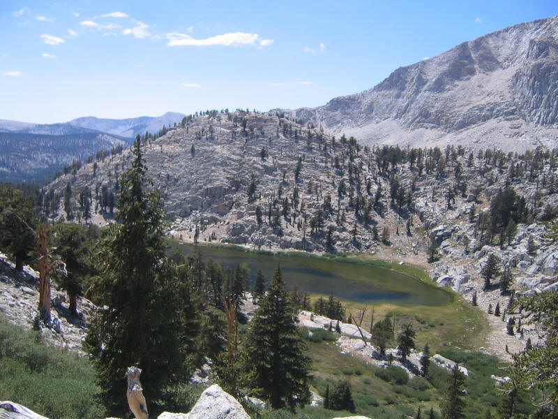
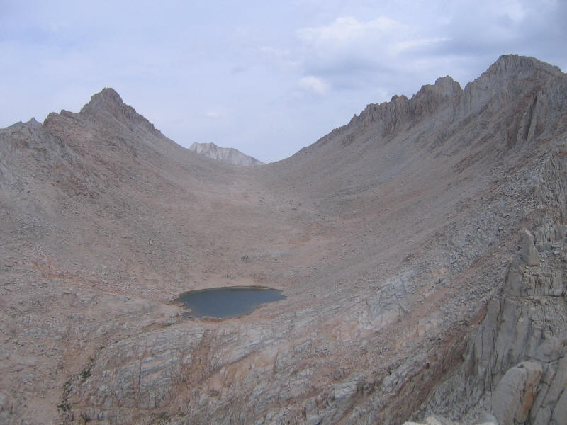
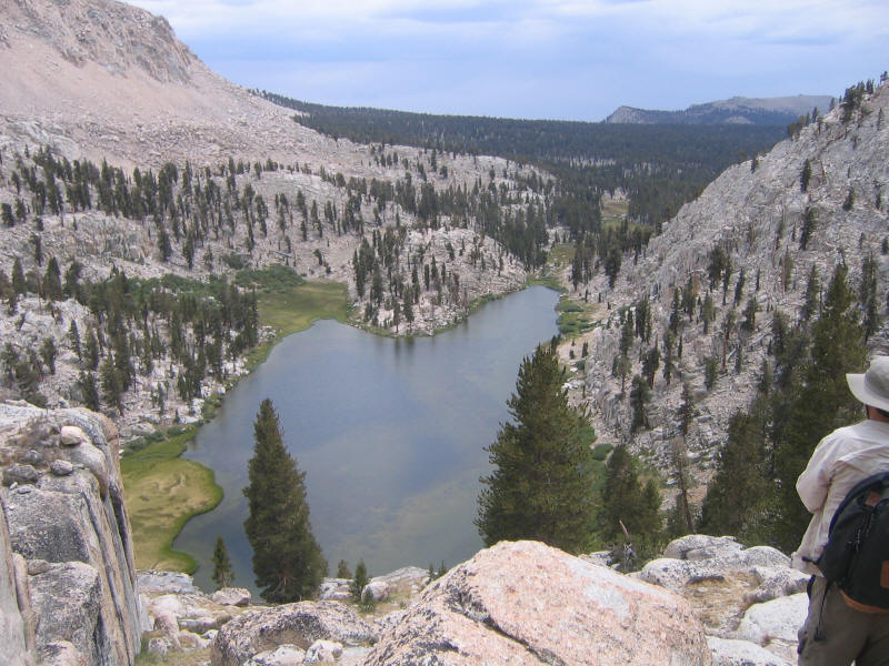
Alan, Daniel and I took off ahead of the others. Soon we couldn't see Jim and Rich, and just tried to figure out our own route. At one point there was a choice of going up to a ridge or moving to the right and then apparently going up later at a better angle. I was for going straight up now to get a better idea of where we were, but Alan liked the latter route especially since the that trail seemed to get more use. We eventually made it up to a plateau, but still had a while to go. We decided to wait and hope we'd see the other two even if they came up a different way. Here's a picture perhaps taken from the plateau a little after 10am. I believe it shows the larger Upper Soldier Lake in the foreground and the small heart-shaped lake is Rock Creek Lake. Lower Soldier Lake where we were camped is hidden slightly to the right of Rock Creek Lake.
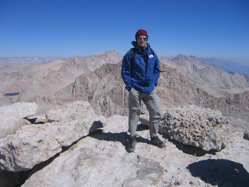
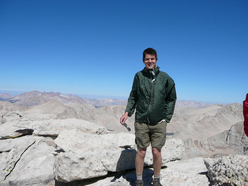
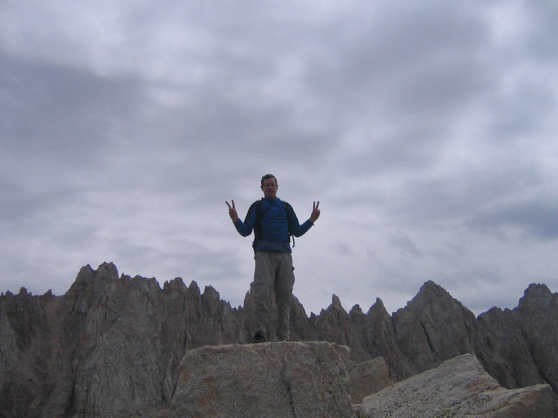
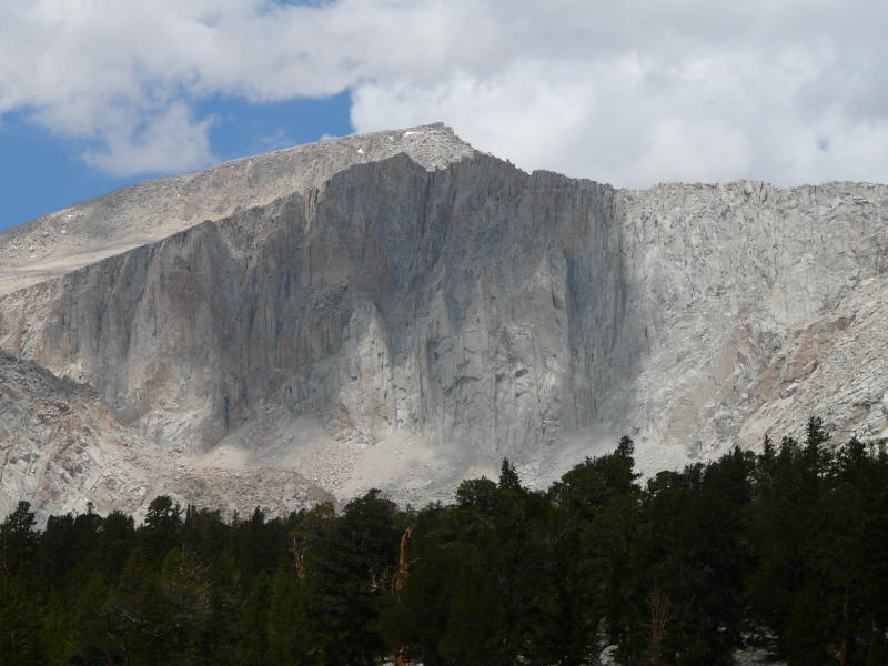
After a while we finally saw Jim and Rich, but they were way to the left of us, so we'd gotten off the best route. We hurried to rejoin them, now behind, and whereas I had a lot of energy earlier after this wait I now felt very tired and started lagging behind everyone again. The hiking did start getting toward class 2 near the top, and rather than go around rocks I decided to just climb a few making it class 3 for me; more tiring but a lot more fun. Finally around 10:20am we reached the summit. The wind, which was quite cold, had been getting stronger and stronger, and on the summit was probably around 30mph. I didn't bring my anemometer unfortunately, not thinking it would be windy this trip. Here's a picture of me on the summit, with Mount Whitney (14,505 feet) in the background.
And a shot of Mount Whitney itself. Quite impressive from this angle.
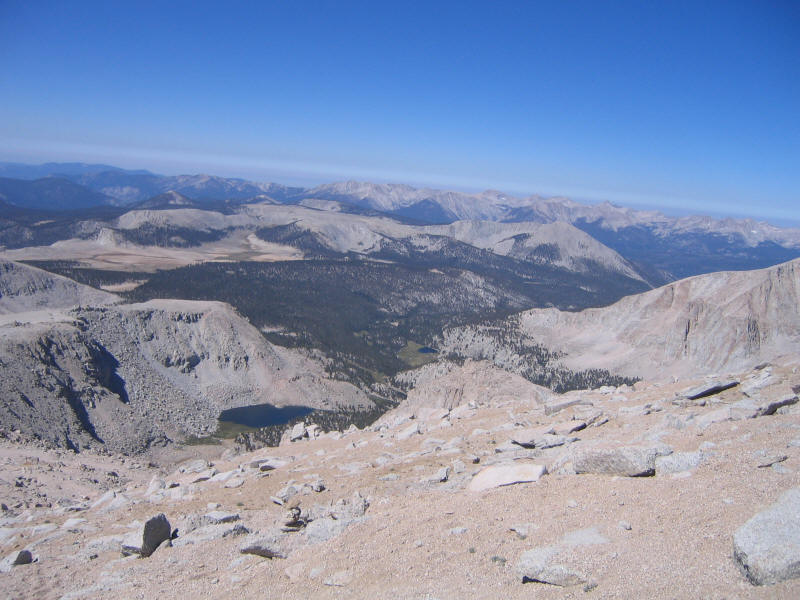
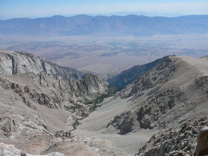
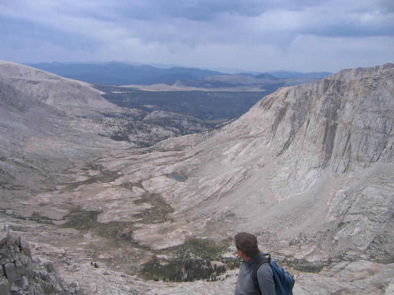
Here's a view down a drainage to the Owens Valley, 10,000 feet below. (DR)
Here's a rare picture of Daniel Ralston. (DR, probably taken by Alan)
I wasn't keen on staying on the summit long, but the others wanted to have lunch there so we hid behind a big rock to keep out of the wind. Here's a group photo taken with the self-timer. (DR)

I didn't feel very good on the summit, but actually felt much better than I expected, so it seemed I was acclimatizing. We ended up staying on the summit for around 50 minutes, until about 11:10am. We were the only ones on the summit the whole time, but we did pass a group coming up after we'd gone down a while. Here's a picture of us descending.
Once we reached a certain point, Jim wanted to try descending a gully leading to Upper Soldier Lake. This gully looked like a lot of fun to me, but I thought maybe I was being naive. And certainly it was not clear if we'd run into some cliff and have to turn back. Rich didn't like the look of the gully and thought it would be no fun, on top of the worry of having to double back. After some discussion we decided Jim, Daniel and I would take this gully and Rich and Alan would return via the trail. We'd see who made it back first. We started down the gully at around noon, and here is Jim negotiating a section near the top. (DR)
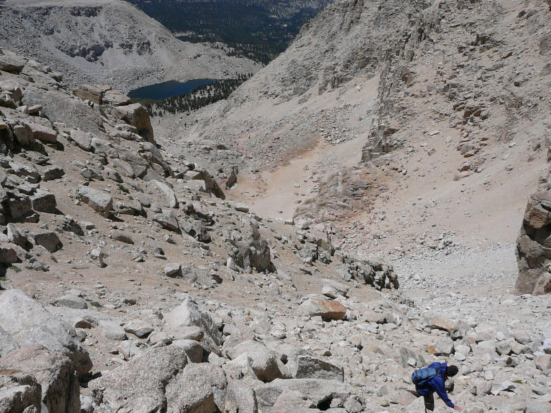
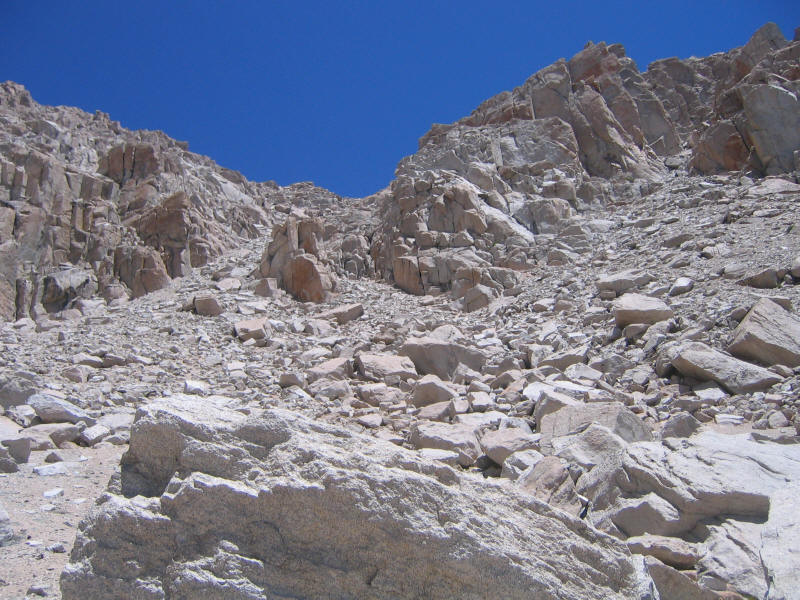
The gully turned out to be a lot of fun. It was mostly scree and loose rocks, which aren't the greatest, but it never got scary or dangerous. It was certainly a lot more fun to go down than it would be been to go up, and I was happy to get some "scree surfing" practice since I heard you also get to do that on Shasta. Here I am almost in a surfing pose. (DR)
Actually more useful was the plunge-step, which I'd learned in May as a technique for descending steep snow but which worked beautifully for scree as well. (DR)
At one point I was riding a sort of mini-avalanche of scree and bigger rocks, which was a little unnerving but it didn't last for long. Here's a shot back up the gully.
And another one further down.
Finally we reached a plateau.
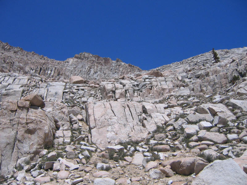
However there was still a long way down to the lake, and more 2nd class to get there.
Here's what we came down from the intermediate plateau.
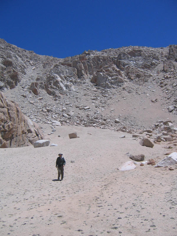
Finally we reached the plateau of the lake at about 1pm, so an hour to get down.
A look back up our gully.
And the adjacent gully to the south. We were surprised to see Rich and Alan coming down this gully! In fact Jim had been thinking of taking this one instead. Rich ran into someone at the top who said this descent was not bad, and indeed there was a sort of trail down it and it seemed quite easy. They would have beaten us down except they had to backtrack a bit to get out of our gully. The same guy also gave Rich some beta (information) on how to climb the Miter, which we were planning to do the next day. So that was great.
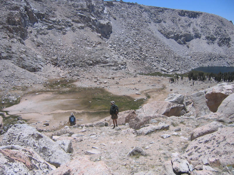
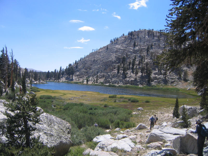
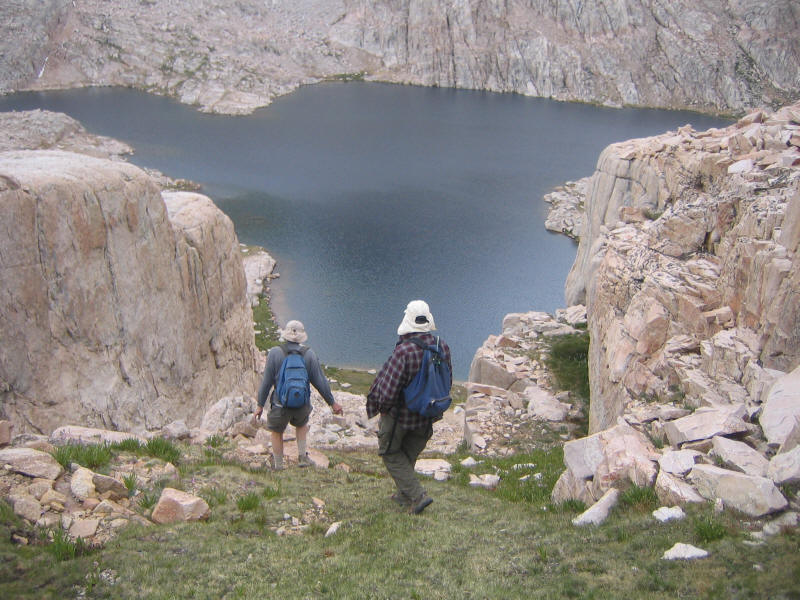
Here we are at Upper Soldier Lake.
Now we still had to get down to Lower Soldier Lake, another 2nd class descent with some different challenges including marshes and thrashing through willows.
We eventually made it down, however, arriving at Lower Soldier Lake around 2:35.
We made it back to camp around 2:50, so a little over 8 hours. The distance was probably around 8-10 miles. This was a fantastic hike. Not only did I climb another 14er (so with Whitney I have two in California now, and two in Colorado: Grays and Quandary) but the cross-country descent was also enormously fun. I was tired and still sick, but starting to feel better. I even slept decently that night, maybe as much as 6 hours. The only bad thing was that there were many more mosquitoes than the previous night, which turned out to indicate the weather was getting worse.
The next morning I felt much better. My appetite had finally returned as well. Our plan was to climb the Miter (12,770 feet), which Jim and Rich had looked at before but didn't find a true 3rd class route on. Secor's book mentions "the northwest chute of the north summit has been reported as being class 3" so we thought we'd try that. The guy Rich had run into before, whose name we found out this day was Mike Bigelow, told Rich he'd tried to climb the Miter three times before succeeding on the fourth attempt, staying on the right side of the northwest chute. He said it was good quality class 3, so we were eager to try it. We'd learn from a member of his group that he posts to climber.org, and on returning to LA we found his posting about the Miter.
We left pretty late, around 7:15am or so. At first we thought Alan would join us and we were waiting for him, but it turns out he didn't want to go (he's not interested in 3rd class or above climbing it seems) and wanted to spend a leisurely morning enjoying his dehydrated eggs. Daniel decided to stay with him, so it was just Rich, Jim and myself. Alan and Daniel would later explore the Miter Basin, but wouldn't climb anything.
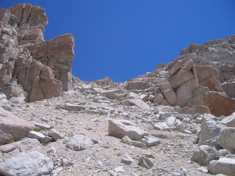
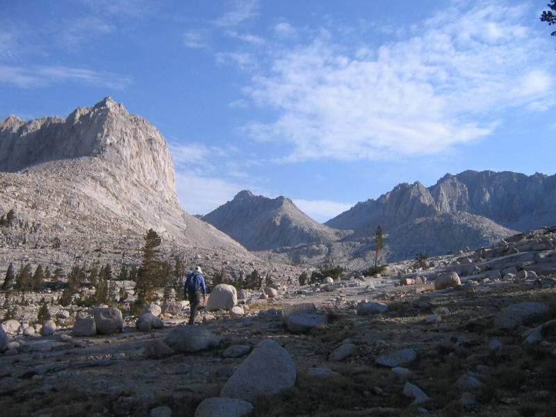
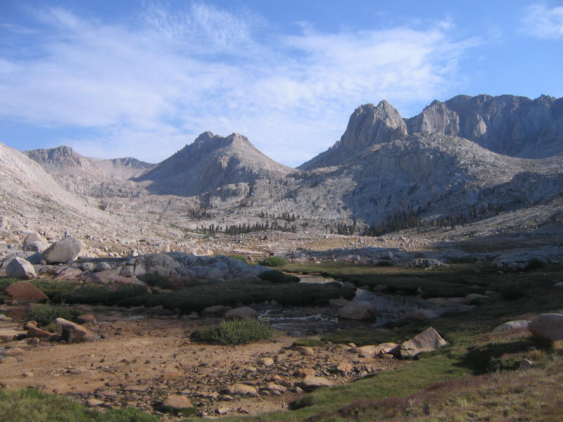
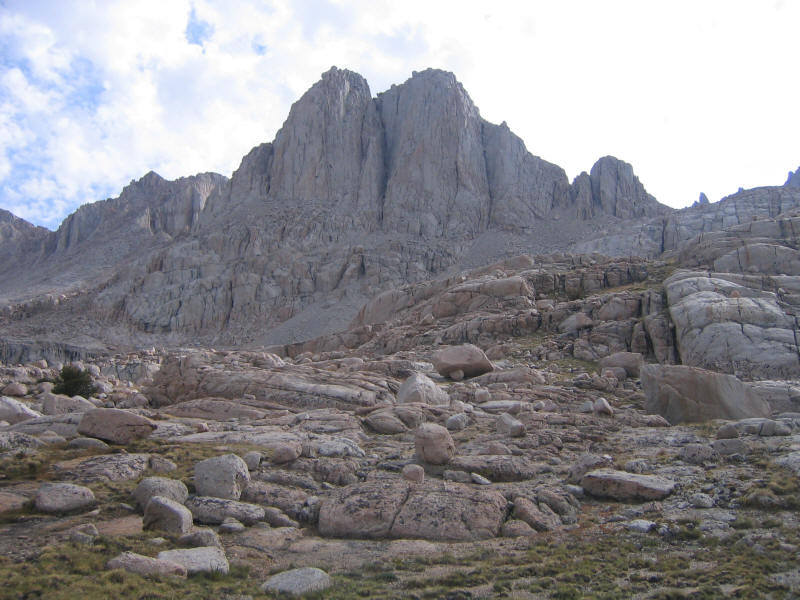
We first had to get up to the Miter Basin, which was a somewhat devious ascent from the northwest corner of Lower Soldier Lake following a use trail of sorts. It would have been quite hard to do with a full pack, which was part of our earlier plan (by now mostly abandoned). It also looked like it would be hard to find coming down. We made it up and I got my first glimpse of Miter Basin. Jim was eager to show us this place and I could immediately see why. It's one of the most beautiful and spectacular places I've ever been. Photos don't even come close to doing it justice, since you are simply surrounded by incredible scenery in every direction.
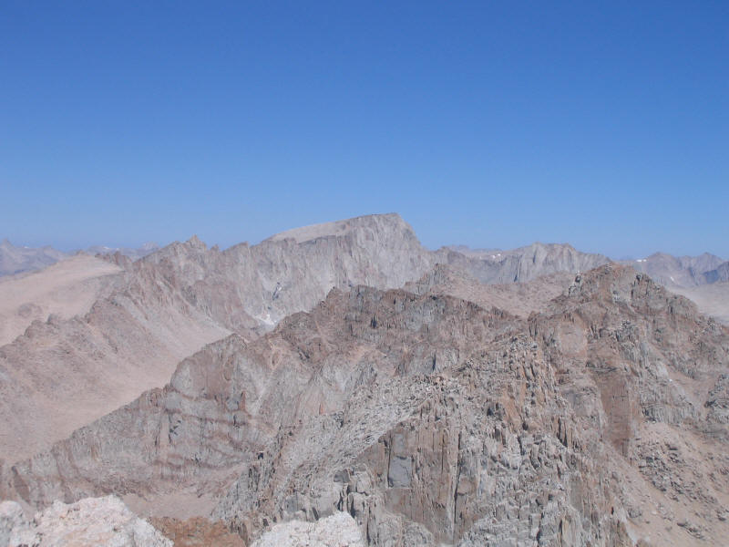
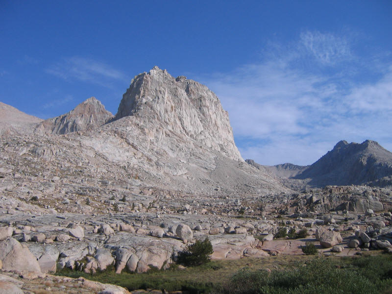
Here we are near the south end of the basin. The Miter can be made out toward the right. In the middle is Mt. McAdie (13,799 feet), which Jim and Rich had climbed on a previous trip and said was a terrific 3rd class climb.
Here's a feature which is unnamed on the map but is perhaps some buttress of Mt. Pickering (13,485 feet).
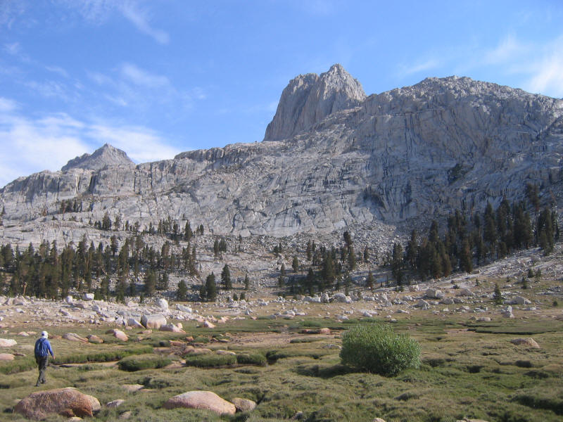
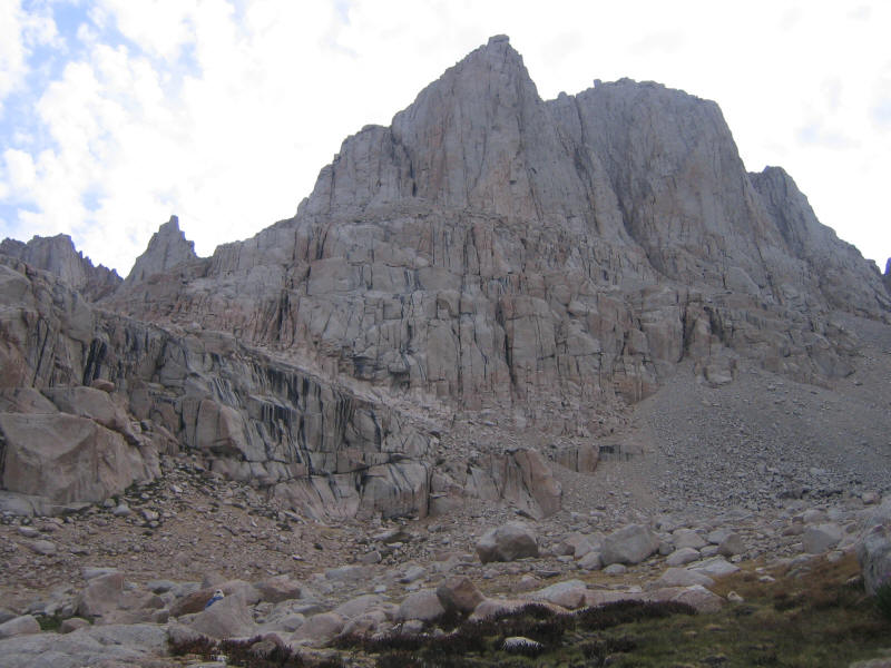
Getting closer to the Miter, it's miter-like shape becomes more clear.
Closer still. Our first problem is how to get up this sort of cliff. Rich and Jim had apparently gone up further to left (out of the shot) where it is less steep, but we ended going up more right this time. I forget just how we went. Rich and Jim ended up coming down the far left side, whereas I went straight down one of the cracks running down the cliffs toward the left. The slabs were probably class 4 and a little scary, but the crack I took was easy class 3 and fun.
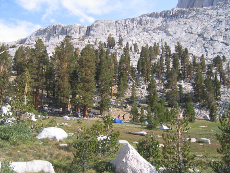
In the grove of trees we found Camp Bigelow, where Mike was about to lead his group up Arc Pass and a climb of perhaps Mt. Mallory (13,850 feet) or Mt. Irvine (13,770 feet). It was by now 8:45am and it seemed a rather late start for such a big trip with doubtful weather. Rich said hello to Mike again and Mike repeated his beta. We all walked together for a while and Mike showed us a nice passage up the cliff. At one point there was a natural set of tiny steps leading up a section of rock. Rich (who has also climbed Snake Dike) said "it's a little Snake Dike!" and sure enough it was like a miniature 3rd class version of that classic climb. Great fun!
Above the first set of cliffs we still had a while to go. I think we headed for right here, or maybe tried something more toward the center, gave up and went further right. Our objective was to climb the higher north peak, in this picture on the left.
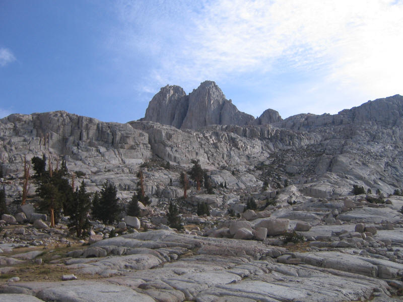
Closer still.
Now moving around to the north.
Here was a little side feature (maybe the small peak sticking up left of the north peak in the picture above) that looked like it would be fun to climb. You could even try crossing the bridge at the top!
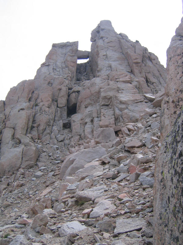
Even the north peak had its interesting features. Here is the northwest chute (or was it around further to the right?), and you can make out at the top a rock balanced delicately on another one. As Rich said, if that's the summit we weren't about to climb up on it.
It turns out the summit was something else. I didn't take many pictures after this point since we were concentrating on the climbing, which after the earlier loose 2nd class was solid 3rd class with no exposure and very enjoyable. I learned that Rich and Jim have less tolerance for exposure than I do, which I was very happy about because I knew we would stay safe. If I were making the decisions I could well have done something a little too reckless and gotten us into trouble. Rich led the way and found a great way up, mostly to the right of the chute, but we did need to trend a bit back toward the center and then back right again to get past some steep sections. Near the end we went through a sort of "tunnel" or "keyhole" that Mike had told us about. Finally we reached the summit! It was about 11:05am, and so 3:50 to climb from our base camp.
Actually there was another block behind us that could have been slightly higher, but you had to go down and up and the exposure was great here so we weren't in the mood to try. We also didn't want to stick around on the exposed summit (fortunately it wasn't windy at least) so we headed down right away. Here is a view of Arc Pass and an unnamed lake from the summit. To the left is Mt. McAdie; to the right Mt. Mallory in the foreground. I'm not sure what's in the middle; possibly it's Mt. Russell (14,086 feet).
A look to the south back down into Miter Basin. The small lake is unnamed.
We ended up downclimbing a different route than we went up--it's hard to remember exactly which way you came. And we probably downclimbed things that looked too hard when we were going up! It worked out well. The loose 2nd class was again not much fun, and we tried to avoid being in the same gullies as we descended. I learned the word "trundle" when Jim at one point sent a fairly large rock crashing down one gully, fortunately not even close to where Rich and I were below him. They told me that sections like this are typical for any Sierra climb, and overall the Miter was one of the best 3rd class climbs they'd ever done. For me it was the first one, so lucky to start with something so good! I loved it.
The clouds started threatening to rain so we waited in a sheltered place for a while and ate some food. However nothing seemed to be happening weather-wise so we just continued and luckily never got rained on. Here we are heading down toward Sky Blue Lake (not so blue this day as the sky was gray!).
At some point on the way down, probably around Sky Blue Lake, I felt a sudden burst of energy and euphoria. I had been waiting this whole trip to feel strong, and now I finally did. I couldn't stop myself--I started running down. I wanted to stick together with Jim and Rich, however, so I waited for them and made sure I wasn't too off-track. The beauty of cross-country travel though is that there is no right way to go, and you can do whatever you like. For me this was the high point of the entire trip.
At some point on the way down we ran into a solo ultra lightweight backpacker who was carrying a pack not much bigger than our day packs. He told us our two friends were looking for us. He was doing an almost identical trip to our earlier plan, starting in Horseshoe Meadow, going over Crabtree Pass, and then to Whitney. However it seems he was doing it in two days, which partly explained the small pack. The trip seems to be under 35 miles so that's very doable, although he was just carrying a tarp so he probably got a little wet that night, and I hope the mosquitoes weren't bad where he was.
We ended up taking a different route back through the Basin as well, and ended up more on the northeast side of the cliffs above Soldier Lake than the northwest side we came up. However this turned out to be very good luck, because we ran into Daniel there! He and Alan were worried about us, thinking we should have been back by 2pm (how did they come up with that time?) and by now it was 2:15. Alan had gone back to camp and was to give Daniel a signal if he found us there. Here is Daniel looking down toward the trail by the lake.
It turned out there was another use trail down this side of the cliff, so we took that down instead. Nice to find something new. We ended up getting back around 2:45pm I think, so about 7.5 hours for the trip. At camp Rich offered me some bourbon. I'd declined before as I don't drink much alcohol, but this was a celebration. It tasted great!
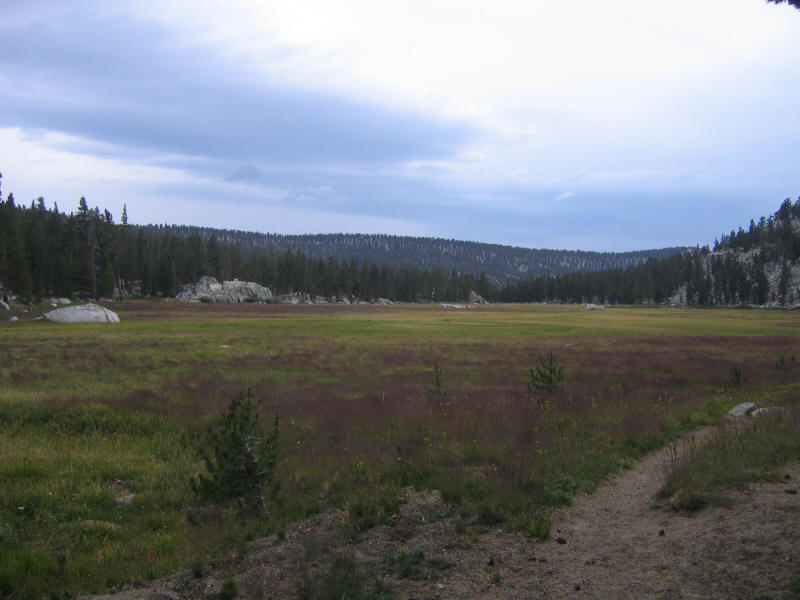
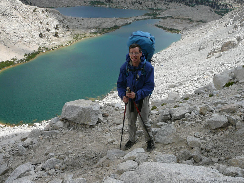
Afterwards I still had a lot of energy and wanted to take a walk. I thought I'd just do a short loop around the meadow south of the lake, but that was too short so I decided to follow the trail toward the Rock Creek ranger station for a while. On the way I ran into a very young and cute female ranger who was hiking alone with a huge pack. We chatted briefly and continued on our way. I had decided to walk until 5:30pm and then turn around, but when 5:30 came I thought I could spot a meadow in the distance and decided to give myself 10 more minutes. I had no trouble reaching the meadow in that time and was glad I did. It was a beautiful place and wonderful to be there alone. The picture doesn't capture the feeling at all, sadly. I made it to a nice lake, not visible in this picture but toward the back right, and it was the same Rock Creek Lake I'd seen from Langley the day before.
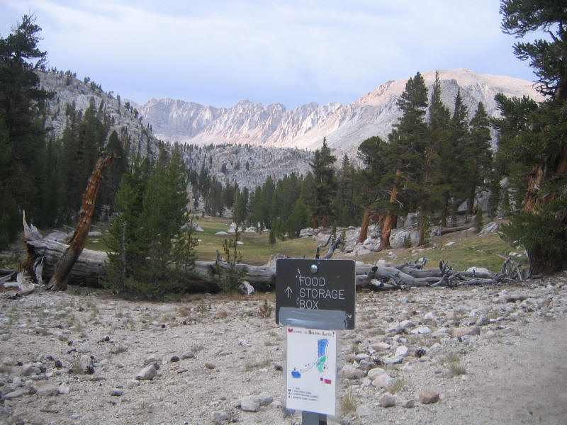
On the way back I found the ranger had posted some signs about campground sites at two trail junctions. Here is one of them, with a view toward the meadow we were camped next to (on the right). In the background is the Sierra Crest surrounding the Miter Basin that we'd just been in. The whole day had been fantastic, certainly one of the best days of my life.
When I got back I told the others of the wonderful meadow and lake I'd found, and after dinner Jim, Daniel and Alan went to check it out. Rich took a walk in the other direction toward the lake, and I stayed at camp in the tent to avoid the mosquitoes, which were getting even worse. I thought I'd sleep very well that night after expending so much energy, but on the contrary I hardly slept again, maybe one hour if I was lucky. I was perhaps too excited still, and there were other problems like the constant whine of the mosquitoes. I tried to take comfort that the mosquitoes here were nothing compared to what my friend Mike Vermeulen was facing as he currently was cycling through Siberia. Also the threatened rain finally came. At first it was just a few drops and thanks to the clever awning on our tent I didn't even need to zip up the fly. But later it started raining harder and we did zip up the fly. We stayed dry and a while later the rain stopped and we zipped down the fly again. I'd left my socks out to dry and was worried they'd be all wet again, but humidity was so low that by morning they were completely dry.
By now we'd completely abandoned the idea the continuing on to Whitney--we'd simply return to Horseshoe Meadow. The only question was whether we'd go back this day or spend one more night in the backcountry. At dinner the night before we'd decided to cross Old Army Pass, descend to Cottonwood Lakes, spend the rest of the day and night there, and then leave on Thursday, our original day to end the trip. We'd perhaps try climbing Cirque Peak (12,900 feet) nearby. I was enthusiastic about this at the time, but when morning came and I hadn't slept well again I was just as happy to finish up this day. It seemed a bother to set up camp all over again as well. It was actually Rich though who made the suggestion halfway through the hike down that we simply hike out, and everyone seemed happy to do this. At that point I felt I'd had a wonderful trip and there was no need to extend it.
We broke camp in the morning and packed up. Since I'd eaten less food than I thought it meant I still had to carry a lot out--I'd guess my pack weight was no more than 5 pounds lighter than before. Still it was mostly downhill this way and I was acclimatized and feeling much stronger. I had no problems this time. We started off a little after 8:30am.
Old Army Pass is no longer maintained and the trail doesn't show up on maps, but there is still a trail and it's in fine shape. There wasn't much uphill to the pass, and we got this exceptional view of the Cottonwood Lakes below.
In the morning there were many dark ominous clouds passing through rapidly, but no rain and the weather cleared as can be seen in the picture above. It was very windy on the west side of the pass, but surprisingly not too windy on the pass itself or the east side of it.
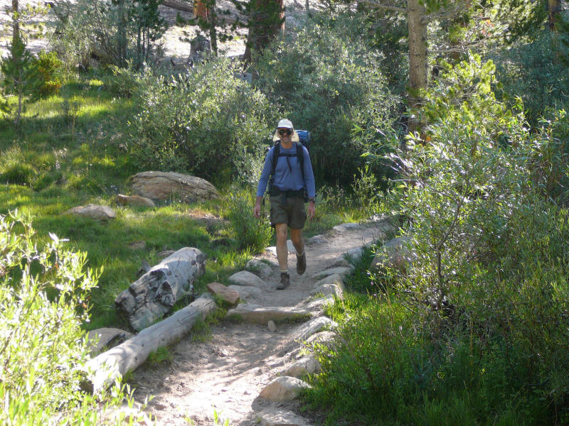
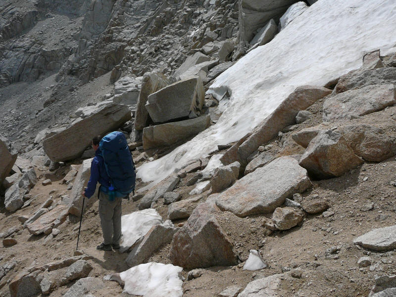
The main reasons the pass is no longer maintained and that the New Army Pass trail was built is that snow has trouble melting in this pass, and there is also rockfall. Indeed there were rocks blocking part of the trail down but we got around them with little trouble. And still snow as well, despite the fact that this was an extremely low snow year. Certainly during high snow years this trail might not be useable. Here I am near a snow/ice section. (DR)
I wanted Daniel to take my picture so I could prove to people that I really did backpack. (DR)
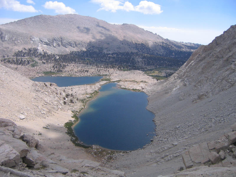
Here is Old Army Pass from Lake 4 (interestingly Lake 4 on the Tom Harrison map but Lake 5 on the topo map I used above). Hard to believe there's a trail up this, even though we'd just come down it. (DR)
Further along the meadow, you can see Mount Langley peeking (peaking?) from behind a ridge. (DR)
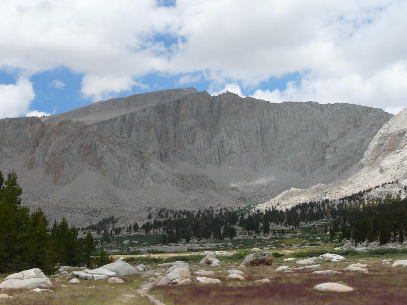
Here's Cirque Peak, which we'd been thinking of climbing if we spent the day there. It looked like a big pile of scree, so maybe good we didn't try climbing it. (DR)
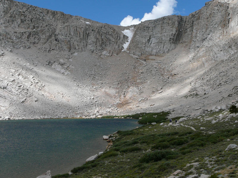
Stopping for a snack while we could enjoy the last of the views we'd have that day. (DR) This was another incredibly beautiful place, and Rich said he likes to take friends there to introduce them to backpacking. This is indeed the perfect place for a first backpacking trip, and I hope to take family and friends here as well.
Rich is pointing out something to us here, but I don't remember what it was. (DR)
It probably wasn't Mount Langley, but here's one last look at it. (DR)
Once we got past the lakes and the scenery, the the last 3.3 miles to the trailhead were pretty dull. We just decided to go as fast as possible, and this time I was able to keep up with Alan. It took us 1:15 to get to the trailhead, and I swear we were going at least 3mph, so the distance on the map seems too low. Maybe more like 3.8 or 4 miles. One problem we then had to deal with was that this trailhead was not in the same place as the trailhead we started with, and furthermore both were not on Rich's map (which we didn't have anyway). Alan, understanding the terrain much better than I did, had a good idea of how to go back, but I insisted on asking someone and it turned out his feeling was correct. Interestingly Rich's group, despite having experience in this area, had more trouble finding his car than we did. Alan and I made it back to the car around 2pm and Rich's group a little later. The distance this day was probably around 10-11 miles, maybe longer if those map distances are wrong. We'd hiked for about 5.5 hours.
We returned to Whitney Portal to pick up the other car, and then all headed back to the Whitney Cafe for another round of burgers. It was nice to eat "real" food again. We called people to tell them we were coming home a day early and then headed back in our separate cars. Rich's wife had told him the drive home was the most dangerous part of the trip, and indeed it was because at one point just south of Pearsonville Rich changed into the left lane of a four lane (two in each direction) divided highway, only to find a car barreling at us in the wrong direction! He quickly got back and honked loudly, but the driver seemed oblivious that he was doing anything wrong. I called up 911 for the first time ever and soon afterwards we saw a police car going in the other direction (on the correct road!) with its siren on, but it didn't seem to be going fast enough to catch that other car. I hope nothing bad happened.
In the Antelope Valley Rich pointed out Vasquez Rocks to me as a place to take my son. It looked very interesting, but soon after it we noticed there had been a fire, and it seemed recent as we could still smell it. Indeed the LA Times articles referenced above mention a fire started there on Saturday. It must have started soon after we drove through.
Rich dropped Jim and I off at his home and then Jim dropped me at home a little before 9pm, I think. I was looking forward to a good night's sleep in my own bed but for some reason, perhaps still too much excitement from the trip or the fact that my sleep was just screwed up, I stayed up until 2:30am and then woke up at 7am. It wasn't until the next night that my sleep started returning to normal. Well worth it, though. An absolutely wonderful trip and now I'm looking forward to Shasta, Hood and Rainier. And of course returning to the Sierras soon and as often as possible. There's so much to explore there. Next summer maybe another try at Arrow Peak?
This section is for my own future reference, although anyone interested is welcome to read it, of course.
Backpacks. As noted in the main text, I brought my fairly new Naos 70 liter backpack so that I could try it out. It weighs about 5 pounds. I then needed a daypack, so I stuffed my Amp daypack into this. This is a bulky pack and also not light (maybe 2 pounds) but it's extremely comfortable and I'm glad I brought it for the two dayhikes. The Naos was also very comfortable and I'm glad I tried it out. Now that I know I'm happy with it, I wouldn't bring it on a trip of this length again. I'd bring the smaller Khamsin 52 liter pack (about 4 pounds) and use it as the daypack as well, saving 3 pounds and resulting in a much smaller pack. It would have fit everything in it with the sleeping pad carried outside between the lid and the main sack.
For dayhikes I carried only my fleece, rainjacket, gloves and warm hat, snacks and 2 liters of water. No other "essentials" since I figured someone else would have them and our base camp was not far away. So this is probably the lightest load I've carried on hikes of 10 miles or so.
Shelter and sleeping. As mentioned in the main text I carried and used the Ralstons' Lighthouse tent. This worked well, but I think I'd sleep better in my own one-person tent and next time would bring my own despite the extra weight. I have an old Sierra Designs Lightyear one-person tent which would work well. I might also buy a small and light 2-person tent and use it as a one person tent since I like space and might be willing to carry the extra pound that would cost. I used my Marmot Arroyo 30 degree down sleeping bag which was just right for the night sleeping under the stars but too warm for inside a tent during the very warm nights we had. It's my coolest sleeping bag, though (the others are 20 and 15 degrees), and I doubt I'd buy a cooler bag. By the end I figured out I should just unzip it completely and use it as a blanket, sleeping directly on my pad. Speaking of the pad years ago I originally bought Thermarest self-inflating pads (which my wife and son now use) but later tried a Ridgerest foam pad and far prefer that. I actually prefer sleeping on a harder surface and like that I don't need to worry about punctures. As you can see in the report I put it directly on the ground when I slept under the stars, and that worked well. The only downside is that it's very bulky, and I was only able to fit it in the Naos because that backpack is so huge. Otherwise you pretty much have to strap it on the outside. For a pillow I just used the stuff sack filled with extra clothes. That was also quite comfortable.
Shoes and socks. I wore my New Balance trail running shoes which worked great. They gripped the rock very well when climbing. No blisters although some skin scraped off the side of my left foot for some reason. It didn't hurt at all so I didn't cover it. I brought two pairs of synthetic wool socks, one Smartwool and one Wigwam I think. Both fairly lightweight. I wore the former pair for two days straight and then decided to alternate and wash each pair at the end of the day (so I only washed each pair once). I just rinsed them in a stream with no soap and air-dried them. This seemed to work well. I brought a pair of very light liner socks as well just in case but never used them. I considered bringing my REI desert gaiters to keep dirt and scree out of my shoes, but didn't. Actually I wish I had them, although I'm not sure how well they would have worked. I'd try bringing them next time.
Clothing. I wore just a single pair of pants and shirt the whole time, and never washed them. This worked fine. The shirt was a synthetic Mountain Hardwear tee shirt which is very comfortable, and the pants Ex-Officio nylon convertible pants. I have a pair of Arc'Teryx nylon pants which are higher quality but the legs are narrow so they're not good for hot weather. These pants were fine although I'd like to find a better pair. As mentioned in the text I eventually cut off the belt (I haven't gotten rid of the last part sewed to near the right front hip, but that part didn't seem to bother me whereas the left front did). I never zipped off the legs. Although I wear shorts year-round in LA and far prefer them to long pants, for hikes I've learned that long pants are the way to go. I don't need to put sunblock on my legs (which then results in the legs coated with dirt) and the pants also protect against plants and insects and so forth. Less comfortable but worth it.
The pants have mesh netting so I didn't wear underpants, but I brought a capilene pair just in case, as well as nylon running shorts to wear if I wanted to wash the long pants. I never used either. I also brought capilene lightweight long underwear (top and bottom) in case it got cold, and didn't use those either. For fleece I used my Arc'Teryx Delta jersey, which is probably the finest piece of clothing I have ever purchased. It packs very small, is remarkably warm for its weight, and is in fact comfortable over a wide range of temperatures. I wear it often in LA too and would like to find another fleece top like it but for some reason no other manufacturer seems to make anything similar. Maybe I'll just buy another one in a different color. I brought my old Northface gore-tex paclite rain jacket which provided good protection against cold wind but I never got rained on. I also brought lightweight gloves and a thin wool cap and used only the latter (on Langley). I normally wore my red Yosemite baseball cap. A bit gaudy, but it had the advantage that other people could tell it was me from afar. Finally I had an Arc'Teryx red softshell jacket that I think I only wore once (in the cooking area picture above). It's very warm and can be layered with the fleece, but it probably wasn't necessary this trip. I should evaluate whether to bring it depending on the expected conditions.
Kitchen. As mentioned in the main text we used Rich and Alan's stoves and pots. If I were to bring my own then my current equipment is fine for my purposes (which are just to boil water). I have a small Primus stove which uses gas canisters, and a titanium pot. To eat with I brought a newly-purchased Snowpeak titanium spork, which for some reason I really love. It weighs pretty much nothing and somehow the feel and design seem just right to me. Jim bought me a $2 insulated mug at Walgreens to eat oatmeal, hot chocolate, desert and so forth out of and this worked well, but it's heavier and bulkier than I need. Next time I'd buy and bring the Snowpeak titanium mug which Daniel and Alan used.
Food. I took a picture of all the food I brought but ended up deleting it when I ran out of memory. I wish I'd saved it! I remember most of what I brought, though. The trip was to to be 5 days and 4 nights; we ended up doing 4 days and 3 nights. However even for the full length I brought too much food. From my research it seemed I should be bringing about 2 pounds and 4000 calories worth of food per day. I ended up bringing 9 pounds of food and a little less than 4000 calories per day, which seems like it should be right, but I should have remembered from my bike trips that I tend not to be able to eat as much as I should. For a week-long trip or less it's better to just bring less and lose a little weight. I was disappointed when I returned to find I didn't really lose any weight at all! And this despite eating much less than I brought! I should mention that I did eat some of the food other people brought (and they all brought too much too and were thus happy to share it) and shared some of my food also.
Breakfast and dinner I got just about right. For dinner I brought 4 Mountain House freeze-dried dinners. These taste good to me and have the advantage of being very easy to cook (just add water and wait). Jim brought instant soup (Knorr) which was very good and which I would bring myself. I found hot food much easier and more pleasant to eat than cold, especially early on when I was having digestive problems. Jim also brought deserts which were nice but I'd just as soon skip them or eat dried fruit instead. For breakfast I had a cup of hot chocolate and then two packages of instant oatmeal. Two was good but I could have gotten by with one package a morning and that would save some weight. I also ate some dried fruit or other snacks if I felt like it. I brought two packages of dried fruit but one would have sufficed.
Where I really went overboard was the snacks for the rest of the day. I brought way too much. I'm not sure I can remember everything I brought, but aside from the dried fruit there was trail mix (a big bag that I finished less than half of), many energy bars (Cliff and Powerbar I think), granola bars, 5 king-size Payday bars (lots of calories per bar--I figured I'd eat one a day but only ate 2 total--I got sick of them), a bunch of the new Cliff Shot Bloks (very good for quick energy--I'd bring them again), some crackers (which were instantly crushed, so that didn't work well), some small Slim Jims (probably 4; ate them all), beef jerky (didn't finish), a Slim Jim deli bar (didn't eat) and I'm sure more. Jim said cheese would last a while and I love cheese so I brought sharp cheddar cheese, something like 1/2 to 1/4 the original bar. I finished it off in 3 days and it lasted fine. It would start melting when it got hot but would re-solidify at night so it was good to eat in the morning.
I wanted to bring Gatorade mix but didn't and regretted that. As good as fresh mountain water tastes I did get sick of it at times and wished I had some flavor. Alan brought a little and let me have some and it was great! So I'd definitely bring that in the future. I brought 2 Nalgene bottles to hold water and that was fine. We had a large MSR water container for the group and that worked well. If I were responsible for group water I'd probably just use my two 2.5 liter Platypus collapsible containers.
I carried all the food in the Ursack (it barely fit at first) and that worked fine but I just kept it in the food storage locker and so didn't get to test it against the animals. I'd use it next time and of course bring less food!
Miscellaneous. I brought my headlamp, my usual "essentials" ziplock bag (compass, knife, nylon cord, moleskin, bandaids, matches, wipes, extra batteries, etc etc), sunglasses, sunscreen (for lips too), insect repellant (didn't use), toilet paper, and so forth. I brought a trek towel (purchased for the High Sierra Camp hike) and used that to dry my hands (and also feet after soaking them in the creek) and that worked well but was probably too big and next time I'd bring my smaller hand-towel. I used a bandanna most often to dry my hands and spork and mug. I wanted to buy hand sanitizer but didn't make it to REI one last time, and so just brought a small bar of soap, which was fine but I'd buy the sanitizer next time.
I brought my old Canon digital camera which still works well (as you can see from the photos) but stupidly only brought the original 64MB memory card, even though I now have 2GB cards at home. I'd only used it for day trips before and didn't realize I'd run out of memory on a multi-day hike. I've just purchased a Panasonic SD camcorder which I'll try using in the Cascades--I think the mountains would be captured much better on video than in still images, although the later still have their place. This camera should be a lot heavier and less robust, so I'm not sure how good it would be on a backpacking trip, and the video would be too large to post to the web anyway.
I didn't bring a GPS or altimeter on this trip but might on others. Also I didn't bring my wind meter which would have been useful on Langley. I brought my trekking poles but didn't use them on the day hikes. For the backpacking portion they were very helpful and I'd certainly bring them again. I brought only two stuff sacks (the only two I own, which I purchased long ago), a larger one for clothing and a smaller one for kitchen items and some miscellany. Also a couple plastic grocery bags and an extra ziploc bag for trash or other unexpected uses. I just used one for trash. Most smaller items and food were stored in ziploc bags.