"It was the best of climbs, it was the worst of climbs." Somehow this quote, slightly adapted from Dickens, sums up this hike perfectly. I'd wanted to climb Mt. Whitney via the Mountaineer's Route (MR) since at least last year, but I wanted to go with someone who already knew it since I was worried about routefinding. I figured I would do it sometime this summer, probably alone, but first got to seriously thinking about it again when Kaya Yuki suggested we do one more hike after Half Dome and before the end of school. I tried to think what a good follow up to Half Dome would be--what would be something even more fun? It wasn't long before I thought of the MR. I figured we could just go up as far as we had energy, and then turn back. However when I suggested this to Kaya she thought it was too far away and too long, at least to do now. She wanted to do something short and close by, and we were perhaps going to do Rocky Peak, but even that never happened.
When researching the MR I found that thanks to our low-snow winter it was already climbable without ice ax and crampons. So it seemed I could just go anytime! The one new problem was that they've just instituted a permit system for the approach up the North Fork of Lone Pine Creek, since many people are using that route now. There's no quota (yet!) but you still have to get a permit, which is a pain since I just wanted to drive up, do the hike, and drive back the same day. The permit office doesn't open until 8am, so I wouldn't be able to get started until late. I could call up in advance and have them leave a permit in the overnight box, but that was a bother and I'd worry that it wouldn't be there when I arrived.
For some reason it took a long time for me to get it into my head that I could easily drive to the Whitney area from LA and do day hikes there much as I used to do at Yosemite when I lived in the Bay Area (I think I went to Yosemite six times one summer). In fact it's even easier than before, since Yosemite was a 3.5-4 hour drive whereas Whitney Portal is only 3-3.5 hours away and the drive is much more pleasant. In fact it's easier to just spend a couple days nearby and do several hikes as there are plenty of hotels in nearby towns like Lone Pine and Bishop, whereas Yosemite is more remote from civilization and requires really staying in the park, for which reservations are tough to come by. So I need to take advantage of this much easier access to the Sierras from LA.
I decided to just drive up the first Wednesday (my favorite hiking day) after school ended, which was June 13. I was originally was going to hike to Meysan Lake and then climb one or more of the mountains near there (Lone Pine Peak, Irvine, Mallory and LeConte), which are in the 13K to 14K foot range and would be fun to try. Maysan Lake has the advantage of requiring no permit at all. And these climbs (or attempts) would be a good way to start acclimatizing, since I have recurring problems with altitude sickness. Indeed that's my main worry for Shasta, and I planned to drive through Tuolumne Meadows on the way to the Bay Area (and then Shasta) this summer, and again climb Mt. Dana which is 13K feet to get used to altitude again. I'll still try to do that, but I also figured--why not climb these 13K+ foot peaks near Whitney as well?
I had a lot of optimism this year about altitude sickness. I've had recurring problems with it, most notably on my first bicycle ride up Tioga Pass in Yosemite (starting at about the 9000 foot level) and then my first attempt on Longs Peak in Colorado (at around the 12K foot level). I've felt its affects at other times too, but last year thanks to a very good acclimatization strategy I had no problems at all, including the 14K Quandary Peak as well as Whitney itself. It also seemed that I felt altitude less last year than the year before, and this year I seemed to have even less problem with it, not really feeling any effects of altitude on the Baldy hike in May, which went to over 10K feet. I wondered if my body was somehow getting more used to altitude over time with all these forays into the mountains, and maybe I wouldn't have to worry about acclimatizing so much anymore.
Tuesday night came and I decided I really wanted to try the MR the next day rather than the other peaks. I figured I'd get up at 4:30am (not much earlier than my usual time to wake up around 5am), take my time, get the permit at 8am and just hike up as much of the MR as possible. I used my medium backpack and packed all my cold weather clothes including rain pants, gaiters and ice ax. I decided to leave the crampons behind and just not proceed further if I found I needed them. I brought along quite a few snacks and 3 liters of water. Looking at the weather forecasts, it looked like the high in Whitney Portal would be 60 and the high at the summit around 40, so I figured I should dress warmly. I'd wear my lightweight long underwear and thicker long pants, plus a synthetic tee shirt and then layer over those. I'd also wear my mountaineering boots which would be useful if I need to walk in snow, and also I wanted to continue to get used to them especially for 3rd class climbing. As the drive would be warm I didn't put on the long underwear until the trailhead, and drove using my usual hiking shoes. I didn't weight my pack but would guess it was around 25 pounds--less water than the usual 25 pound weight (I'd bring 5-6 liters to get that weight), but more clothes plus the ice ax. This was a bit heavy, but again I wanted to get used to hiking with weight and figured it would be good exercise.
I ended up going to bed at around 10 or 11pm, and then waking up at 2am perhaps due to excitement. I briefly considered just driving there and doing Maysan Lake, but I still really wanted to try the MR. I couldn't get myself back to sleep until about 3am, but then slept until 4:20am or so, when I got up, ate breakfast, and started out around 5am. The drive turned out to be even shorter than I expected and I got to the permit office in Lone Pine over 15 minutes early. I then had to wait for them to open, but I found out where the night box is and got to enjoy the great views of Whitney and the other mountains.
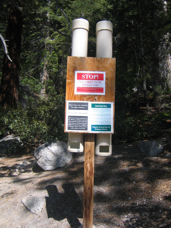
As the permit for the North Fork is new there was some confusion about it, but no problem. A couple rangers knew the route well and one had even done it recently. He said there was some bulletproof ice near the summit that I'd have to avoid. I had read in about half my sources that you're supposed to start on the north side of the creek and half on the south side, so I asked the rangers which was better and they said definitely the north side. They gave some vague directions about where to go but basically said just follow cairns if the path was unclear. One guy told me I was starting too late to have a real shot at the summit, and said a good goal was just to get to Iceberg Lake. Of course my feeling from the start was that this would just be an exploration and I'd go as far as I could, but I was hoping to get at least to Iceberg Lake and perhaps even start the main climb. The ranger also warned me that clouds were seen coming in (this wasn't in the weather forecast) and that there could be thunderstorms in the afternoon. That was good to know. I got the permit and also a "wag bag" for packing out poop, as the main problem they seem to be having is human waste. I already had an unused wag bag from the last time I did Whitney, but didn't bring it along and it was good that I got one this time.
I then drove to the trailhead, which was nice since I'd previously driven up Whitney Portal Road in the dark and didn't see it. It was also nice to arrive at the trailhead, which I couldn't even find in the dark the previous time, and be amazed how I could have not seen it. Since this is still early season there weren't too many cars parked and I got a nice parking spot right near the trailhead; furthermore as this was a late time to start a hike no one else was around! What an awesome experience to have the trail, one of the most popular in the US, to mysefl!
I got started just after 9am and the beginning was terrific. Just like the drive up, this was actually the first time I'd seen this trail going uphill since it was all in the dark the previous time. The weather was perfect, in fact on the warm side, and everything was beautiful. This was going to be an incredible hike I was sure. However I'd already made the mistake of putting on my long underwear, which it turned out to be too warm for. I couldn't really remove the bottoms (even if no one was around) since I didn't bring other underwear with me on the hike. And I was reluctant to take off the top for the silly reason that I didn't want to have to put sunscreen on my arms. I was sure it was going to get colder and colder and I'd need them anyway, but that turned out not to be true. I'm sure this overheating of my body contributed something to the problems I would later have.
For now I was a bit warm but everything was fine, and there was a mild cool breeze anyway. The mountaineering boots seemed fine and not too hot and turned out to be very handy for creek crossings as they are partly waterproof. I didn't bring trekking poles, figuring I'd use the ice ax for balance (if possible!) if there were any tough creek crossing, but the crossings turned out to be easy. An advantage of the low-snow winter.
After just 18 minutes I'd hiked the first mile (maybe less) to the crossing of the North Fork of Lone Pine Creek, shown below. I thought the trail would be hard to find, but it was easy--just go right at this sign!
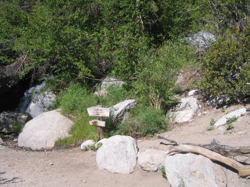
In fact the trail is so good it's the same quality as the main trail, and to warn people who go the wrong way they have the sign below a little further along.
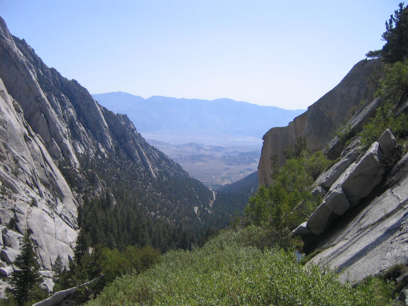
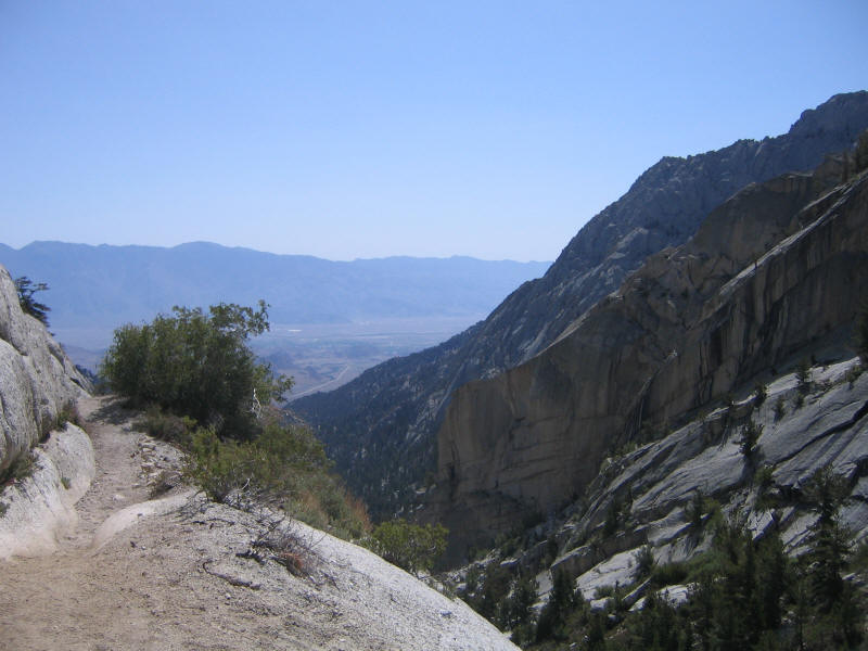
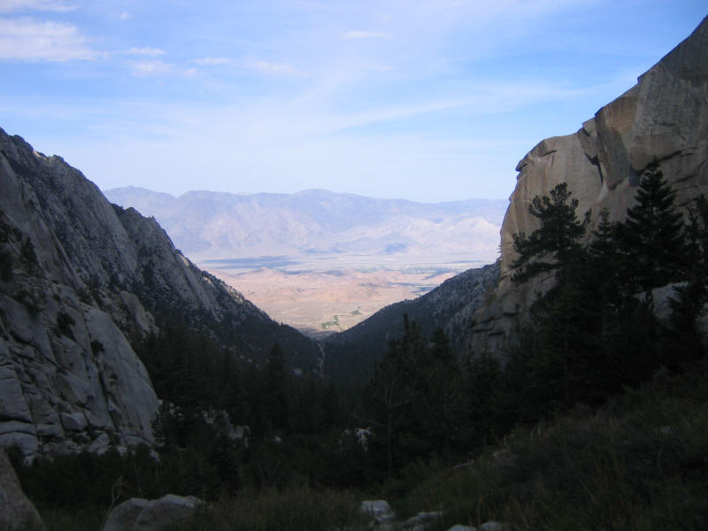
I ran into four people who were descending the North Fork trail right when I started up, but after that had the trail entirely to myself until around Upper Boy Scout Lake, 3.5 hours after I'd started. Again it was wonderful to enjoy this incredible scenery alone. As you are ascending a canyon, you have two main views: up and down. Both were stunning. Here is the view down.
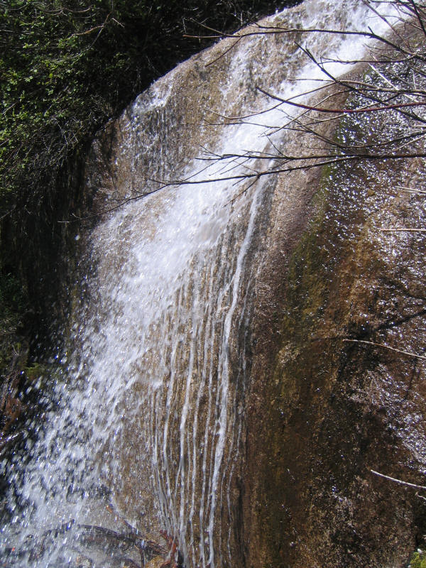
I had no trouble following the trail which was pretty much as good as any official trail I've been on, and would be fine to do at night. I had no trouble with the two creek crossings that one makes, and the trail was beautiful and enjoyable. The second crossing involves going past a waterfall and you have to get close enough that you get a little wet. The water fall is tiny (I think I read 8 feet or so) but very cool--this was like a miniature version of Vernal Falls on the Mist Trail to Half Dome!
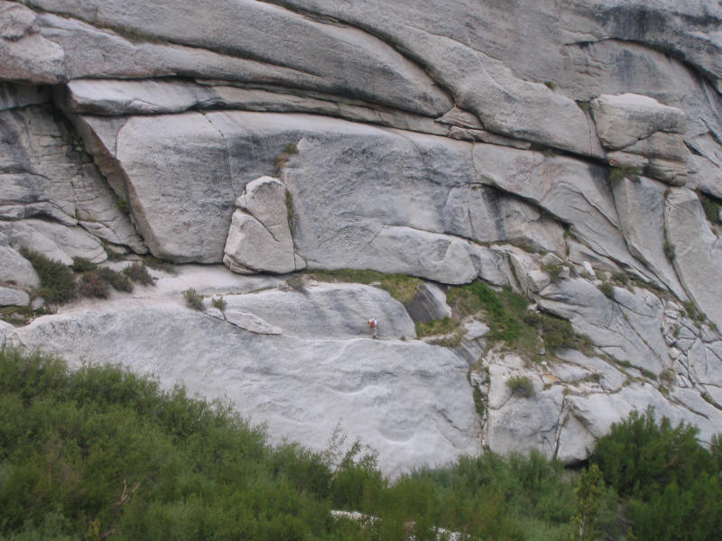
My first worry, then, were the notorious Ebersbacher Ledges used to escape the canyon. I'd read many descriptions and brought along my Supertopo High Sierra book which had the most detail, but I found the detailed description confusing and not very helpful. Really it's very simple go up. In the picture below (taken from before the waterfall), you want to go to the base of the cliff, walk left until you find an easy way to climb to the first ledge (with the lone tree toward the left on it), and then continue along that ledge to the right until you find an easy way to climb to the next ledge with all the other trees on it. Then continue left along that ledge and path out of the canyon is obvious. There are probably many good ways to climb up to the second ledge; I liked the one I picked. The climbing was wonderful secure 3rd class and the ledges are plenty wide to feel completely safe. This climb was maybe the highlight of the hike for me and I'm sure my six year old son would love it was well.
Here's a view, I think from the first ledge just beyond the lone tree, showing how wide the ledge is. This photo was taken just 5 minutes after the waterfall one so it was a quick climb to this point.
Here's a photo taken 17 minutes after the previous one at some point on the second, main, ledge system, heading toward the top of the canyon.
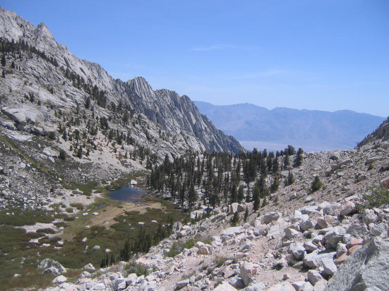
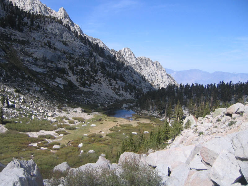
Twenty minutes later, at about 10:40am, I reached Lower Boy Scout Lake. This was a stunning location that the picture doesn't nearly do justice to. Again I had it all to myself. I stopped for about 20 minutes, ate some food, and enjoyed my surroundings. This was certainly the high point of the entire hike. I thought how it incredible it was that I could drive 3 hours from LA, hike 1.5 hours, and reach such a beautiful and remote spot.

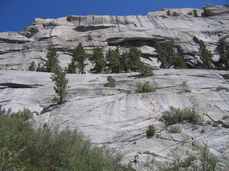
I then headed upward for Upper Boy Scout Lake. From here the trail got less distinct and harder to follow; it was also more rough and if you lost it you definitely had to put in more energy. However I felt that it was better for to just forget about guidebook descriptions (save for the largest overall details) and just try to figure out where to go myself. I'd get practice reading the terrain and it was impossible to really get lost. Often I'd lose the trail and have a tougher time going for a while, but I'd soon find it again. This was slower going than optimal, but the whole point was to explore and learn, and I'm glad I did it this way. The whole route felt much more like real mountain climbing than my usual class 1 hikes.
The picture below was taken at 11:30. This is looking down above Lower Boy Scout Lake.
After Lower Boy Scout Lake, which is at 10,300 feet (so about 2,000 feet above the trailhead), I started having altitude problems. At first I didn't realize what was happening--I was just moving more slowly and having to stop a lot. I tried practicing the rest step and pressure breathing but never really had success with either. My version of the rest step ends up being to take several steps up, and then stop for a few seconds. It would be much better to maintain a continuous pace no matter how slow but for some reason I still can't do it. I really need to work on that.
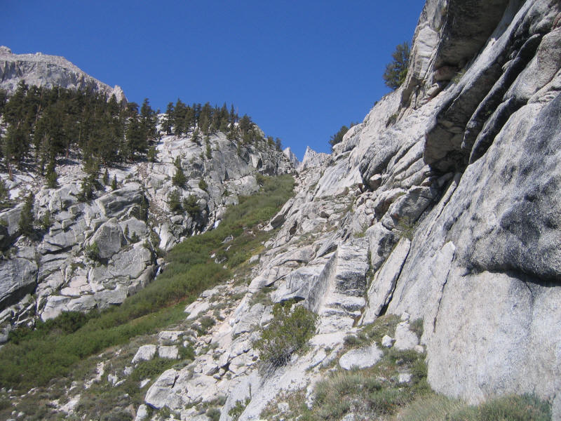
The picture below was taken at about 12:30pm, which means it took 1.5 hours to go up just another 1000 feet to the level of Upper Boy Scout Lake, seen in it (the route doesn't go past it, so that is all I saw of the lake). I was going slower and slower and feeling worse and worse. I must have realized by this time I was having AMS (accute mountain sickness) problems. Here I ran into my first people, four backpackers descending, probably from Iceberg Lake.
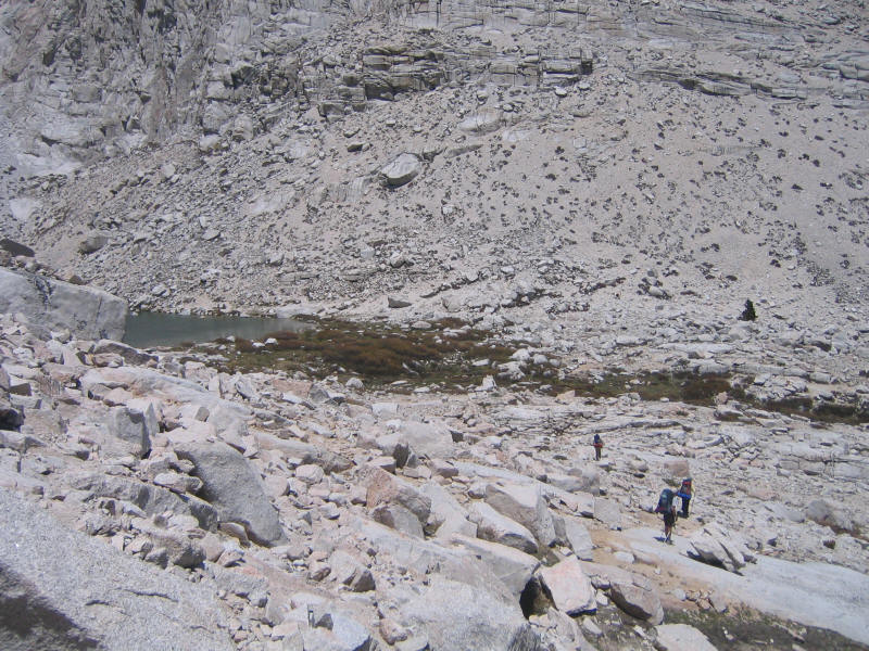
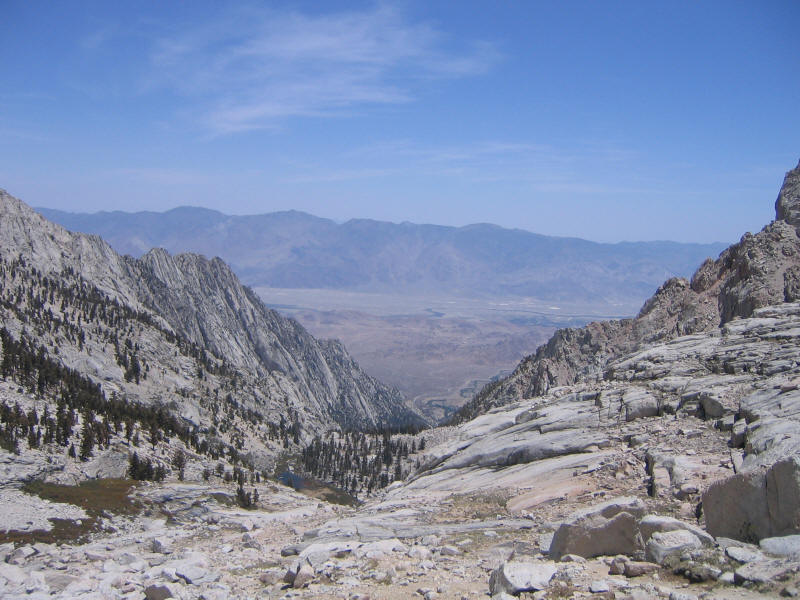
Here's the view down from the vicinity of Upper Boy Scout Lake; you can still see the lower lake and a great view of the Owens Valley and Inyo Mountains.
Things just got worse and worse, and I felt more and more terrible. Still I wanted to try to get at least to Iceberg Lake. I set a turn-around time of 2pm, figuring that would be 5 hours up, it would take another 5 hours to go down and I'd get back at 7pm, with still plenty of daylight just in case something happened. I was also worried about thunderstorms, but at this point there were only wispy white clouds and no threat of bad weather. I should have turned back earlier, though, given that I felt so bad. In a way it was a mistake to keep going.
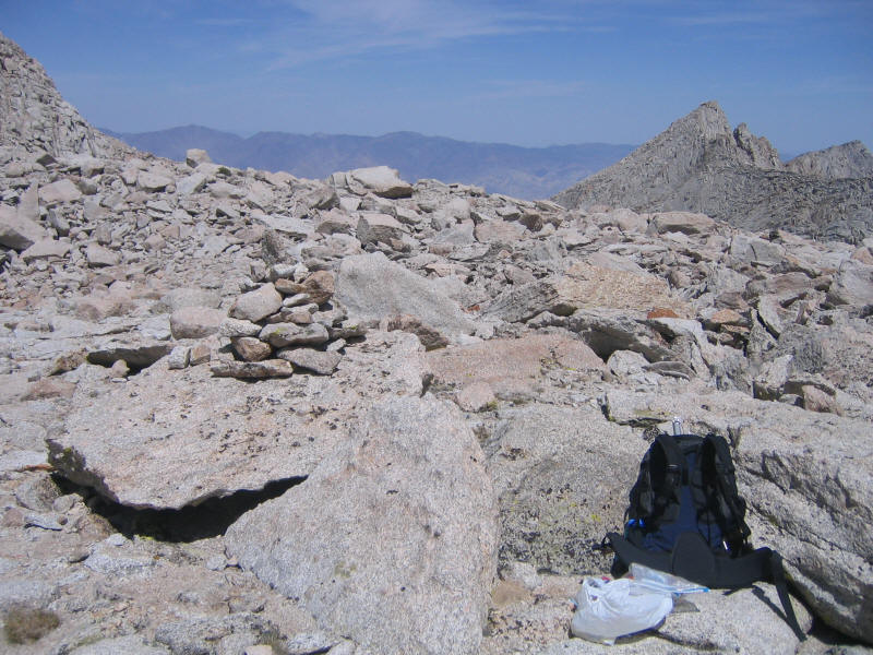
I did keep going almost until 2pm, though, and finally arrived nearly at the base of Mount Whitney and the "needles" to the left of it.
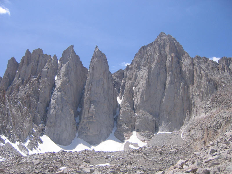
I thought Iceberg Lake would be here but it's apparently to the right of this photo, and requires another 500 feet of climbing. I'd only gone about 800 feet up and very little horizontal distance in another 1.5 hours, and by this time I felt really awful. I was sad not to even be able to see Iceberg Lake, but I knew that I definitely shouldn't go any further. Here's the high point I reached, next to a big cairn.
I felt really sick to my stomach at this point, and used the wag bag, my first time ever. It worked very well. I still felt ill and thought I might throw up at a few points when going down, but never did. It was tough because I felt like I didn't have enough energy and needed some food, so I tried to eat some Skittles I'd brought for quick sugar energy, but even these made me feel even sicker. I also felt like I must be dehydrated and my throat would feel dry often, so I carried water in my hand or clipped it to my waist belt for quick access, but I could only get myself to drink a little at a time. I think the AMS had just screwed up my body somehow because it seems I never really was dehydrated. By the time I got down I wasn't thirsty anymore, and when I weighed myself at home I had lost no weight at all, strangely.
The trip down was something of a nightmare, probably my worst experience hiking ever, even worse than the first time down Half Dome when I had incredible knee pain. I felt just awful, so bad that I would have been content to just like down at some point and die. I didn't even feel any survival instinct. But somehow, just for lack of anything better to do, I kept forcing myself to take steps and continue down. Descending the trail is easier in a way (gravity is now your friend, and losing altitude is the best way to help AMS) but also much harder on your body during the rough sections. Thankfully I had no knee problems--that could have made things a lot worse. I did have much more trouble losing the trail, which I thought would be easier to stay on coming down because you can get a better overview of terrain, and also I'd just come up it. But my brain was not functioning very well at this point either.
I'd been singing songs silently to myself both on the way up and down. On the way up the recurring song (one I don't even like) was "You take the high road and I'll take the low road", which was no doubt inspired by all of the bifurcations of the trail which would later rejoin. I ended up taking the high road most of the time going up, but going down took the low road it was almost always the better choice either way as the high road would typically go up and then back down again.
The song on the descent was Meat Loaf's "Two out of the Three Ain't Bad", no doubt inspired by the fact that I'd only reached two of the three main lakes on the route. Also on the descent I started running into a lot of people who were also coming down, from Iceberg Lake I presume. There were two types. One was the backpacking crowd, and even with their big packs they easily blew by me at my pathetic speed. I was beyond caring, though. One guy (who helped me when we both were a bit lost because we hadn't crossed a creek that we should have crossed earlier) told me he'd hiked to Iceberg Lake the day before, climbed Mt. Russell, then climbed Whitney via the MR today and was descending. I wish I could do that someday....
The other type was the day hikers, all extremely fit and going even faster. Unlike me they all had tiny packs and were wearing light clothing--clearly they were much smarter. Everyone except me used trekking poles, too. I'd considered them but thought they'd get in the way for the 3rd class sections, and also I wanted to practice descending without them to work on my balance. However I was in such bad shape going down that I had no opportunity to practice--this was just survival. I think I should bring them next time since they'll make going down 2nd class terrain a lot easier. Several people, seeing my ice ax, commented that it wasn't needed.
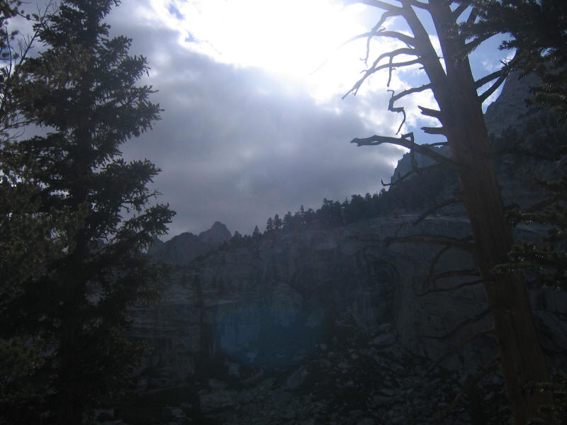
As I descended the darker clouds started coming in. Amazingly, though, despite my incredibly slow pace the clouds moved even more slowly! I was very worried I'd be rained on trying to descend the Ebersbacher Ledges, which could make them very dangerous. The clouds neer really looked that threatening, though, and fortunately it never did rain.
The picture below was taken at 4:12 and I finally reached Lower Boy Scout Lake at 4:33, after 2 hours and 10 minutes from the high point.
I think I was feeling slightly better at this point but still felt awful and couldn't wait for the hike to be over. As I was going down the ledges a couple passed me, and then later a man a little older than me who told me I was going down the wrong way. I probably should have paid more attention to just how I'd come up. He showed me a good way which was I think different than the way I'd come up, and mentioned he'd seen a rope left behind by someone who had apparently gotten lost on the ledges and resorted to a single-rope rappel. I don't know why the guy didn't just backtrack to find a better way to get down--maybe it was dark at the time. Anyway this guy who helped me asked if it was my first time, and said he'd done the MR 30 times by now. He was with the young couple, and said there was another guy behind them going very slowly who'd done the MR 100 times.
At the waterfall we split up since the guy said if I wanted to go his way I'd have to walk on a 50 foot long wedge a couple inches wide. That would have been interesting but I felt so bad I didn't trust my balance, so I figured I'd better go the safe way. I then managed to get a little off track in the waterfall area and crossed the creek at a more dangerous (and wet) place than I should have. It was good I didn't go with the guy because I then had a great chance so see him on the ledge! It was wider than he had indicated--more like a half foot to a foot wide, but clearly you have to be very careful. He downclimbed the first crack system and then I don't know what he did from there.
Below is a nice view of the canyon in the shade of the clouds, contrasted with the valley in sunlight.
After the ledges you get back to the good trail and the going was easier, even though I still felt awful and tired. I had plenty of water but decided to try drinking some from the creek. I've read various conflicting things about the danger of drinking unfiltered water, but figured I'd try it out since the next week or two is an okay time to get sick if I do get sick. The water tasted good and hopefully there will be no problems. I'd rather not have to deal with filters and iodine anymore if I don't have to.
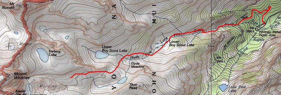
I finally made it down to the trailhead at 6:38pm, so quicker than I thought it would take, but still incredibly slow. I'm still not sure how long the MR is. I've seen estimates from 9.4 miles to around 15 miles roundtrip. The former number seems to originate in the Mount Whitney book by Paul Richens, and Richens seems to simply estimate the mileage from looking at maps and other books, so it's not clear at all if it's accurate. The Supertopo guide seems to use Richens' figures as did the ranger (who said just 4 miles to the summit!--it should be 4 just to Iceberg Lake, but perhaps he isn't counting vertical distance). If these numbers are right then I only did about 3.5 miles out and another 3.5 back, although it certainly felt a lot longer (my route is very roughly indicated above, based on the Supertopo guide). And only 3800 feet of elevation gain, not even as much as the 4800 feet of Half Dome. The Supertopo guide said it should take 3 hours to get to Iceberg Lake, although it could take double that with a heavy pack. I don't think my pack would count as heavy, but it took me nearly 5 hours and I didn't even make it to Iceberg Lake.
This really depressed me. First of all succumbing to AMS so easily again and at quite a low elevation. Secondly I feel like I can't blame everything on AMS--I'd thought I was in pretty good shape but clearly I was not even close to proper condition for this hike. I feel like I have a long way to go on both counts.
The nice thing about AMS is that it's easy to cure--just go to a lower elevation. And indeed once I reached my car and took off the pack I instantly felt much better. Still I was very tired and sleepy as well, and quite worried about the 3+ hour drive home. I thought of just checking into a motel in Lone Pine and driving back the next morning, but then I'd hit morning rush hour into LA, whereas if I went now the traffic would be good. I decided to go for it and fortunately was able to keep myself awake and alert. I left at about 7pm and got home around 10:20 with one stop for gas.
So what started out as a fantastic hike with the hope that it might be the best ever ended in total misery. It has my very worried now about my plans to climb so many mountains, including 14K Shasta and so forth, this summer. I'll keep working on conditioning and acclimatization. I did decide to cancel a tentative planned trip to come back and do Maysan Lake and beyond next week, but I'm certainly not giving up. By the next day I'd forgotten the pain except in a vague abstract sense. I do remember the part to Lower Boy Scout Lake being fantastic and something I think Kyle and Kyoko could enjoy, so we've already made reservations for the night of Tuesday the 26rd to camp at Whitney Portal. The plan is to go Tuesday morning, do the hike to Lower Boy Scout Lake that morning (no permit required that far!), camp that night, and then go as far as possible to Maysan Lake the next day. I'll pick up more valuable acclimatization and the other two will hopefully have a lot of fun. Then at some point later in the summer I'll come back and give the MR another try. I'll carry a much lighter pack, just one liter of water (plenty of places to refill along the way!) and trekking poles next time. I remember that Half Dome the first time felt very hard for me but by the second time I thought it was easy. Whitney via the main trail last time was long but also not hard. I think with enough conditioning and acclimatization that the MR as well will not be too hard, and at that point it will also be enormously fun. I have hope that I have perhaps indeed found an even better hike than Half Dome.
Roundtrip distance: 7 miles?
Elevation gain: 3800 feet (8300 feet to 12,100 feet)
Time up: 4:57 (9:01am to 1:58pm)
Time at high point: 0:25 (1:58pm to 2:23pm)
Time down: 3:25 (2:23pm to 6:38pm)
Total Time: 9:37
| Location | Time |
| Trailhead | 9:01 |
| North Fork sign | 9:19 |
| Waterfall before ledges | 9:59 |
| Lower Boy Scout Lake | 10:41 |
| Leave Lake | 11:01 |
| Upper Boy Scout Lake | 12:31 |
| high point | 1:58 |
| leave high point | 2:23 |
| Lower Boy Scout Lake | 4:33 |
| Trailhead | 6:38 |