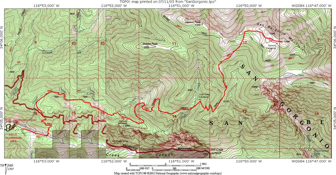
This was the second time I did this hike; the previous trip was in 2003 and more pictures and details can be found in that trip report. One thing I learned this trip is that the hike is actually quite a bit longer than I'd thought. The Tom Harrison Map (San Gorgonio Wilderness) indicates the one-way distance is 7.8 miles, which the Schad guide also states (the Robinson guide says 8 miles). However both of these distances are low. The San Gorgonio Wilderness Association has a handout which states the one-way mileage as 8.6 miles, and I believe if any measurement is accurate this is. The problem on the Harrison map is that the distance from High Creek to the next higher junction is listed as 2.4 miles, which is way too low--it should probably be 3.2 miles. No doubt they didn't account for all those switchbacks--maybe if you went straight up it would be 2.4 miles. It took me 1:26 to go down this segment, whereas it took only 51 minutes to go down the next segment from High Creek to Halfway camp (listed distance is 2.3 miles on the Harrison map and 2.2 miles on the SGWA handout). The terrain is slightly tougher and the elevation higher on the former segment, but on the other hand I should have been more tired on the second having walked farther at that point. So as I was hiking I guessed there had to be a big mileage error on the map there, and the handout mileage breakdown confirms that. Anyway this explains why this hike seemed harder and longer than the original mileage seemed to indicate.
On July 22 I bought new hiking shoes, only the second pair I have owned as an adult. The first pair was my trusty New Balance 742 trail walking shoes that I bought over 7 years ago--certainly I wore them on my first hike up Half Dome, and I've used them on every hike I've done since. Amazingly they are still holding up well, but the bottoms have gotten smooth, so they've gotten a bit dangerous for boulder hopping and so forth. I went to the new REI in Santa Monica and looked at some lightweight hiking shoes but they still seemed too heavy for the kind of hiking I do. So trail running shoes seemed more appropriate. REI had one called the Vasque Blur that looked good with a nice tread, but they were not in stock. So I went to the New Balance store, which is also in Santa Monica, and got a pair of 809 shoes. I don't like the color (I picked black/grey over brown/orange) but otherwise the tread is very good and the shoes very comfortable. I wore them home and then officially broke them in on a very nice 5.4 mile hike (the Hoegees Loop in the Angeles Front Range) with Lydia Yue the next day. They soon turned to brown/black! I only wore them once (to school) after that, and so was worried my next hike with them would be so long and difficult. I'd noticed some rubbing on my back left heel which was worrisome, and sure enough this recurred on the San Gorgonio hike. After a while I put on some moleskin, but it wouldn't stick and I neglected to bring tape, so I used a gauze pad instead and that more or less stayed in place. On the downhill the heel was no problem but my left small toes got a bit jammed. I think this will all sort itself out soon, and otherwise the shoes were great. They have significantly more traction than my old shoes on all terrain--dirt, rocks, or gravel. I thought this might help my knees as well and indeed it did. I did have a little trouble with my right knee (again the first time I did this hike with no poles) but much better than before, and on the final very steep and slippery switchbacks my knee didn't get worse and if anything felt a little better by the end. I recall thinking on every trip up Half Dome that the rock under the cables was getting more slick, but now I think it was probably my shoes more than the rock! Anyway I loved those old shoes and hope these new ones give as much great service.
Doing the hike when I did was nearly perfect timing. For one thing a recent heat wave in California had ended, so the weather was excellent (although temperatures during the hike ranged from below 60 to the mid-90s). Also the trail had just reopened a few days earlier after being closed due to threats from nearby fires. I called up the ranger station the day before to make sure there would be permits available in the morning (since the trail has a quota) and they said it was wide open. There were several (maybe 4 or 5) permits when I got there.
As I knew this would be a long day I wanted to leave earlier this time. My sleep has been screwed up for the past year or so, so I have no trouble waking up early. I set the alarm for 3am but woke up myself at 2:50. My wife and son, who stay up late and sleep late, happened to both still be awake! That was nice since it felt like a regular morning rather than so early, and I could eat breakfast with all the lights on. I left the gas station at about 3:50 and got to the trailhead an hour and a half later. I'd brought my headlamp in case I wanted to start before it got light (a little worrisome still due to the creek crossing near the beginning of the hike) but it just started getting light enough to see when I started on the hike at 5:40am, so perfect timing. It did start out rather cold, though, and got colder as I ascended. I figured it would be a hot day and so didn't bring my fleece. At one point when the temperature was about 60 with a cold wind I put on my rain jacket briefly, but the fleece would have been better. It did warm up of course and for most of the hike down the temperature was in the 90s. Due to the heavy Spring rain this year the creeks were flowing well, much more than I recall from 3 years ago, and there was at least one nice waterfall I saw. On the other hand the insect situation, surprisingly, was enormously better! I didn't run into flies or mosquitoes until the very end of the hike, although I attribute this more to starting and finishing earlier in the day. I brought 3 liters of water as usual, but this time didn't bring a 4th liter for the car. Due to the cold temperatures on the way up I only drank 1 liter, but on the way down I drank nearly all of the other 2 liters, so the amount was just right. I might consider just bringing 2 liters next time and refilling from a creek if need be. One nice thing about this hike is that there's plenty of water.
I had done both Baldy and San Jacinto in much faster times than in previous years, so I was hoping to do this hike much faster as well. I didn't feel very good at all this time, but then I didn't feel especially good the previous hikes either and had still gone up fast. So I thought maybe I could get up in even as little as 4 hours (of course I still thought the distance was 7.8 miles at the time). Surely 4.5 hours would be doable. But I was indeed in worse shape this hike, plus had the problems with my left heel which took several stops before I got the gauze in place, and it ended up taking 4:55, still 35 minutes faster than the last time I went up, but then I took pictures 3 years ago which could account for most of that time. I didn't bring a camera this time but wish I had--it was much clearer than the last time, and I could have gotten much better pictures. In particular I could see the San Gabriels crowned by Old Baldy very clearly this time, and what's more they rose out of a sea of fog which made them look especially spectacular. It was an awesome sight and I hope to see it again someday. San Jacinto Peak was also especially stunning, and I spent my 30 minutes on the summit mostly looking at it while I ate some snacks.
There were more people on the mountain than the last time I hiked up. Soon after I left I heard voices behind me. After a little while I couldn't hear them, so I figured I was hiking faster, but later on I could hear them again, and finally after 10 minutes on the summit a pair of guys came up. They said they'd started at 6:30 but I thought I heard them long before that. In any case they left before me and I didn't see them again. I did pass several people going up when I went down, and earlier had passed a guy with a big pack and two dogs coming down (he had no doubt camped somewhere) when I went up. He said he'd left a green Gatorade bottle somewhere and had searched for it but couldn't find it, so if I saw it could I pick it up for him? Interestingly the last time I hiked up San Gorgonio I ran into some people at the High Creek camp who said some other party had left a big bag of trash there, and asked me to carry it down. I was very tired and didn't want to carry someone else's big bag of trash, so I declined. It seems the theme for this mountain is people leaving trash there! Anyway this guy must not have looked very carefully (or more likely it was someone else's trash that he didn't want to carry himself), since I saw the bottle very clearly on the trail a mile or so above him. This time I did pick it up (fortunately very light), and ended up carrying it in my pack to the summit and back down, where I threw it out. If trash is the theme for this mountain then San Jacinto Peak has its own theme. The second time I hiked up I ran into a recovering alcohol and drug user on the summit, and then this year I noticed the trail register for San Jacinto had many entries from such people. That seems to be the peak of choice for people trying to recover from addiction and dependency.
One nice thing about the Vivian Creek Trail is that it gets better as you get higher, and near the top it is the most fun. Not as great as the cables on Half Dome, but after that probably my second favorite "ending" to a hike to a summit so far (I'm sure Longs Peak will be better if I ever make it to the Homestretch--I'll be trying again this September if the weather cooperates). I signed the summit register on San Gorgonio and saw a guy before me had made it up in 4:20 carrying 38 pounds (my own pack was probably 20-25 pounds, 15 of them water) so I didn't mention my own time. The views were spectacular so although I didn't intend to spend much time on the summit I couldn't resist staying there a half hour. The sky was completely clear; the only clouds I could see were far away and below me.
I'd had no altitude problems on my previous hikes up Baldy and San Jacinto, so I was curious how this hike would be. And it was strange. I did start to feel really tired and bad around 9000 feet, so I could attribute that to altitude but I'm not sure. It seemed a little different than the other times I've had altitude problems, and it's possible just general sickness or the temperature changes could be to blame. Also above 10,000 feet or so I started to feel better again! Then when I descended it seemed again that 9-10K section was the bad one. So I don't know what to think. I'll just see how Mt. Fuji and the Colorado hikes go.
Once again I was infuriated by the long switchbacks above High Creek. This is the only really poorly designed section of the trail. They take forever to go up the slightest distance, and you can see the next section of trail just above or below, which then takes several minutes to reach. They should have had much shorter switchbacks or just run the trail straight up as it is not that steep. Indeed there are many use trails cutting the switchbacks, and although I resisted on the way up, on the way down I could no longer resist the temptation and cut the trail at a couple places that I felt were completely safe for both me and the mountain. Next time I'll probably do that more. That section is the least interesting part of the trail as well.
It took 3:56 to get down, so again not much better than my previous time of 4:20. I was exhausted when I finished the hike, but really enjoyed it. Unfortunately the ride back was terrible--many excruciatingly slow sections on the 10 Freeway. Compared to two or three years ago it seems clear traffic is much worse now. It took over 2.5 hours to drive home. If I had to drive more often I would never live in the LA area. I'd thought of maybe doing one more big hike before going to Japan, but thanks to the traffic I think I won't. I do plan to do one short hike this weekend, a 3 mile roundtrip with my son (who wants to try climbing a mountain himself) to Sandstone Peak. Having climbed the three highest peaks in the San Gabriel, San Jacinto and San Bernadino Mountains, I'll now finally climb the highest peak in the Santa Monica Mountains. At only 3111 feet it should be quite a bit easier, though! This is maybe a good theme for future hikes. I'm not much of a peak bagger, but I love mountains and want to climb to the highest point of a range, so maybe I can use that as an excuse to climb various ranges in California, the Western US, and elsewhere.
Distance up/down: 8.6 miles
Total distance: 17.2 miles
Time up: 4:55 (5:40am to 10:35am)
Time on top: 0:30
Time down: 3:56 (11:05am to 3:01pm)
Total Time: 9:21