I classify my trips as hikes or climbs, but this one doesn't fit neatly into either category. The hiking was too short to write up a special report on it as a hike, and the climbing too easy to write it up as a climb. But somehow it captures the best of both worlds. I put it in the hiking directory since it felt more like a hike than a climb, but linked from both indexes. Indeed one of my goals is to go on more trips that involve both hiking and climbing, and this was an ideal beginning.
I hadn't gone on a long hike in over a month and really wanted to go somewhere, but I didn't have a good idea of where. I was getting out of shape from not hiking (or cycling) much recently, so I thought I should do something short, and also close by since I didn't want to drive a long way to do a short hike. That meant either the Santa Monica Mountains or the San Gabriel Front Range, but somehow I wasn't in the mood for either. I was just going to delay hiking until the next weekend, when Saturday night I opened John Robinson's Trails of the Angels and flipped through trying to find something appropriate. I was looking for short hikes with a lot of elevation gain. I found hike 36, "Colby Canyon to Strawberry Peak", 6 miles and 2600 feet (according to Robinson), and when I read the description I realized I'd found a gem--a short steep hike with 3rd class climbing, and what's more less than an hour drive away. It seemed perfect.
My longest walks these days are my weekly pilgrimage to REI Santa Monica every Friday morning, 8 miles roundtrip along Santa Monica Boulevard. This Friday I picked up my brown Arc'Teryx Amp daypack that I'd brought in two weeks earlier to be fixed. I'd bought this pack many years earlier (probably around 2000) and it's still my favorite backpack I've ever used. Superbly designed and extremely comfortable. I've used it on many hikes, but at some point a couple years ago the stitching on one of the shoulder straps came undone. Fortunately I'd bought a second Amp for my wife (in orange) and since she doesn't hike anymore I started using that. I bought a different Arc'Teryx daypack (a blue Flash) for school, since the Amp was no longer made, but although it's also a very nice pack it's still not quite up to the Amp.
Just recently I realized Arc'Teryx has a lifetime warrantee on all their products, so I brought the Amp to REI to send to them to be repaired. I was surprised it had come back so soon. However I found out REI had sent it to someone else to repair it rather than back to Arc'Teryx, and wanted $6 for the repair. When I complained they just let me have it for free, so very nice of them, but it's too bad I didn't get to test Arc'Teryx's warrantee. In any case the new stitching seems good, and even if I'd paid $6 I should have just gotten it repaired years ago. It's very nice to have it useable again.
I originally wanted to use my brand-new Naos 70 liter backpack (also by Arc'Teryx, whom as you can guess I'm a big fan of), filling it with 30 pounds or so to test it out and get myself used to carrying more weight. I still have yet to try the Naos, but if it works out it will be the pack I use on Rainier this coming summer. When I decided to do this hike which involved climbing, I thought it would be better at first to keep everything light. I will try third-class climbing with a heavy pack at some point, as that's a skill I want to develop, and one reason I got the Naos is that it's designed for such a use.
For this trip I just used my Amp and my usual trail running shoes (rather than the mountaineering boots I also want to continue to break in), and kept everything as light as possible to go fast and enjoy a short hike. So just one liter of water, very little food, and just the clothing I thought I'd need. I brought my fleece, a light rainjacket, baseball cap, wool hat and gloves, and it turns out I used every one of those items, so perfect planning for clothing. I wasn't sure if I could find the trail, which is not marked on maps, so in addition to the map I brought my compass, GPS, and the guidebook. But it turns out the trail was very easy to find and I didn't need any of them.
I didn't worry about a really early start, since it was Sunday and I didn't have to drive far. I woke up a little after 5am as I usually do, and took my time getting ready and eating breakfast. I left at 6:10am and with no traffic arrived at the trailhead at 6:50, a mere 40 minutes! The drive was very pleasant, especially Highway 2 into the mountains, which I'd not been on before. I'd intended to cycle up this road at some point, the idea being to cycle from home to the top of Mount Wilson (5710 feet), and then back, about a 120 mile roundtrip, but I'd never managed to get in shape to do that. By now I've hiked to the top of Mount Wilson, so maybe this winter I can work on getting in shape to cycle up there as well. The climb up the 2 seems very nice (save for the high-speed traffic, but there wasn't much of that), and indeed there were a number of cyclists doing the climb, but it seemed they were parking their cars at the base of the climb and starting there.
The Colby Canyon trailhead is at a little under 3500 feet (let's say 3461) and since Strawberry Peak, the highest point in the San Gabriel frontrange (another reason I wanted to climb it) is 6461, that means 2700 feet elevation gain. The hike is about 3.2 miles one-way, so that's fairly steep. However the first 2.2 miles are to Josephine Saddle at around 4861 feet, so that means 1400 feet gained in those 2.2 miles, but 1300 feet gained in the final 1 mile! The last segment is probably a little longer than a mile, but you get the idea that it's very steep. There are some (steep) downhill sections as well, so there's actually even more overall elevation gained. Of course this last part is where the fun 3rd class climbing is.
I started the hike right away at 6:55; it was cold enough to wear the rain jacket over fleece and the wool cap but just 5 minutes in I removed the rain jacket and cap. Right at the start I was faced with a choice--one rock path led left and one dirt path led right. The rock path looked more like a gully and the dirt path a trail, so I followed the latter which was the right choice. I'm curious where that gully leads to, though. The trail crisscrosses a (now mostly dry) creek a few times, and is supposed to go past some waterfalls. I did hear something that sounded like a fall at one point, but I couldn't see it. I'm sure this part of the hike will be much more interesting in the Spring.
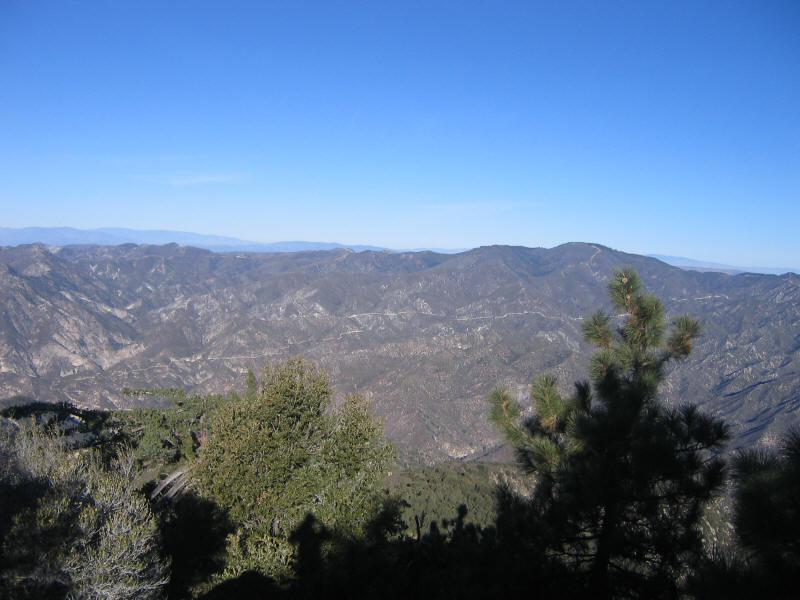
I'd lost interest in the San Gabriel Front Range after doing a couple hikes around Mt. Wilson--it seemed the area was too close to civilization and also lacked good views. However this hike, a little further from populated areas and also more out of the forest, was enormously better and made me realize there's a lot more to see just in this area. There were terrific views very soon into the hike and they just kept getting better as I got higher.
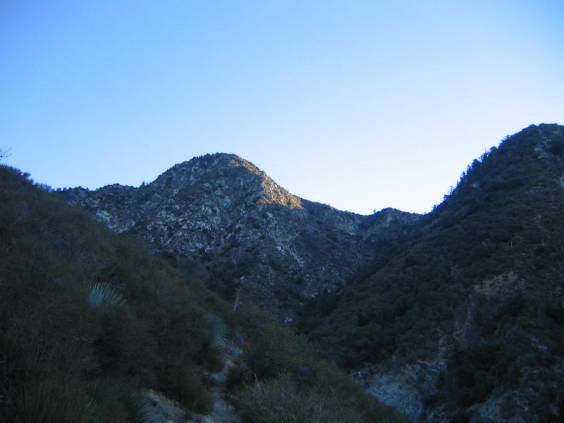
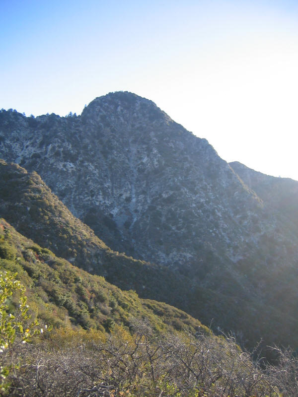
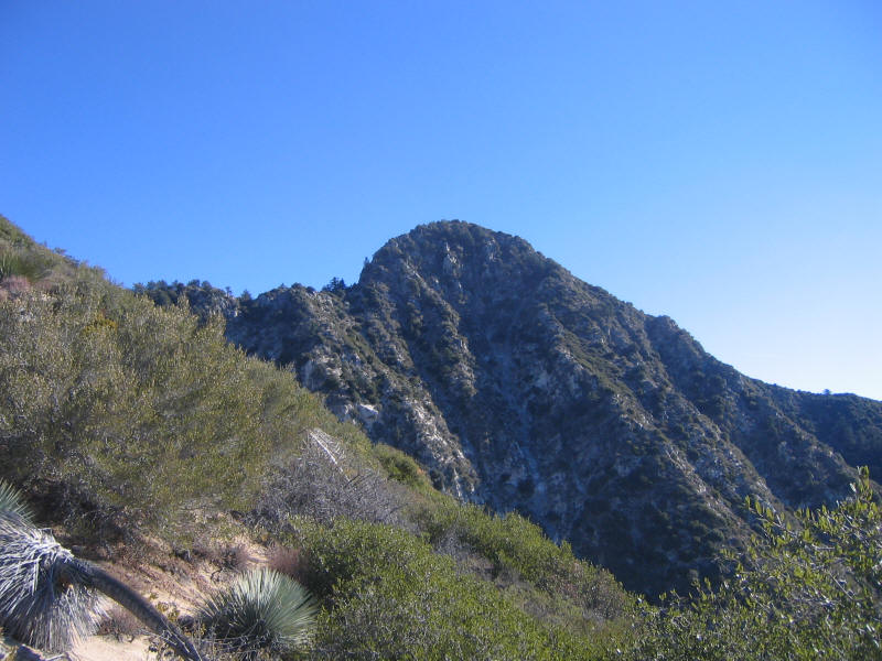
Here's an early view of Strawberry Peak from the trail. The climb goes up the left ridge.
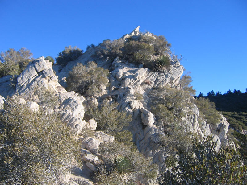
A while later I could see this rocky outcropping, and wondered if I'd been mistaken and this was really Strawberry Peak. However it did seem a lot lower. It looked like it would be interesting to climb as well, and I got my wish because it turns out you climb this enroute to Strawberry Peak! Unfortunately I didn't get a picture with both peaks in it.
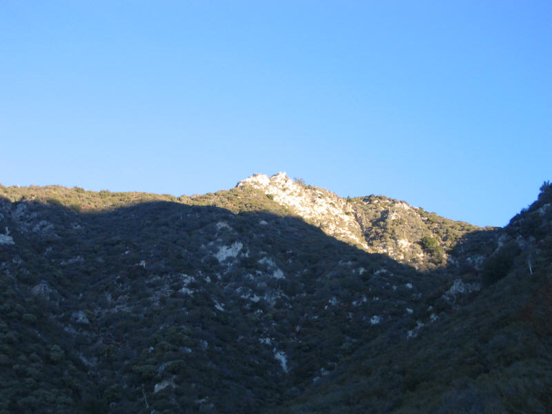
Strawberry Peak as you get closer.
I had a lot of pent-up energy from not hiking for a while, and combined with my excitement and the rare lack of much weight on my back I couldn't help walking very fast and nearly running up parts of the trail. I did slow down after a while, though. I arrived at Josephine Saddle, 2.2 miles in and 1400 feet up, in about 40 minutes, a pretty decent time especially as I stopped a lot to enjoy the views and take pictures. There were several signs at the junction but strangely this one (hard to read here) seems to imply that the trail down to where I'd started goes in the opposite direction from where I came. Fortunately I'd just come up it and knew where it went! At the saddle I also knew I was to leave the main trails and take a side trail, which basically goes up the rock you see here to a ridge leading to the peak. The trail was very well-defined for the most part and easy to follow.
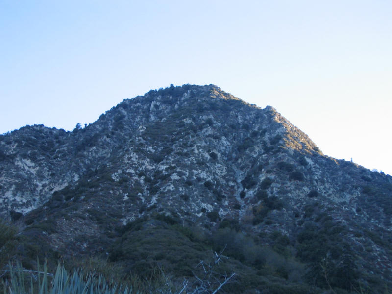
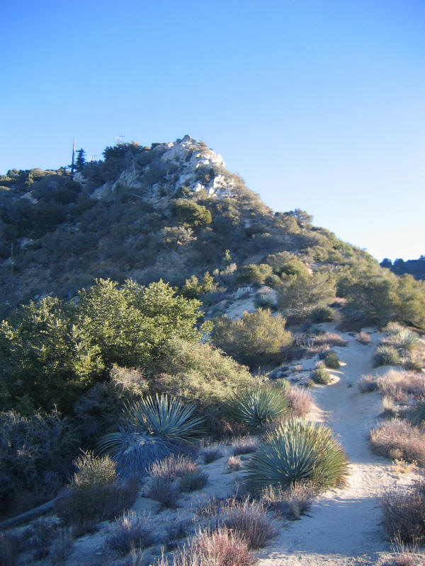
Strawberry Peak from Josephine Saddle or thereabouts.
The climber's trail leading to the rocky outcropping and the start of the first 3rd class section.
The start of the first 3rd class section. Robinson says there are about 75 vertical feet of climbing here, but it seemed like more. You only see a tiny bit of it in this picture. The climbing was a lot of fun, on very secure and safe rock.
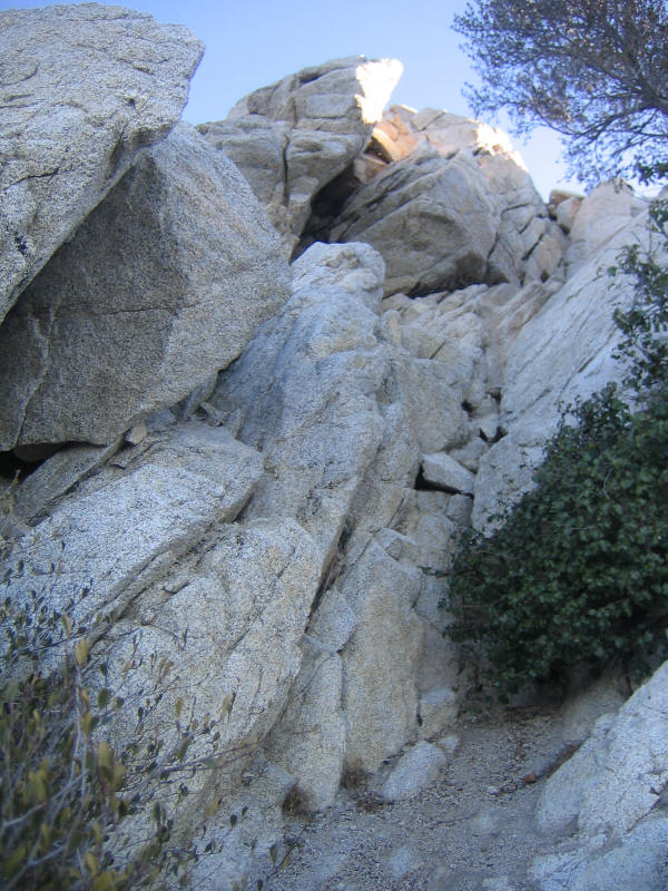
Looking down, you can see two of the many purple painted arrows showing the way. Robinson's guide said there would be faint green arrows showing the path in the second 3rd class section, but these were mostly replaced by less faint purple arrows, and someone also added purple arrows to this section as well. In a way they took away the fun of figuring out the route for myself, but as the optimal route was far from obvious I was glad to have the help. I did manage to get off-route a few times despite the arrows and those sections were often more loose and dangerous, so it was good to follow the marked route as closely as possible.
Near the top of the rock outcropping.
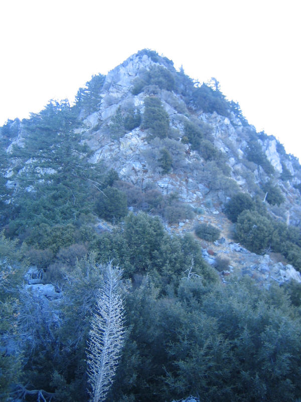
Strawberry Peak from the rock outcropping. You can see how steep the final (also 3rd class) section is going to be. Again the route goes up the left ridge.
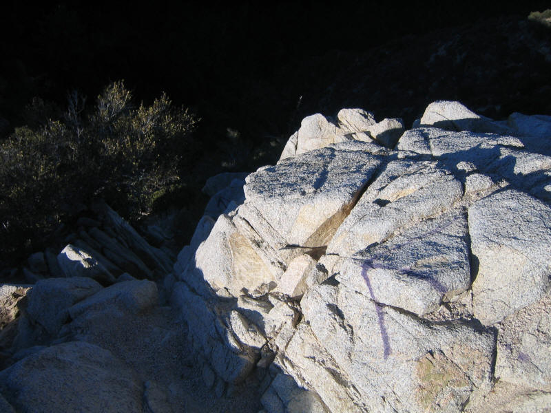
After the rock outcropping you descend a bit and then walk on trail again for a while, until you come to the much longer second 3rd class section that leads to the top of the peak. Robinson has a great quote about this section: "Here the faint-of-heart will turn back; the route looks more difficult than it actually is and has some exposure." Here's a picture of part of that section. I didn't take too many pictures as I was more busy climbing! Again it was terrific fun.
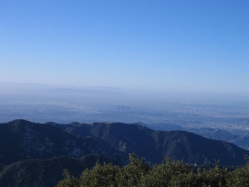
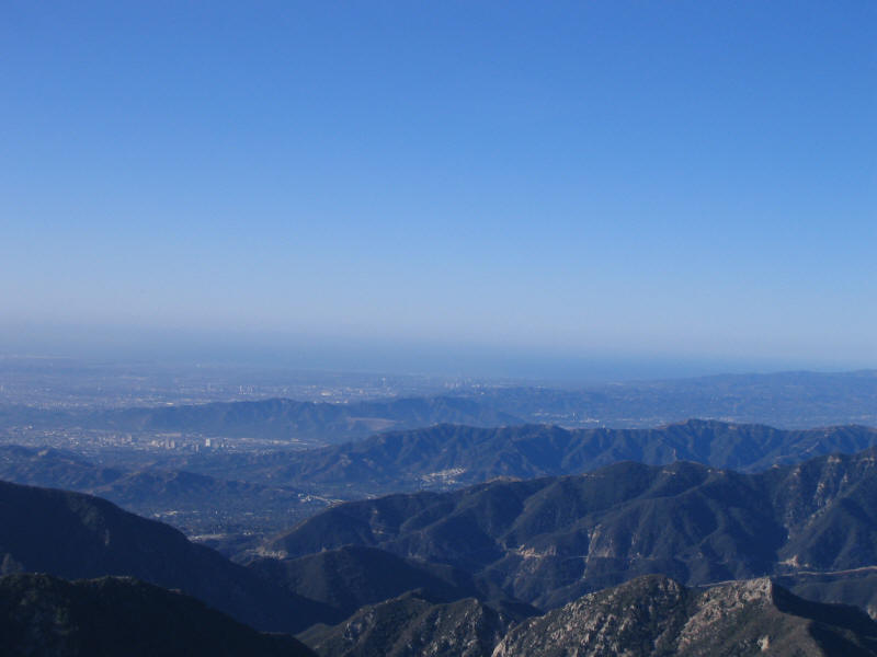
I reached the summit at around 8:35am, so about an hour from the saddle. Much slower going while climbing. It was very windy all morning from the Santa Ana winds, and I was worried that would be unnerving on the 3rd class sections. However they were mostly sheltered from the wind. Near the top there were exposed sections and I had to put on my rain jacket, wool cap and gloves. It was quite cold up there even though it was very warm just a little further down. The summit was rather anticlimactic. As befits a peak it just all came together at a point on the top, and that was it. Views were blocked for the most part on the other side. They did have a summit register, and I made sure to sign this time. Views from the direction I came from were spectacular, so I stayed at the top for about 15 minutes enjoying them while eating some snacks. Pictures don't do the views justice, of course, but here are a few. Thanks to the Santa Ana winds the LA Basin was less hazy than usual, although it wasn't exceptionally clear. Below you can see the downtown skyscrapers in the center.
This view is a little to the right of the previous one. You may be able to make out Century City, the Wilshire Corridor in Westwood (I live near there) and the ocean in the distance.
Closer by, some beautiful mountains.
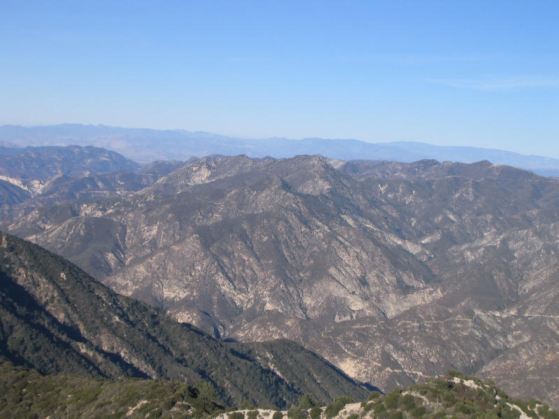
And more to the right of those. Lots more to explore here!
I was fairly slow downclimbing, taking about 5 more minutes to get down to the saddle than I took to get up. The purple arrows were helpful for the most part, but at times I couldn't see the next one. At one point there were arrows pointing two different ways! I figured it was just two routes to get around an obstacle, so since I'd come up one way I tried going down the other. But that was probably a mistake--it was a lot harder to downclimb that way, with few holds and a long drop. I just barely made it. At another place I saw two ways to go down, neither of which looked quite right, so I went down one, ended up traversing to the other, went back up, and found the right trail. And at yet another place I again couldn't find the right way down--the only purple arrow I saw turned out to be pointing in the opposite direction of where I should have gone! (Perhaps it was to show the ascent route.) However I could see at that point where I wanted to end up. I went down a somewhat dicey route and managed to get back to the real trail. So there did end up being a little adventure on this hike.
It warmed up quickly as I descended, and soon I was back to just shirt and pants, plus cap and sunglasses since the sun was high enough. Once I was back on the trail I again went as fast as I could, often running down sections. However I didn't end up going down a whole lot faster than I went up, for some reason. Just under 35 minutes from the saddle to the trailhead, and my overall times to go up and down were nearly identical! This hike and climb are supposed to be very popular, but perhaps since I started early I didn't see another person until I was below the saddle heading down, and even then I passed just a few people (one going down as well, so he must have been doing some other loop hike). The drive home, even though there was a lot more traffic, was just as fast as the drive there, since everything moved smoothly. I got home at 11:10, just after my wife and son woke up, and they were surprised I was back so early. Just 5 hours door-to-door.
This is a fantastic hike, already up there with Mt. Baldy as one of my favorites near LA. Short, steep, great views, 3rd class rock climbing, close to home...I can't believe it took me so long to discover this great hike. Now that I know about it I'm sure I'll go very often--it seems an ideal way to spend a Sunday morning. I'll see if I can get some friends to try it out, and also my wife and son. It may be a little long for Kyle still but I'm sure he'd love it, especially the rock climbing.
Roundtrip distance: 6.4 miles
Elevation gain: 2700 feet
Time up: 1:40 (6:55am to 8:35am)
Time on top: 0:15 (8:350am to 8:50am)
Time down: 1:40 (8:50am to 10:30am)
Total Time: 3:35
I didn't write down the exact times and don't remember them exactly, so these are my best guesses rounded to the nearest 5 minute point.
| Location | Time |
| Trailhead | 6:55 |
| Josephine Saddle | 7:35 |
| Summit | 8:35 |
| Leave Summit | 8:50 |
| Josephine Saddle | 9:55 |
| Trailhead | 10:30 |