The roots of this trip go back to the Sierra backpacking trip of last year, and that report is good background for this one. Basically last year's trip was intended to be centered on a climb of Arrow Peak, which Jim Ralston and Rich Korf had climbed partway on an earlier trip. Joining them were Jim's son Daniel, his friend Alan Lewis, and myself. We were unable to do the trip as planned due to fires near Independence which closed down the trailhead, and instead did the trip in the report. We tried to go back again (sans Alan) just before school started (September 20-23) but an early snowstorm derailed that plan, and we instead hiked in a couple canyons in Death Valley, where the weather was unseasonably pleasant and cool and there was even a little rain. I didn't write up a trip report about that, but I enjoyed the visit so much that I took my wife and son back to Death Valley December 16-18 where we visited some of the same places.
The choice for this year's trip was then obvious--we had to give Arrow Peak another try. This would be in a way the fourth attempt for Jim and Rich, and the third for Daniel and me, although it's not clear whether two of those should really count. Also I was still eager to overcome the "King's Canyon curse", in that this would be my 6th planned attempt to enter Kings Canyon National Park. There were the first two planned bicycle rides that didn't work out, then our two planned trips last summer, and then a planned drive there just a couple months ago. Would I finally defeat the curse this time?
There were a few worries. One was that our planned trip in early July might be too early. It was only about a week earlier than our trip last year, but there was a lot more snow this year (an average year, but fortunately it mostly snowed early) so it was possible athough we could get into Kings Canyon we might not be able to make it up Arrow Peak. Also there were a lot of fires in California, although mostly Northern California. There were just a couple in SoCal, one near Isabella Lake and the other near Olancha. I could see smoke from one on my recent trip to Ross Mountain, and we ran into plenty of smoke as we got near Olancha, but fortunately nothing interfered with our trip this time.
The original plan was to start July 3, but Jim couldn't get a permit to enter that day (very popular with the July 4 weekend crowd as we'd find) and the closest he could get was July 2. Daniel and Alan couldn't get off work on the 2nd, so their plan was to drive up that night and hike all the way to Bench Lake on the 3rd. Jim and Rich and I went the 2nd to pick up the permit and get an early start. Our plan was to hike halfway up Taboose Pass to a good campsite Jim and Rich knew about, and then complete the trip to Bench Lake the next morning, hopefully securing their favorite campsite there. We were actually debating a lot of options, including leaving early the morning of the 2nd and trying to go all the way to Bench Lake, and starting quite late in the afternoon (or early evening) to try to avoid most of the heat up Taboose Pass that we knew would be extremely unpleasant. Rich wanted to get started earlier in the afternoon, and that's what we did. It turned out to be not as painful to hike in the heat as expected, and the plan went very well.
Also this year Alan's friend from high school and backpacking mentor Li Brannfors was planning to meet up with us. Li was coming directly from his job in the Grand Canyon and would likely not even be able to start with Daniel and Alan, but was such a strong and fast hiker that he should still arrive at Bench Lake by the night of the 3rd.
This was essentially a 5-day 4-night trip, but we opted to carry only 3 nights worth of food, simply eating a late lunch at the Whitney Cafe (now called Whitney Restaurant, but I prefer the original name) and then some light snacks upon reaching camp. In general I tried to carry a lot less food than last year. My equipment list goes into all the details. I managed to keep my pack weight down to 27 pounds including poles but not including water, but I made the mistake of bragging about this to Rich who then suggested I carry the climbing rope and slings. As he was carrying the kitchen equipment and I wanted to practice carrying more weight this seemed like a fine plan. My pack weight with water then went up to 35-36 pounds.
After our lunch we headed to the trailhead. The air was so smoke-filled that we could hardly even see an outline of the Sierras. It seemed the views would be pretty bad at the start, and it wasn't clear they would get better, but we hoped for the best. We made it find to the trailhead but Rich's vehicle stalled out several times, apparently due to the heat. Fortunately Daniel and Alan would be coming in a separate car so they could potentially help us if we couldn't get started on the way home.
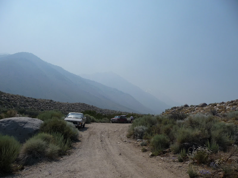
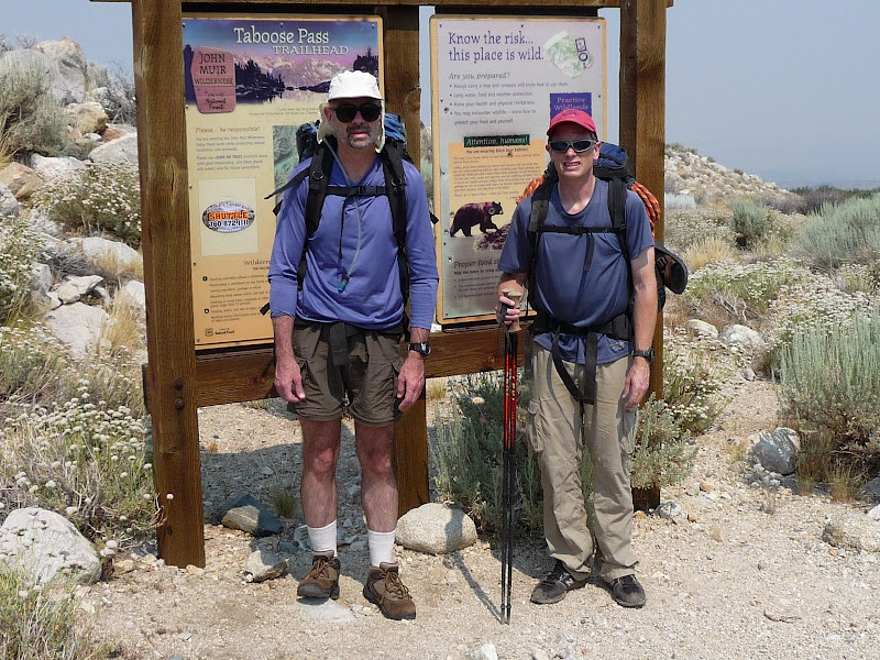
Here we are at the parking area of the trailhead, which was even more primitive than I expected. There was only one other car there, a pickup truck, and we'd wonder just who that was as we didn't see anyone for a while. It would turn out to be a ranger who had started up earlier but came down at the end the same time we did. This was about 3pm.
Here are Rich and I in the "before" photo in front of the trailhead. I was surprised to find such a nice sign at the start. We started up around 3:20pm.
I had done several hikes to prepare for this one, and in fact wondered if it was too many, but I'd neglected to address the two problems I'd have: pack weight and altitude. I carried about 25 pounds on some of the training hikes, but that really wasn't enough--I should have practiced carrying 35 pounds, because I found there was a huge difference between the two weights. Altitude there wasn't a whole lot I could do about. I thought I'd acclimate during the trip, but strangely it never really happened. More about that later. In any case altitude was not really a problem at the beginning since the trailhead is only around 5400 feet. It was mostly weight and heat that were tough at the beginning. I felt really weak, as if all that training hadn't helped a bit. Meanwhile Jim and Rich, who had hardly trained at all, were doing fine. I was upset at still being so weak, but grateful we were just doing 4 miles or so this day.
Actually the distance from the trailhead to the top of Taboose Pass was something we discussed quite a bit, because there was all sorts of contradictory information. Estimates ranged from 5.5 miles (an old Tom Harrison map) to 8 miles (the new map), with some number in between like 6.25 (Secor) and so forth. The ranger at the end told me he though it was about 7 miles. My feeling is that 8 miles, or maybe a little less, is probably correct. The trail gains 6000 feet, and I'd done a lot of steep hikes recently so I had a feeling for what they were like. And there was no way this trail was only 6 miles long, which would be 1000 feet/mile. There were some steep sections which were around the 1000 feet/mile steepness, but also long sections that were relatively flat. I can imagine the steep sections alone accounted for 6 miles or less, and the fairly flat sections 2 miles or longer, which would make sense. 6000 feet in 7 miles is 857 feet/mile which seems too steep overall, while 6000 feet in 8 miles is 750 feet/mile which seems more reasonable, comparable overall to the Baldy Bowl Trail (765 feet/mile) which has very steep sections along with a fairly flat beginning.
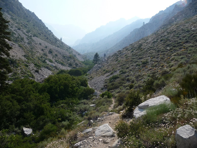
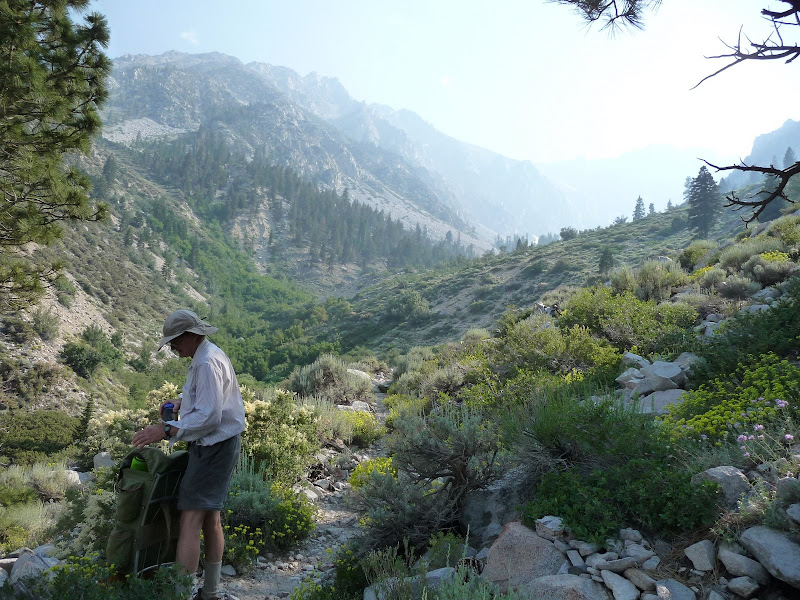
Here's some of the scenery along the way. You can see how hazy it was. The trail was a lot more lush than I expected, and it was cool how the vegetation changed with the altitude.
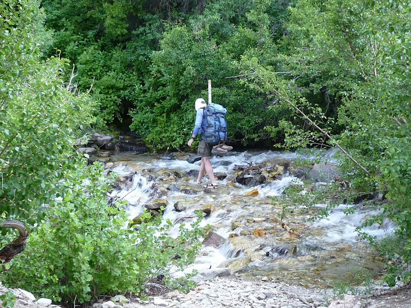
Here is the first of the two stream crossings. It was just a little before our camp, and the second was a little after our camp. I knew about these from Rich and Jim, and decided to bring my chaco sandals to change into for them. They worked great. Rich also brought sandals, whereas Jim opted to just wear his hiking shoes without the socks. I lent Jim one of my trekking poles to use for balance, while Rich, below, used a pole he found by the river.
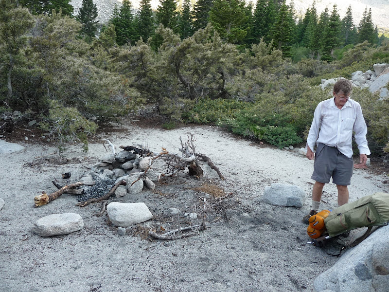
We arrived at camp a little before 6:10pm, so 2:50 to hike the 4 (or fewer) miles there, including the stream crossing which took some time (something like 15-20 minutes with changing footwear at both ends). We found the very ugly remains of a campfire (I hate campfires) at the site, and cleaned it up a bit.
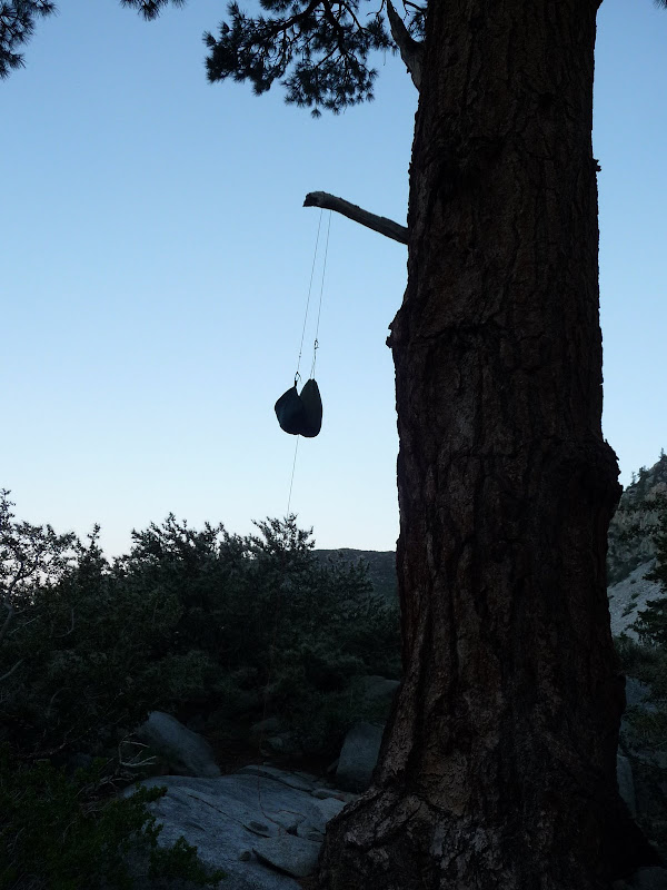
Jim and Rich hung their food, which looked rather eerie in the dying light.
I put mine in an Ursack placed in some rocks. None of the food was disturbed. It was a nice cool night with few insects, so we all opted to not get out our tents and simply sleep under the stars. Unfortunately as usual I could hardly sleep, partly just needing more time to adjust to sleeping outdoors and partly due to a few mosquitoes that I worried would turn into many more. Fortunately they never came, and I got to enjoy an incredible stellar display including Mars and the Milky way which turned from horizontal to vertical in the sky as the night progressed.