Seeing me hike more often recently, Kyle wanted to try hiking himself again. I'd just hiked up Mount Baldy with Kaya Yuki on Saturday, so Sunday it seemed a short hike nearby would be nice. One good candidate would be to try Temescal Peak (according to Schad "the highest peak in the Santa Monicas east of Topanga Canyon") again, which we'd tried last summer but which we aborted midway through, due to heat and running out of water. However looking through Schad's Afoot and Afield in Los Angeles County I also came across Rocky Peak, apparently the third highest peak in the Santa Susana Mountains. I'd never hiked in the Santa Susanas before and always wanted to try. The hike had two big advantages: It was very close and convenient, the trailhead being an exit of the 118 freeway. Also the end apparently featured a scramble over rocks to get to the summit, which I knew Kyle would love. Schad lists the distance as 5.6 miles roundtrip which seemed just right. I asked Kyle whether he wanted the easier or harder hike, and he picked the harder one, since it would be more fun. Just like his father.
Kyoko and Kyle got up earlier than usual Sunday morning, so we were able to leave around 10:30am (of course that's very late by my usual standards...) and traffic being light on Sunday we got there in less than a half hour. An unpleasant surprise was that they charge $3 for parking at the trailhead; you leave the money in an envelope. Fortunately I had $3 with me. I'd looked up the weather and it seemed it would be hot: the high was supposed to be 89 in Chatsworth (it apparently went above 90 in reality) and I thought the mountains might even be hotter. So I made sure we had plenty of water--I brought 2 liters of LA tap water and Kyoko brought 1 liter of bottled water and some snacks. She wore the lumbar pack and I my small day pack. I didn't carry too much weight this time. I did bring my GPS and pocket weather meter, both of which turned out to be useful. Since this was to be an easy hike I tried wearing normal clothes (shorts and a tee shirt) rather than my technical clothes, but I found I really missed the synthetics so I won't do that again.
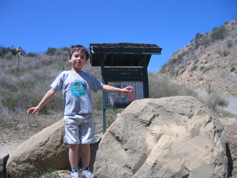
We got started a little after 11am. Here's Kyle at the trailhead. The trail is very near Stoney Point, where I've been a couple times climbing, and not surprisingly there are big boulders everywhere. A very cool area I'd like to explore more.
It's hard to tell how Kyle will be on a hike. Some hikes (Sandstone Peak and Angels Landing) he has no end of energy, whereas others (Temescal Peak) he'll get tired soon into the hike. One factor seems to be temperature--he seems to dislike hot hikes. In this respect he's similar to Kaya (but not me, since I like heat normally). He's very unlike Kaya in that while she prefers to keep moving at a steady pace, Kyle likes to sprint ahead but then runs out of energy. This hike was no different. And unfortunately it was one of the bad hikes where he soon lost interest. It actually turned out to not be too hot--indeed the temperature was about ideal, around 75 for most of the hike as measured by my pocket device, and only around 82 at the end. There was no shade, however, and it was very dry due to the Santa Ana winds. Kyle got a slight nosebleed due to that which bothered him.
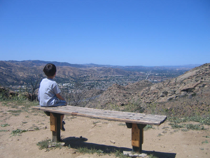
As usual at the start Kyle started running up the hill, with me alongside. His goal was to leave Kyoko behind. However he soon started running out of energy, and started to stop a lot. Here he is resting on the first bench we ran across, enjoying the view.
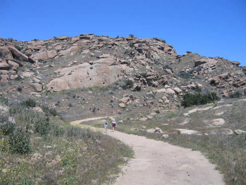
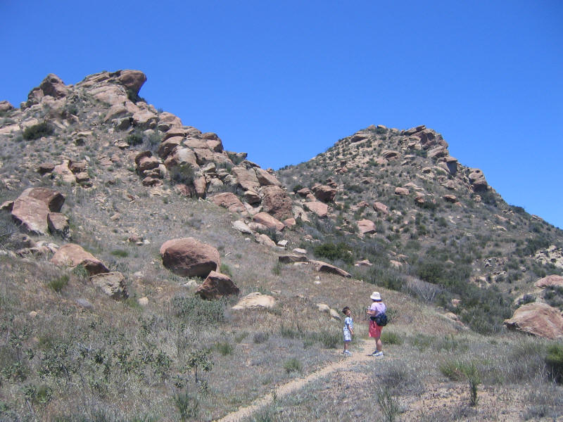
He started stopping a lot, asking for water (he preferred my tap water to the bottled water, as do I) and then candy. Kyoko started to hike ahead of us when he stopped, sure that Kyle would start running again and pass her. But he got upset when she went ahead and didn't want to keep moving. Finally I'd get him to go, and eventually Kyoko waited up for us and the two of them started hiking together. Here's a picture further along; Rocky Peak is still hidden.
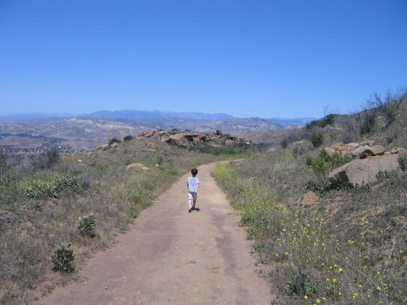
There were signs at a couple places on the trail saying there was some construction to support a movie being filmed there titled Lions for Lambs, set in Afghanistan. This location is apparently popular for movies. We saw some trucks parked at one point but there didn't seem to be a lot of filming activity, at least not in our sight. Here's Kyle walking along a later part of the trail. As you can see it's mostly a wide and pleasant fire road.
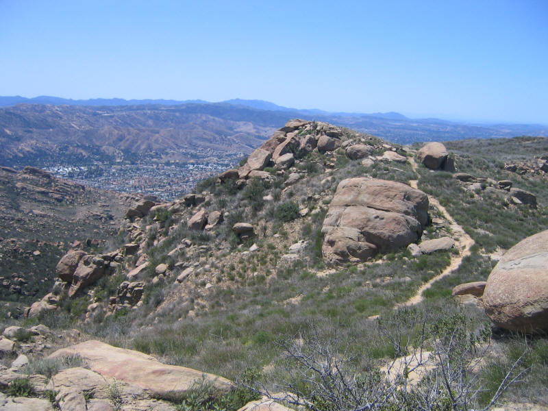
Finally a couple miles in we reached what seemed to be Rocky Peak. It wasn't just clear which peak was the highest one, and in this photo the one on the left seems higher. As Kyle was tired and unhappy at this point I figured we'd just climb whichever was easier and call it a day. Note that we're on a side trail at this point--we could have followed the road further but it seemed this trail would cut the distance down a bit, and indeed it did.
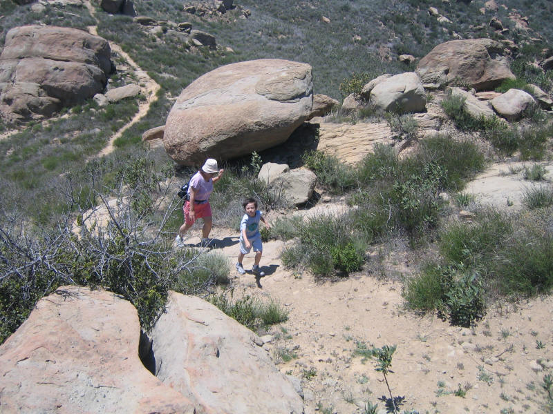
The trail worked its way up to the left-hand peak, and got very steep in sections. Here are Kyle and Kyoko heading up. Kyle started to get more energy on the steep portion. Another factor of how much he likes hikes is how steep they are and how much climbing and other "fun" aspects there are. He doesn't seem to enjoy just walking along trails.
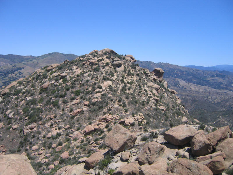
We reached the top of the left-hand peak, which I guessed was not Rocky Peak but named "Rocky Peak #2". It seemed clear the real Rocky Peak was the right-hand peak, and here is a shot of it from Peak #2.
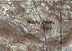
I didn't have a commercial topo map for the area and so just printed one out on the computer, the first time I've ever done that and it worked very well. I had a guess from the map of where we were, but wasn't completely sure. I also had my GPS but had neglected to upload maps of this area into it. So I marked a waypoint and then looked on the computer later. Sure enough we were exactly where I thought we were. The yellow diamond below shows where we were. Looking at Schad's book this point is referred to as a "false summit". It seems the easiest path to Rocky Peak is to go first to Peak #2, then scramble from there down and up Rocky Peak itself. Next time I'll do that, but for now this was satisfying enough for Kyle.
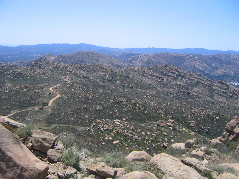
We climbed up to the big rock jutting out at the top of Peak #2 (see the picture above) and Kyle kept wanting to get dangerously close to the edge, which you can see in the picture has quite a bit dropoff. It was windy throughout the hike but extremely windy on the top. We measured the wind for a while and got the meter to register over 31mph at one point, so not much less than the 34mph I'd registered at Mt. Baldy the day before (although I'm sure the winds were stronger on Baldy, and with the cold were certainly less pleasant). We enjoyed sitting or lying on the summit rock and feeling the wind whistle by, and I took several pictures. Here is one toward the west of what I would call Rocky Peak #3 (the one the side road on the map above leads to). The trail there is the longer one we didn't take.
The picture below is more to the south. You can see the fire road we came up clearly in it.
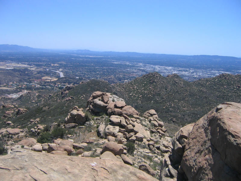
This is to the left of the previous picture, I think. It's hard to make out at this reduced size, but around the middle of the mountain skyline are some things jutting up that I thought were likely skyscrapers downtown. You could also vaguely make out the San Gabriel mountains in the distance (they didn't come out well in the photo). One nice thing about the Santa Anas were that the views were great this hike.
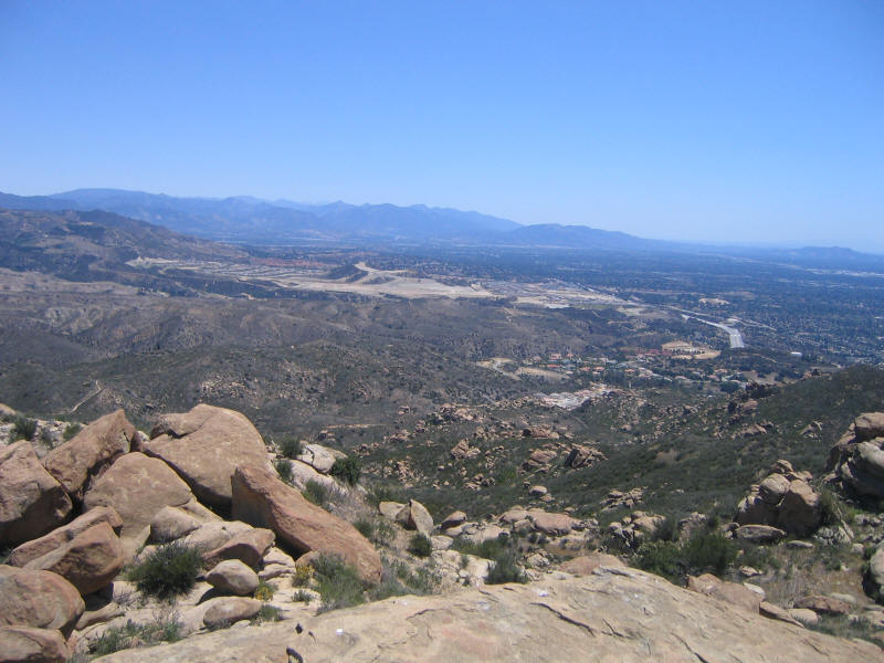
Here's another picture further left still.
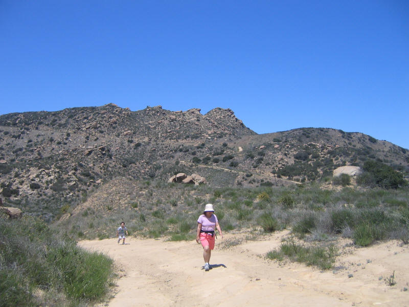
It probably took us about 2 hours to do the hike up. It gains about 1200 feet in 2.8 miles (of course we didn't make it all the way to the highest point of 2714, but we were close). The hike back took about an hour and we were done shortly after 2pm. Kyle started down with some energy but then alternated bursts of energy and lethargy. Here he is falling behind a little. In the background can be seen (according to my naming scheme), from right to left, Rocky Peak #1, 2, 3 and 4.
In summary a great hike on a perfect day and I'd love to go back and finally climb Rocky Peak itself. Wonderful to have such a great short hike so close to home.