Surprisingly I hadn't done this hike, my favorite near LA, since over a year ago with Kaya Yuki. Previous to that I'd already the hike three times alone (in 2003, 2004 and 2006), and once with Wang Huan September 2006. The previous reports contain a lot more information as well as pictures; I didn't even bother to bring a camera this time. This is the hike I typically do as my first long hike of the summer, and I suppose this year was the same. It seems like I've hiked quite a bit recently, but always shorter easier hikes, and I haven't been cycling much so I feel very out of shape. With Jim Ralston and friends we're planning another attempt at Arrow Peak around the July 4 weekend, and I want to be in good shape for that, so this hike was in a sense the first step. I decided to do it in the traditional Wednesday early morning, waking up at 4am and leaving at 4:30am. I've been waking up at 5am lately, going to bed around 9pm or 10pm typically, so it wasn't too hard to wake up an hour earlier. I ended up getting the earliest start of any time I've done the hike.
I used my car GPS (which I must have bought less than a year ago) for the first time to get to the trailhead, and it recommended a different route (10 to 60 to 210 to Baseline) than I took before, which did seem a little faster--about 1:10 versus 1:20 or so for previous trips. Also I didn't get lost in Claremont as I sometimes do. Ah, I love GPS. I recalled from reading a previous trip report that I have trouble remembering just where the trailhead is, and amusingly this time was no exception! They added an extra portapotty and moved them both to the other side, which confused me, and also the parking area (basically a gravel divider between roads) seemed somehow different, but probably I've just forgotten. But I did figure it out eventually, and for future reference the trailhead is San Antonio Falls Road! Now that I'm moving back to Palo Alto I may not get to do this hike again for a long time, and I'm really going to miss it. There's nothing in the Bay Area even remotely as good as this hike, or many others in the LA area for that matter.
I wanted to practice carrying weight, just as I did last time, to get in shape for backpacking, but I didn't carry as much as last time. I just brought my normal day pack with some extra clothes and supplies, 2 liters of water, and then an extra 4 liters of water for weight. Probably just over 20 pounds of weight. I should have used the pack I'll be backpacking with instead to get my body re-used to that. The day pack, my favorite, was still comfortable with the weight, but it certainly slowed me down. Feeling out of shape I feared my time would be really slow, but the point was to get into shape so I didn't care about my speed.
I got started at 5:51am and felt like I was going very slow indeed. I signed the register at 6:07am. There were just a few entries for the previous days, and I was the first this day. Indeed I didn't see anyone else until the very end of the hike, a reason I do it on Wednesday. It's great having the mountain to myself.
I did have a couple newly purchased goodies for this hike. One was new hiking pants, just purchased the previous day from REI, since my old Ex-Officio pants had developed a hole in the rear end and the patch my wife tried to apply wouldn't hold. I figured I should get something new. REI had some very nice North Face pants that were very thin and light but seemed durable, and also weren't convertible which was a plus since I never want to take the legs off. They're quite a bit better than the old pants and very comfortable for warm hikes, so I love them already. I just hope they last for a long time. The other item was a new watch, since my old watch's batteries ran out for a second time and it was getting old. I finally got a Casio Pathfinder, which I'd wanted for a long time and they just came out with a slim model so good timing. It has just about everything I want: solar power (so no more batteries), atomic time, and an altimeter. The only other things I could wish for would be ability to download data and GPS functionality, but those would probably require a battery. The altimeter was about 200 feet too low when I reached the summit of Mt. Baldy (a 3900 foot climb), which is on par with other altimeters I've used (which always seem to tend to the low side): the Suunto Vector and my Polar watch/altimeter/heart rate monitor. So I'm very happy with the watch.
The weather was terrific, and although I started wearing my fleece I soon took it off and did the rest of the hike in a tee shirt. I stopped a few times to drink or just for a second to catch my breath, but mostly just kept going at what seemed like a very slow pace. I recalled I always seem to think I'm going really slow on this hike, so this was nothing new. But after a while I realized I was low on energy and quite hungry. I'd eaten some cereal and yogurt for breakfast, and not having much hiking food around lately just brought a bag with a few Cliff Shots and Cliff Bloks in it. I was really in the mood for Cliff Bloks luckily, and just before the ski hut ate the package of Black Cherry, which has caffeine. This somehow really hit the spot, and I felt much better. I didn't eat again the rest of the hike, and drank exactly one liter of water for the full hike, which is rather a lot for me, but then it was a fairly warm day.
I made it to the ski hut in 1:01, stopped briefly for a drink, and continued. I felt a little better as the trail flattened out a bit, and somehow made it through the rocky way with no navigation problems at all, which may be a first. I then reached Kaya's "Broken Friendship Hill", the endless switchbacks up the side of Baldy Bowl, and it actually didn't seem bad to me at all--a lot less difficult than the early steep section. I guess which part is hard varies depending on the day and how you feel. For the last section to the summit I somehow managed to get off trail at some point, and realized it when it seemed too steep with poor footing, but it wasn't clear just which way to go to get back on trail. I ended up scrambling (3rd class) up some loose rock at one point, and managed to scratch my right arm on a sharp branch, drawing a thin line of blood about 3 inches long. But that was minor and I soon found the trail again.
I couldn't remember exactly how long Kaya and I took to get to the top last year, but I did remember it was a record and amazingly I seemed to be going fast enough that I had a chance to beat it! What's more I might even be able to get to the top in under 2 hours! I went as fast as I could at the end but it still wasn't very fast. I didn't really feel the altitude (perhaps the previous trip to Sequoia National Park helped) but I'm sure it must have slowed me down some.
I ended up making it to the summit in 2:02, so a little disappointing that I couldn't make it in under 2 hours but I was still happy especially given that I'd seemed to be going so slow. If I hadn't gotten off the trail perhaps I would have made it up a few minutes sooner.... Anyway it turns out Kaya and I made it up in 2:23 last year, so this was a huge improvement! That was a big surprise. My other times had been slower still, up to the very first time which was 3:50, so this was almost twice as fast! It's nice to know I'm still somehow getting faster, and certainly there's still plenty of room for improvement. My speed was 2.5mph, which is a little slower than the 2.7mph I averaged hiking up Mount Si, but then although the Mount Si trail was slightly more steep overall (800 ft/mi versus 765 ft/mi). the Baldy Bowl trail is longer and at higher altitude, and I was carrying a lot more weight. Also for reference on the 4.2 mile main segment of the Baldy Bowl trail (not counting the initial paved/dirt road), which climbs 3504 feet (so 834 ft/mi) I averaged 2.4mph. Not surprisingly for both hikes my thighs were sore for a couple days afterwards.
The summit was windy as usual but not cold. I decided to empty the extra 4 liters of water bringing my pack weight to around 10 pounds (or less since I'd drunk some of the other water) for the descent. I only spent 5 minutes on the summit and then started down. I wanted to work on my descent skills as well, and tried to go as fast as I could. I found I could run down many sections which weren't too steep and had decent footing. On the way down I tried to figure out where the descent route is that Schad talks about: "Or, if you like fast descents down talus and scree slopes, you could walk down to the saddle just west of Mt. Harwood, and then drop straight down to the ski lodge 1200 feet below. Sturdy, ankle-protecting footwear is essential for the latter route, which can be recommended only for hikers with an excellent sense of balance." I couldn't remember exactly what he'd said so I wasn't quite sure where to look, but in any case I must not have excellent balance yet because nothing I saw looked safe for me to descend. Maybe next time.... While (unsuccessfully) looking for more info about this route on the web I ran across another route, used more for ascent it seems, up "Register Ridge". It looks very interesting and I'd like to try it out sometime.
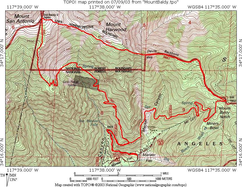
I made it to the ski area by about 8:51, so two hours from the start. (Note that I didn't follow exactly the route outlined on the map above, but rather followed the less steep dirt road, also seen on the map, that Kaya had found the last trip.) The last section of the hike, after the ski area, is just a dirt road at a gentle grade, so I ran down most of it. I would walk at times just to rest and also because I could feel a little pain on the outside of my right knee, a recurring problem. I think there must be something wrong with my running mechanics but although I tried to adjust things I couldn't figure it out. Anyway I tried to take it easy. Interestingly I had no right foot pain, which is my main problem when I try to run on flat sidewalks. So I'm not quite sure what's going on there.
After a bit I had the bright idea to use my hiking GPS, which I had with me, to measure my running speed. I did this just for the last couple miles. My typical speed while running was between 7 and 8mph, which going downhill felt like just a jog. But because I alternated with walking my overall speed was just 6.1mph. Still not too bad.
Just before reaching San Antonio Fall I ran into my first person, and older guy walking alone. He was surprised to see me running down and stopped me to ask some questions. His English was not great and he had trouble understanding me, but I tried to explain that I'd already gone to the top going up the Baldy Bowl trail and down the Devil's Backbone trail. He was amazed that I'd only taken 2 hours to go up an a little over an hour to do down, and thought I must be a "mountain man". He asked me how old I was and when I asked his age he said 70, but he looked much younger and was clearly in very good shape. He asked me how long I'd been hiking and I said, without trying to figure it out exactly, 10 years. That's actually not too far off as I consider my first real hike to be Half Dome on August 18, 1999, so a little less than 9 years ago. He said he'd grown up in Korea and so had been hiking in mountains all his life; I of course grew up in Indiana and didn't experience mountains until I moved to California. Anyway although I lost a few minutes talking with him it was nice to chat and be able to brag a little bit.
Near the trailhead I ran past a few more people going up--I don't know if they were in the same group as the lone guy or not. I made it down at about 9:26, and so a total time of 3:35, which is more than an hour faster than my next best time and again nearly twice as fast as my first time of 6:55. I was very happy. My overall speed for the hike, including stops, was 3.3mph.
The only problem was that it was only 9:30, and based on those much slower times I'd told my friend Lydia Yue that I would be done around 12 noon or 1pm. She's been staying up late and waking up late during the summer, and said I should call around noon and wake her up; our plan was to eat lunch together near her place on my way back home. So now I needed to kill some time. I figured I could drive to REI in Arcadia, which is not too far from her home in El Monte, and look around there for a while. I made it there around 10:15 and gave her a call waking her up early, and asked if she'd be willing to get up and meet me at her place at 11am. She said okay, luckily, so I spent a half hour in REI and then took 15 minutes to get to her place. I suggested Din Tai Fung or Shinsengumi for lunch, and had forgotten she hated Din Tai Fung. So we went to Shinsengumi in Rosemead, which Lydia had actually first told me about. I'd been to their original Gardena branch many times, and it's about tied with Santouka as my favorite ramen place in the US. But Gardena is a 30 minute drive with no other reward, so when I found out about this place close to good hiking I'd already gone twice in the last two weeks, both times after hikes to Dawn Mine near Altadena (I'll write up a trip report covering them both after I do the hike with Lydia, planned for Sunday, June 22). It was great to go this third time, the first time I'd made it in time for the lunch specials, and Lydia was nice enough to treat me as well! A great lunch, and then we went back to her place to chat some more before I had to leave around 1:20pm.
I managed to find a gas station with relatively cheap gas on the way to the highway, only $4.37 per gallon which sad to say these days is pretty good, and I needed gas as I was nearly on empty. I was dreading the drive home mid-day, but perhaps because high gas prices have thinned out traffic it wasn't bad at all, and everything moved fast all the way--I made it home just after 2pm. It's really easy to get from her place to mine as you take the 60 to the 10 which bypasses the more congested parts of downtown traffic.
So a wonderful day and it wasn't even over yet! I took a shower and then walked to UCLA, getting there at 3pm where I'd planned to meet Melissa Tong to play a piano duet. She'd invited fellow first year grad students Laura Smith and Frances Fukushima, and we lined up two benches and played various combinations of 4 hand piano, mostly Heart and Soul and the Bruckner duet that I'd learned years ago from my teacher in Menlo Park. A terrific day!
Distance up: 5.1 miles
Distance down: 6.8 miles
Total distance: 11.9 miles
Elevation gain: 3904 feet
Time up: 2:02 (5:51am to 7:53am)
Time on top: 0:05 (7:53am to 7:58am)
Time down: 1:28 (7:58am to 9:26am)
Total Time: 3:35