I had climbed Mount Baldy 6 times previously including just two weeks ago. However every single time I'd gone the same way, up the Baldy Bowl Trail and down the Devils Backbone Trail. As this is my favorite hike near LA I didn't see any reason to change that. I did know of another route, described in Robinson, in which one hikes up the Mt Baldy Trail from Baldy Village, and then descends one of the other trails. However you need a car shuttle to do that. A couple years ago (June 3, 2006) the math department hike was to do Baldy, and I couldn't make it for some reason, and then was really disappointed to find out they'd done this route, coming down Devils Backbone and the ski lifts! I didn't think I could ever arrange a car shuttle, so I'd never be able to do this challenging hike that gains nearly 6000 feet in some 6 miles.
I don't know why it never occurred to me to simply do the route as an out-and-back. Perhaps I misremembered the distance (thinking it was 20 miles roundtrip rather than 12) or perhaps I thought the descent would be too painful. In any case I didn't even consider this all too obvious option until talking with Yongning Zhu who had hiked up Baldy in April (so there was still snow) with some friends, and did it via a long and difficult route. She couldn't remember just what it was, but from her description it sounded like it must be from Baldy Village. Of course I thought if they could do it I should be able to as well!
I wanted to do some warmup hikes before our upcoming Sierra backpacking trip, and along with Iron Mountain, done just 4 days previous, this seemed like a good one. Iron Mountain was rather unpleasant with the heat, so I figured if it didn't cool off I would wait on this hike, but it did get cooler so I decided to give it a try. On the difficult day hikes list it is ranked number 8 (with Iron Mountain number 5). I saw someone on the web say they thought Baldy was harder, but I couldn't believe that would be true, and both Jim and Ernie (who had been on the math department hike) thought Iron was harder. I suspected Baldy was a lot easier, with apparently a good trail and little intermediate descent, and even thought I could hike up it in about 3 hours, which although that would be at about 2000 feet elevation gained per hour would be distance-wise a mere 2 mph, much slower than my speed up the Baldy Bowl Trail two weeks previous. I thought 5 hours for the whole hike might be reasonable, although from the start I thought these times were likely overly optimistic.
I was going to meet up with Lydia Yue for lunch afterwards so I told her I should finish between 10am and noon. I wasn't thinking carefully since I would be starting at 5:30am at the earliest and so 10am was pretty much impossible even at a fast pace. But anyway that's what I said. I set my alarm for the usual 4am and left, after eating a reasonable breakfast, at just after 4:30am. I brought pretty much the same things as for the Iron Mountain hike, including 6 liters of drinks (1 liter gatorade and 5 water, but all unfrozen), except less food. Again my pack should have been around 22 to 25 pounds, and carrying weight was part of the exercise. I ended up carrying a lot more weight overall on this hike since I drank a lot less water (just the one liter of gatorade on the way up, and one liter of water on the way down, but I only carried 2 liters of water down and dumped the remaining 3 liters are the summit). So this in contrast to 5 liters needed for Iron Mountain. What a difference cooler temperatures make! For further comparison, I drank only a little over a liter on the 13.5 hour 22 mile Whitney hike in cool to cold weather, and was completely fine.
I made it to Baldy Village a little after 5:30, but, as I had been worried about, couldn't really figure out where to start the hike. I ended up parking across from the visitor center which worked out fine, but I found I could have driven up Bear Canyon Road a bit and parked there, including a spot pretty close to where the real hike begins, and saved a little walking on the road. I walked through the visitor center grounds, including an area with Indian things, and recalled Yongning had told me there was some Indian stuff around where she started, so this must have been the same place. I wasn't really sure just where to start timing the hike, and just decided to start where it really seemed to be a trail rather than the road. This was at the broken-down wooden footbridge at the end of the road. The Tom Harrison Mt Baldy map marks a location lower down as the start (perhaps the last parking area, where there is a trail register as I discovered on the way down), so I've lowered my one-way "official distance" from 6.4 to 6 (likely conservative). Of course I walked even longer than 6.4 miles each way, but the extra part wasn't timed. Incidentally the trail register has a wilderness permit pad in it. I wasn't aware that one needs one for this hike (and I'm still not sure you do); I'd be surprised since the Manker Flats hikes certainly don't seem to need one. In any case I've never run into a ranger on this mountain as far as I can recall.
My official start time at the footbridge then was 5:55am. I'd been feeling a little sick to my stomach lately so I was worried about that, but it turned out not to be a problem. The trail starts out fairly steep but then actually flattens out for a while, certainly a surprise! The first 1.8 miles (according to the map) to Bear Flat at 5580' are comparatively easy, only 700 feet/mile. Bear Flat to the summit on the other hand is 975 feet/mile, and overall it's 898 feet/mile. So steep but certainly nothing compared to Iron Mountain. Also there was very little downhill going up (a good thing!); I'd guess less than 100 feet. My pace seemed pretty good at the beginning, but definitely started to lag in the middle, especially as it got steeper. I ate some Cliff Bloks again in the middle but they didn't seem to help as much this time. I ate some crackers and cookies on the summit (plus a few nuts as will be mentioned below) but nothing else for the hike.
One disadvantage of this hike versus Baldy Bowl is that you're on the east side of the ridge for the first half of the hike or so, and so there's no mountain to block the sun. And the sun was quite annoying. At least it was cool. I wore my t-shirt the entire hike and it was close to perfect hiking weather, just a little on the warm side. The temperature was a lot more mild (the downside was a layer of fog and smog that blocked views, especially in the early morning) and the hike is at higher elevation than Iron and so you get a benefit from that. The summit was a perfect 61 degrees (I brought my weather meter) with only the slightest breeze. I don't think I've ever experienced such mild conditions there before.
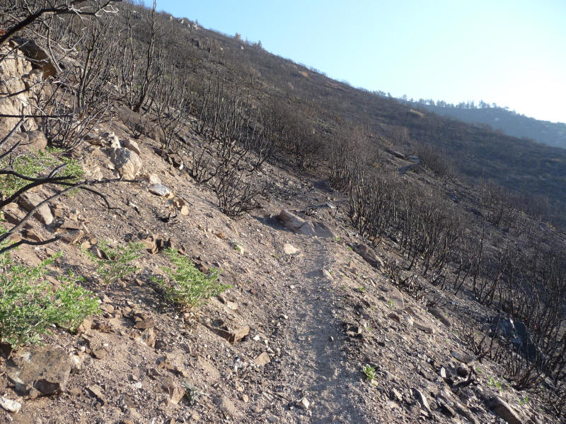
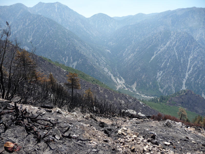
Since this was a new route up the mountain I had an excuse to take some pictures again! And there was plenty of beautiful scenery. I had forgotten that only a month ago (mid-May) there was the "Big Horn Fire" in this area that burned quite a lot around this trail. Indeed it's lucky the trail has been reopened! It was especially interesting to hike through the burned areas, and I could still smell the burnt wood. It was amazing how resilient the trees and shrubs were to this fire. I certainly got the feeling the periodic fires are good for this vegetation. Here's one part of the burned area.
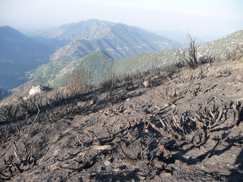
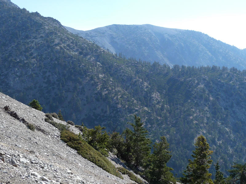
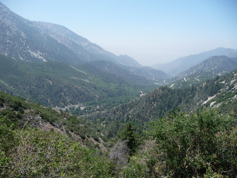
Here's another, looking back down into the valley.
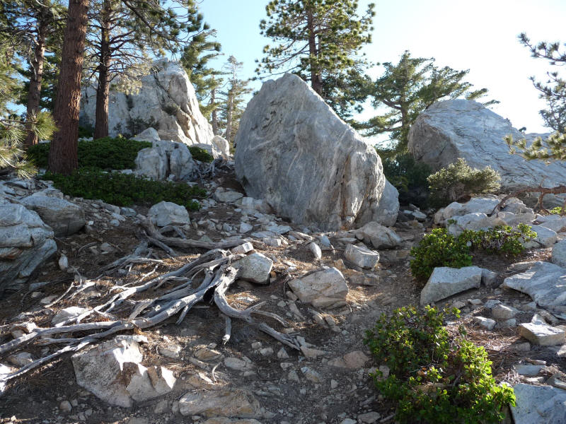
Here's a cool rock area higher up. These looked like they'd be fun to boulder, although I didn't try.
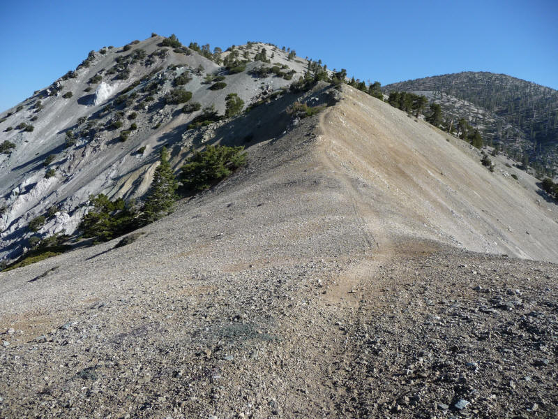
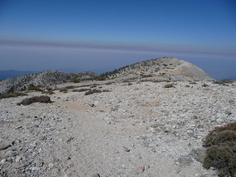
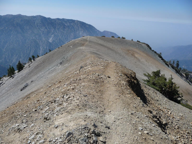
The trail actually doesn't start on the ridge; after Bear Flat it angles up the side of the ridge. This part was quite demoralizing since aside from being steep you don't get any views forward and can't tell just what's ahead or how far until you get there. But eventually you do reach the top of the ridge, and get the big reward. I love ridges and this was a fantastic one to hike on.
At some point on this ridge I ran into another person, which was a huge surprise as I hardly ever see anyone else on a Wednesday on Baldy. He was a backpacker, and said he'd started at highway 10 and camped a little bit lower last night. He'd take Devils Backbone down. We chatted a little and he offered me some of his nuts, which tasted great! I figured I'd run into him again as I would come back down this same trail.
The trail is completely separate from the other two trails. Here's a view of what must be the final ridge that you ascend after "Broken Friendship Hill" up the Baldy Bowl.
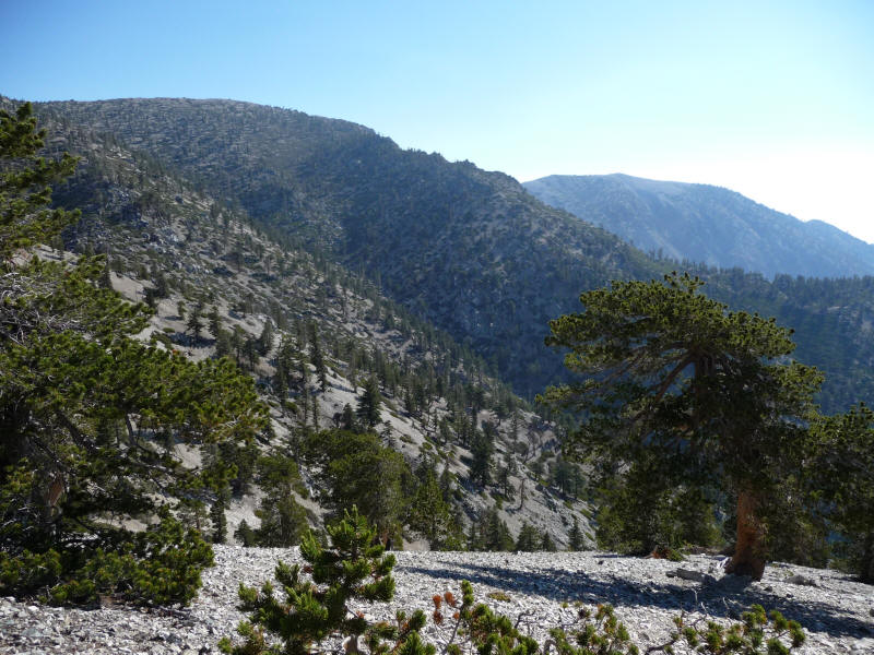
Here's a closeup of the same ridge that was actually taken a little earlier, and that came out particularly well.
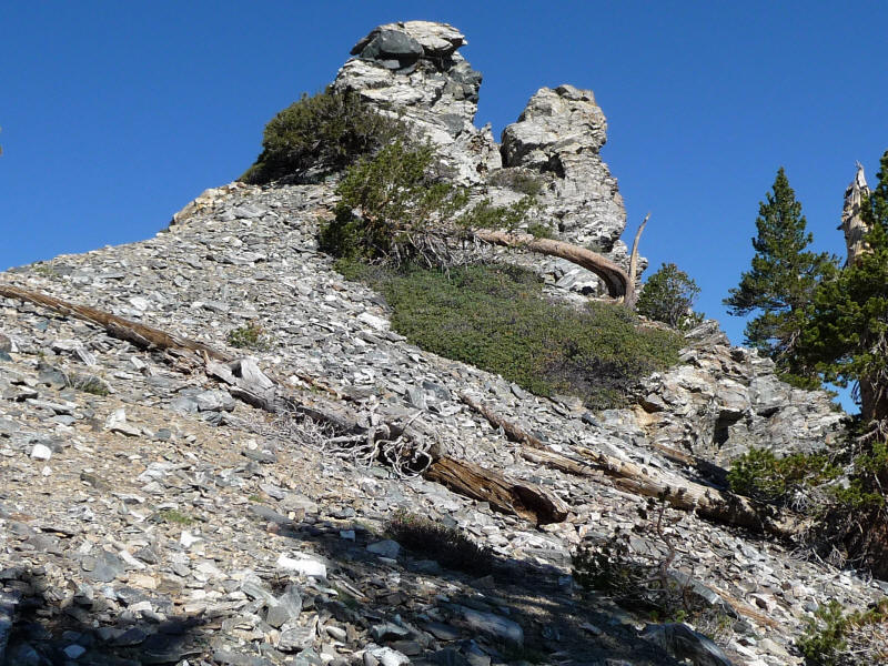
A cool rock formation and twisted tree.
Near the top I could hear some voices, and I saw an elderly couple on the last part of the Baldy Bowl trail who reached the summit at the same time I did. My hope to get up in 3 hours was of course not satisfied, so my new goal had been 3.5 hours and I did manage that: 3:26 to be precise. A little disappointing but not too bad. The couple was impressed with my speed because they'd seen me get out of the car when they drove by to Manker Flats. They started themselves a little after 6am. They seemed to be veterans of the San Gabriels. The woman was saying the summit register box (which was not there) had only lasted 6 months. I had only seen the box once, when I hiked up with Kaya last summer. I didn't ask them what happened to it.
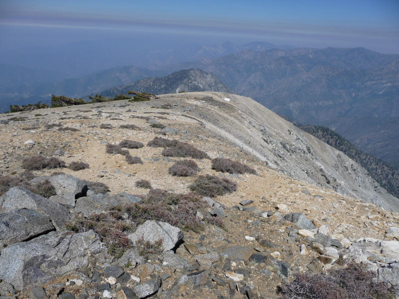
The two ate near the summit plaque while I wandered around the summit a bit. I wanted to see Iron Mountain and the San Antonio Ridge. I saw what I thought was Iron Mountain and the ridge (in the foreground below) that seemed to be San Antonio Ridge, but I was completely confused as I soon realized looking at my map. I also saw a post and what seemed to be a trail leading to the ridge, and I thought it must be pretty well-developed if there was a trail there!
This was all wrong, though. My map doesn't show much west of Baldy, but looking at it I guessed this mountain must be Baden-Powell, which it is. The trail is the North Backbone Trail which I didn't even know existed! The ridge in the foreground is the Pine Mountain Ridge and in the background the Blue Mountain Ridge. As I should have known, San Antonio Ridge connects first to West Baldy, and I was planning to finally bag that subpeak as well since it's just off the main Baldy Trail. I had decided to do it on the way down so it wouldn't interfere with my ascent time. Here's West Baldy from the trail as I'm heading down.
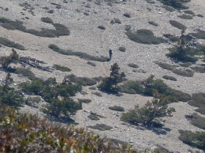
As I started up the side trail I noticed the backpacker on the main trail. Fortunately I was close enough that I could shout down and say hello. A little later I took a picture of him heading up to the summit using the 10x zoom of the camera.
From West Baldy you get an even better view of Baden-Powell.
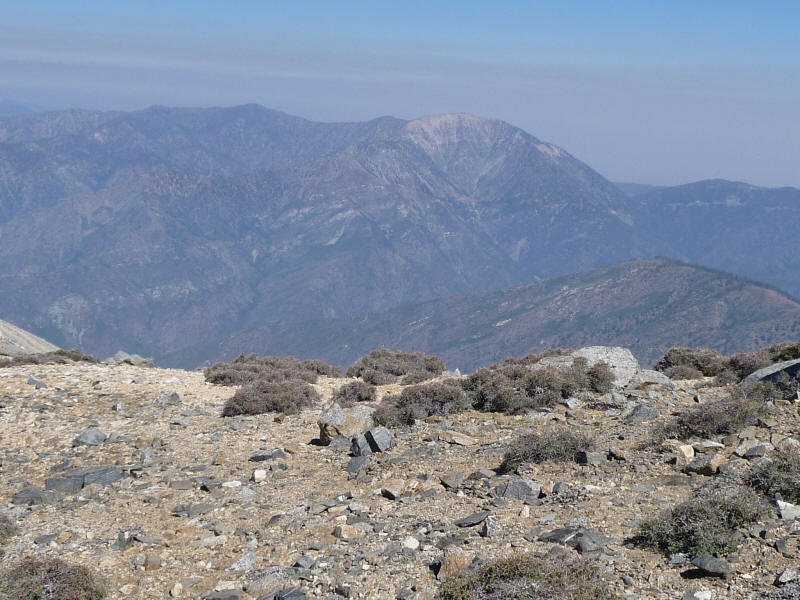
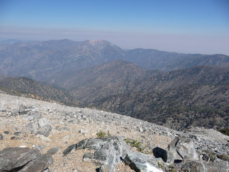
Sadly you can't see the San Antonio Ridge very well (much easier to see it from Iron since it's going up from there!) and mighty Iron Mountain at 8007 feet looks quite insignificant from the summit of 9988 foot West Baldy! I think it's the mountain to the left.
Unfortunately I didn't keep track of my time on this little detour but I would guess it was 20-30 minutes. Very worthwhile. I then continued down the trail, taking more pictures. I tried to go fast but couldn't manage the speeds I'd done on the Devils Backbone trail, especially the dirt road portion! There were parts I could jog down but plenty of steep, rocky and loose sections I had to be careful on. I was more tired than last time too and seemed to be affected by altitude more, sad to say. The long descent was tough on my knees too and the outer part of my right knee started hurting again. The skin on the back of my left heel also got scraped off. And at one point when going down quickly I moved my right hand out and down for balance and managed to put it right on top of a yucca! I got several pokes but all extremely minor.
Here's the ridge again on the way down. So beautiful.
A look down into Cattle Canyon.
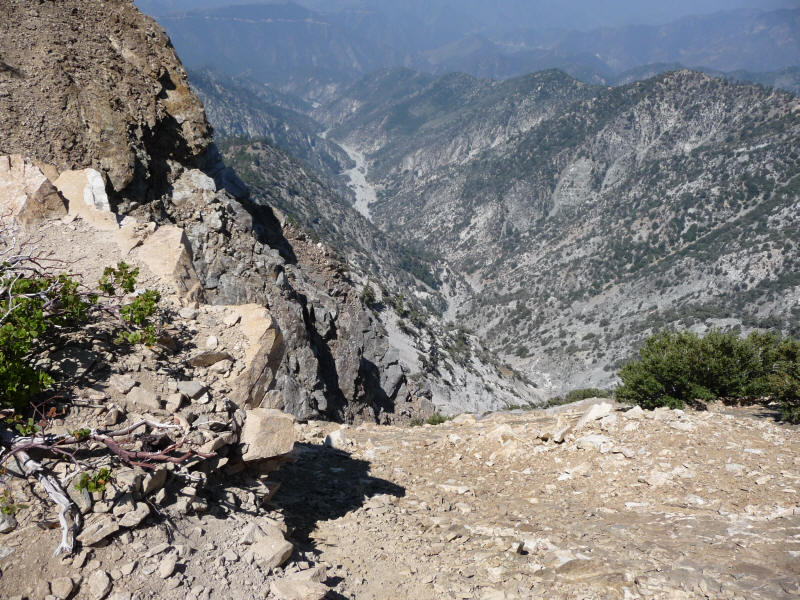
A look down toward Manker Flats, I think.
At some point toward the end I ran into a couple young guys hiking up with a dog. So quite a few people out this day!
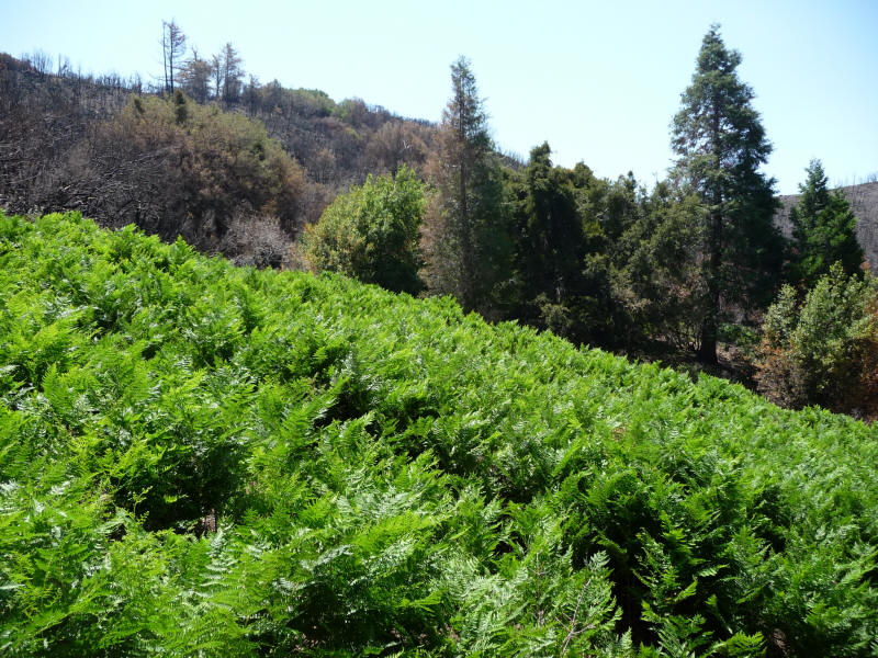
Here's lush Bear Flat.
A look down toward my destination of Baldy Village.
I made it back down at 12:02pm, so just after the time window I gave Lydia. It took over 6 hours rather than the 5 I'd hoped for, but still not too bad. Given that Iron Mountain took almost 5 hours just to get up, I'd say it's clear which is the easier hike. Descent time was 2:25, but that included the side trip to West Baldy so it was probably under 2 hours. Unfortunately I couldn't get cell phone reception until I made it down to Claremont a half hour later. I told Lydia I'd make it to her place at 1pm, and arrived around then. She and David and I went to a Northern Chinese style restaurant that they really like (sure enough it was on Valley right near the other two places we ate at the last couple weeks). The food was great. I then dropped them back at home and drove back. Luckily although the other direction was jammed, traffic my way wasn't bad at all at around 2:30pm, and in fact it went faster than it did when I went home Sunday!
This was a very nice hike, about what I expected in terms of difficulty. The scenery was great and it was an excellent workout. I think I still prefer the Baldy Bowl/Devils Backbone loop which is surprisingly about the same length but has a better flow to it with a shorter (but still steep) uphill part and then a long easy descent. As a loop there's more variety too. But for the best variety if I were to stay in LA I'd probably alternate the two hikes. Sadly I'm moving up north, and I'll really miss Mount Baldy.
Distance up/down: 6 miles
Side trip to West Baldy: 0.5 miles
Total distance: 12.5 miles (plus 1 mile to and from car)
Elevation gain: 6000+ feet
Time up: 3:26 (5:55am to 9:21am)
Time on top: 0:16 (9:21am to 9:37am)
Time down: 2:25 (9:37am to 12:02pm) [includes side trip to West Baldy]
Total Time: 6:07