Following our Strawberry Peak and Mt. Baldy hikes, this was to be Kaya Yuki's and my last warmup hike before Half Dome on the 21st. I suggested we do a yet harder hike like San Jacinto Peak, but Kaya wanted to do an easy hike instead. Looking at guidebooks and maps I found four good possibilities, all of which were new to me. Since Kaya had said she enjoyed the trees and creek at the start of the Strawberry Creek hike, I thought she might like trying a canyon hike. I normally don't like these that much, as I prefer climbing mountains and getting great views. But canyon hikes are fun to do every now and then and if she enjoyed them it would be a good excuse for me. So the four hikes comprised two pairs, each pair consisting of a canyon hike and nearby companion mountain hike. The closer pair was Bear Canyon and San Gabriel Peak. The trailhead of the former is essentially across the street from the trailhead from the trailhead for Strawberry Peak, and the trailhead of the latter is just down the street. In fact the creek forming Colby Canyon that we'd hiked along to get to to Strawberry Peak feeds into the Arroyo Seco which goes through Switzer's and then splits off, one branch going down Bear Canyon. And San Gabriel Peak is the second highest peak of the San Gabriel Mountain front range, just 3 feet shorter than nearby Strawberry Peak. I seemed to recall our friends Wang Huan and Cong Ze had hiked down Bear Canyon before, saying it was a beautiful hike, but I might have confused it with something else.
The other option was to drive a fair bit further on highway 2 to near the Mt. Waterman ski area and try either Devils Canyon or Waterman Mountain. Kaya was unsure what to pick but at some point during the drive we settled on Devils Canyon.
Kaya wanted more time to sleep so I picked her up a little after 6am. Despite having driven to the 2 freeway many times, including just two weeks ago, for some reason downtown I got confused and took 5 south instead of north. I decided to just take the 10 and then the 710 and try to get back to the 210, but I didn't realize just how poorly connected the freeways still are. We had a map and just decided to connect through on some surface streets. This cost us some time, but was an interesting variation on the drive. And it set the theme for the whole day, which was trying out new things.
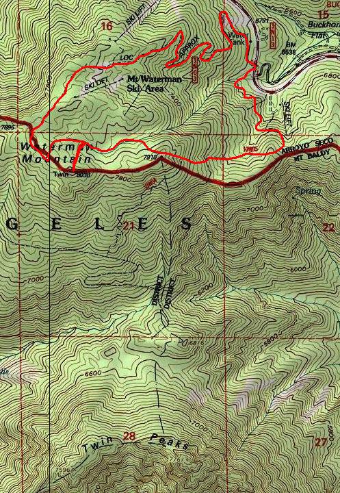
At some point we arrived at the Devils Canyon trailhead, where we were the only car. This was the first time I'd driven so far on the 2. Here's a picture of Kaya at the trailhead, which immediately enters the San Gabriel Wilderness, another first. Kaya took a picture of me too at the start, in front of another sign saying stay on the trail, but she must not have pressed the button firmly since no picture seems to exist.
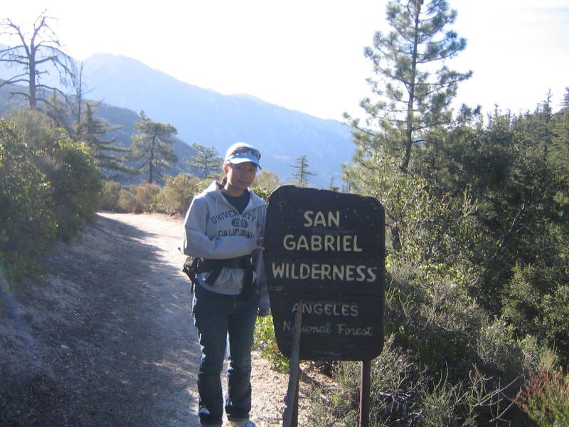
We started down the canyon and the views were quite nice still. However the hike didn't seem that interesting, at least at the start. I figured it would get more interesting as we got further into the canyon, but then we'd lose the views. What's more the trail was narrow with a very steep dropoff to one side, which Kaya didn't like. So after a little bit we both decided we'd rather hike up a mountain instead. Here is Kaya giving the Japanese "batsu" (no good) sign saying the hike is over.
We drove further then to near the Mt. Waterman ski resort, and I had some trouble figuring out just where the trailhead was. Kaya got to experience what it's like when I do a hike for the first time and don't know where to go (well, I guess Mt. Hollywood was like that too). We picked a gated fire road to try and luckily that was the right guess. I don't recall just when we started--I seem to remember around 10am, maybe 9:50am or so, and Kaya though it was definitely after 9:30. But this time would seem awfully late given how quickly we then finished the hike.
The hike we did was not specifically listed in either of my guidebooks, but parts of it were in them and just looking at the map I found a nice loop we could hike and visit the top of Waterman Mountain, at 8038 the highest mountain in the vicinity, and a nice mountain intermediate in both location and height to our previous two Strawberry Peak (6164) and Mt. Baldy (10064). I didn't bother to add together the mileages of the trail segments on the Tom Harrison Angeles High Country Trail Map, but later I'd find the length to be 6 miles according to those maps, not including the side trip to the summit. My measured distance using Topo (the map at the top of this page) was about 4.7 miles, and that should be too low as the trail details aren't fully captured. So I'd guess 5 or 6 miles for the hike, but given the time we did it in it seems like it should have been shorter.
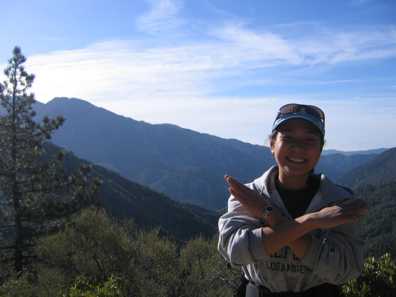
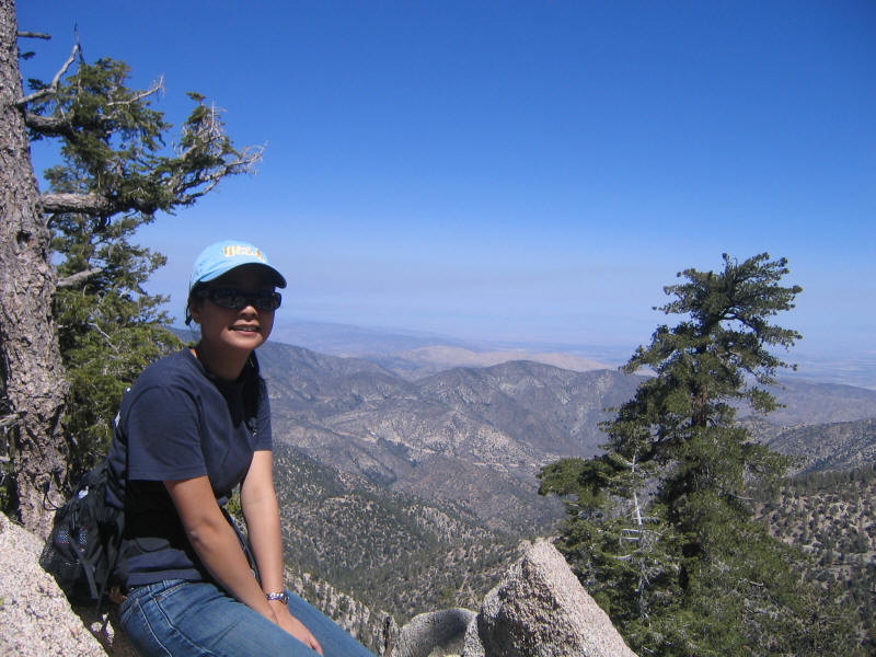
I carried my usual medium-sized pack, down to 22 pounds this time, and after finishing the SMI snow travel course on Wednesday I just wore my normal hiking shoes this time. Kaya as usual carried her own things in my lumbar pack. I wanted us to go up on the foot trail and take the fire roads down, and luckily we did find the foot trail with no trouble. We were rewarded with great views almost from the start, and hike turned out to be fabulous, a wonderful easy hike. Lots of trees, pleasant walking, and fantastic views. Here is Kaya in front of one such view. Notice that above her head a mountain is peeking (peaking?) out of the clouds. I thought at the time this must be Mt. Baldy, but looking at maps later it seems the direction is wrong, and also Mt. Baldy should be more rounded. Direction wise the view is toward the Santa Ana mountains, so perhaps this is some peak there--maybe even Santiago Peak, which I have hiked up before!
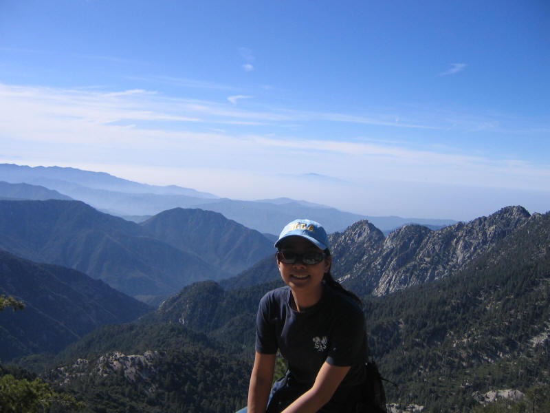
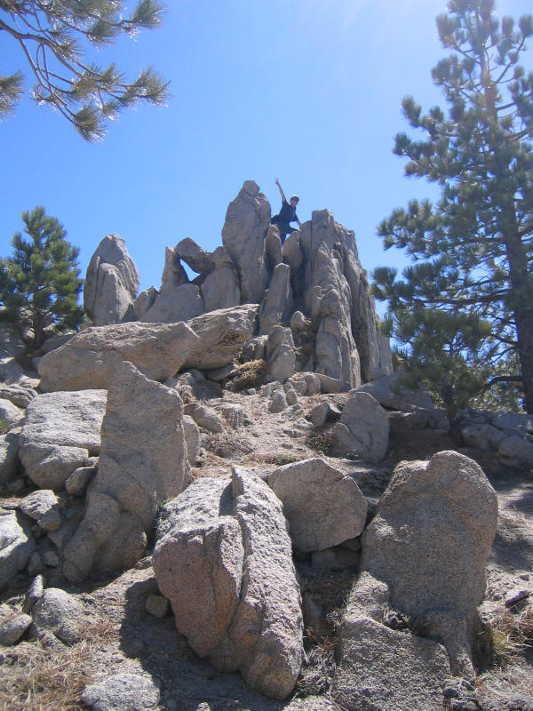
At one point Kaya noticed a steep side trail, and it seemed that would lead to the summit. However it was unclear just where the summit was. It's fairly flat up there, save for some rock formations. We'd passed several cool rock formations on the way up, and I was tempted to stop and climb some, but now we finally had a real excuse. We picked the three tallest ones and climbed all three, figuring at least one should be the high point. All involved very enjoyable and safe class 3 climbing. Here is Kaya atop the easternmost of the three, I think, which was also probably the lowest of the three. One of the other two seemed clearly the highest, and indeed we found a USGS benchmark plaque on it, although not at the highest point of the rock formation. However the plaque neither indicated the name of the location nor the altitude! Also Schad's guidebook says there's supposed to be a register on the summit, but we didn't see that. So maybe we didn't visit the true summit after all.... But we had a lot of fun playing around anyway.
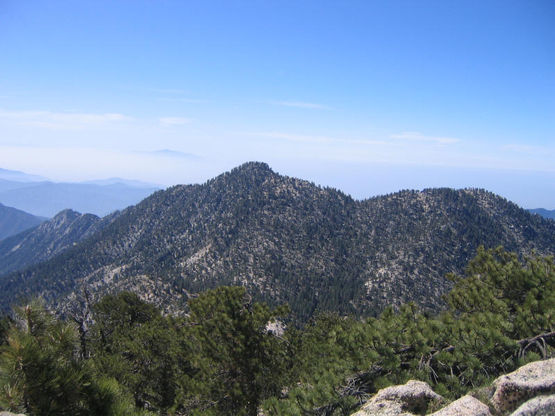
Here's a view with Twin Peaks in the foreground, and the mystery peak behind them. Apparently the view from Twin Peaks is even better as they block some of the view from Waterman Mountain, even though they are lower (see the map above).
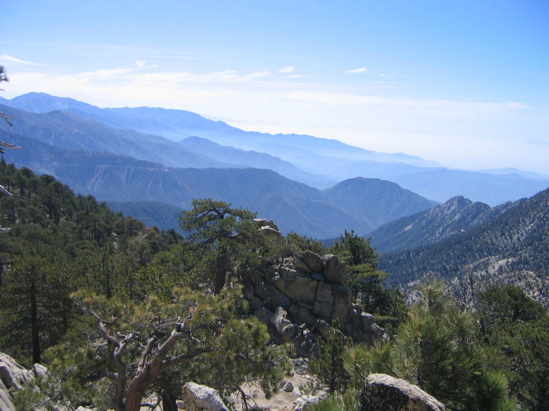
Another great view toward one of the rock formations.
We headed back down to the main lower trail, and then took it until it started to get indistinct. I looked around and happened to see something that looked like a fire road, we we headed toward that. It was lucky I spotted it as it was the right way to go even though the trail and it don't clearly intersect. This was then a very pleasant descent. On the way we got more great views, this time to the north into Antelope Valley.
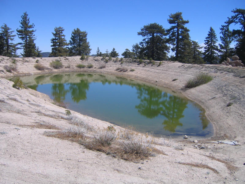
Further down we ran into this strange greenish pool. I suggested to Kaya perhaps this was California's version of Crater Lake (which she has visited and I hope to visit this summer).
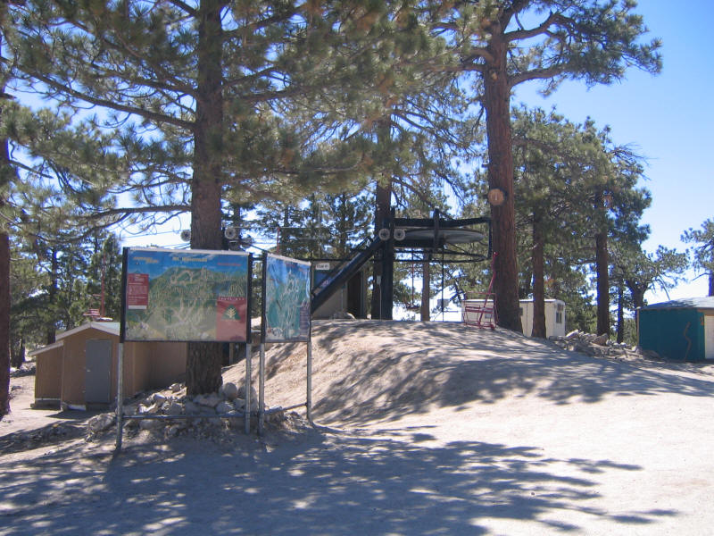
Further down still we reached the ski area. No one was around. In fact we didn't see another person the whole day, and it was great to have the mountain to ourselves.
We followed the fire road back down the trailhead and got back at 11:30pm. Notice that it apparently took just over 1.5 hours to do a supposedly 6 mile hike. Something's got to be wrong, because although we walked fast we surely didn't go more than 4mph, and furthermore we must have spent at least a half hour taking pictures, enjoying views, rock climbing, and so forth. I'm not sure how to reconcile all this. But in any case we agreed this was a wonderful hike, a perfect easy hike to introduce friends to.
Kaya still wanted to check out Bear Canyon since I'd told her Wang Huan had said it was so nice. So in the spirit of trying as many new things as possible we decided to stop by. The trailhead is at Switzer's Picnic Area and by now the upper parking lot was nearly full--we'd find two lower parking lots which were also nearly full. We first headed down a paved road to the picnic area, and on the way we had a great view of nearby Strawberry Peak. The left ridge is the one we climbed to get to the top.

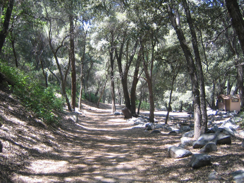
Further down we could see the picnic area alone was beautiful. No wonder it was so popular. We didn't go further than it, but here's the start of the trail leading toward Bear Canyon.
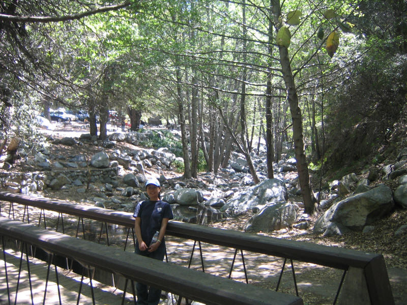
And here's a look back at the Arroyo Seco. This looks like a great place to spend more time as well, so we're thinking of going here Memorial Day weekend with Kyoko and Kyle. Kyle should love playing in the creek and on the rocks. We'll have to get there early to beat the crowds.
We drove to San Gabriel and the usual Chinese mall, where we first tried to go to the big Cantonese restaurant, but it was 1 or 1:30pm by now and it was jammed. They were calling out number 176, I think, and the first available number was 205. We were both hungry and didn't want to wait, so we decided to try a Taiwanese place instead. I'd gone to one Taiwanese place with Wang Huan after our hike up Mt. Baldy before, but it turns out there are two right next to each other and I couldn't remember which one I'd gone to. Kaya wanted to try the other one, but I kept going back and forth about which one I'd been at before. I'm still not sure if we were at the same one or the other one. Anyway we ordered mostly different food and it was all delicious, with one exception. Kaya loves stinky tofu, which I've always avoided because it does indeed stink, but since she ordered it (and it didn't seem to stink too much this time) I thought I'd give it a try. She warned me it would taste awful, but I figured it must be like Japanese natto which smells terrible but doesn't taste too bad. I was wrong. Stinky tofu tastes just like it smells, and it was disgusting. Well, I survived, and I'm glad I tried it once.
The restaurant, like most stores in the mall, takes cash only, so after we'd eaten we were both almost completely out of money. Kaya wanted to buy a telephone card and some desert, but decided it was too much bother to figure out how to get cash to pay for them, so we just headed to Soyodo, the store we'd tried to find last week which was supposed to sell Chinese musical instruments. We found the correct address for it in Alhambra which turned out to have nothing to do with the address we'd written down last time--I have no idea how we found that wrong address. This one was right on Valley Blvd, and we had no trouble finding the store. I didn't know what to expect but was surprised to find a store full of random things, mostly books and CDs and videos and almost no instruments. They did have a couple guzheng, a couple erhu, and one pipa. Kaya took a look at the pipa and thought it seemed decent; the price was fairly good too at only $135. Surprisingly the erhu was more at $150 but it was fancy. She wanted to buy a dizi for a friend and there were a couple left for $9 each. While we were waiting in line we noticed a sign in English that said "Members Only" but Kaya said there was no similar sign in Chinese so I thought it was just something to keep non-Chinese from shopping there. But it turned out you do have to be a member to shop there! For some reason our friend Lydia who told us about the store never mentioned this important point! In any case Kaya had to give up buying it, and our two trips there ended up for naught, although it was an interesting adventure in a way.
Kaya was upset by our experiences in the Chinese shops, so she wanted to clear her mind by going to a Japanese store. We stopped by Mitsuwa in Del Mar on the way home, and that was a much more pleasant experience, and so the day ended on a good note. We were both home by about 4:30pm. A wonderful day with many explorations of new things. Now I can't wait for our Yosemite trip.